Monument Creek campground, located on the Tonto trail between Hermit and Bright Angel trails, only came onto my radar fairly recently. But once I started looking into it, I knew we'd have to check it out. As things turned out, it is located perfectly for a 3 day backpack trip. So, when December rolled around and I had a couple of vacation days to kill and the weather was unusually warm in AZ, we decided to get out of town and into the canyon.
Nancy and I had previously done a very memorable 3 day trip which started at Hermit's Rest, so we were familiar with taking Hermit Trail, all the way down to where it meets the Tonto Trail. For this trip we'd be heading east on Tonto instead of west toward Boucher.
Since our entry and exit point for this trip were not the same we planned to park at the Hermit's Rest trailhead and take the bus from Bright Angel back to our car at the end. However, while talking to the ranger in the backcountry office we were informed that buses stopped running Dec. 1. When she saw our panicked looks, she quickly explained that we could call a taxi service to get us between the two points. Fortunately the taxi took only about 10 minutes to arrive and we just happened to have the exact amount of cash required for the ride. Crisis averted. Time to get to it.
No ice or snow this week – unlike the beginning of our
October hike. Go figure.
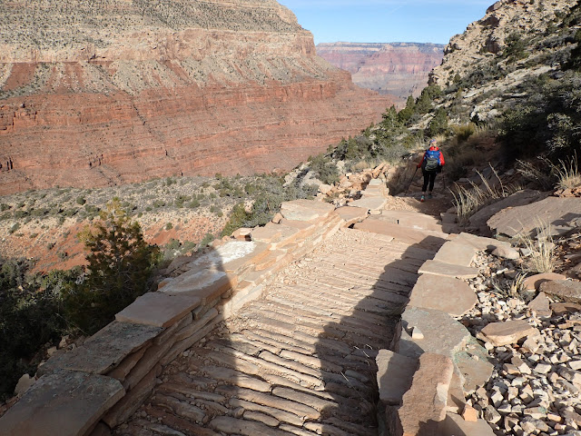
ok, looks pretty easy
hmmm, getting a little rougher
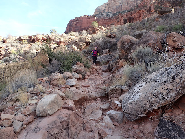
Do they even maintain this? (not so much)
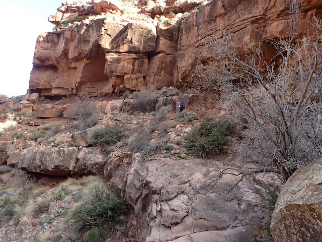
Ok, now I see why people think this trail is rough. (she ain't seen nothing yet)
and then you run into a section like this. Nice work!
We actually saw more folks on this trail than we expected. Maybe the promise of 75-degrees?
Down the first descent. Time to go along the redwall
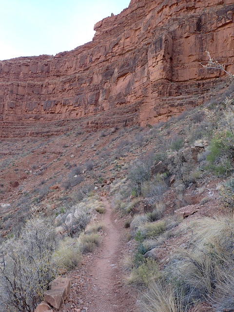
It is red. And it is a wall.
Some of the less maintained trail.
You can see the little house at Santa Maria Spring.
Don't feed the darned squirrels!
A nice place to chill on a hot day.
On we go
The near canyon is Hermit Creek
Even though downhill, this trail is a bit of uphill work.
and there are brief smooth sections
These stairs are a nice detail you just don't expect out here.
Lunch with a view.
Lunch over, time to hike.
Heading down...
There is a big switchback on the other side of that saddle.
There was a bit of rockfall here. And more up to go down.
and more (short) smooth trail
Starting down the switchback. You can see where we are headed.
looking back up
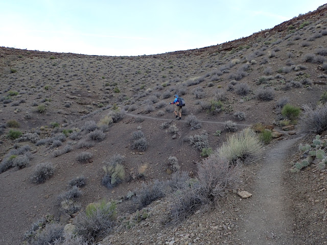
Heading down the long section on the side of this hill to the Tonto Trail.
From above it looked really smooth, but there were plenty of rocks.
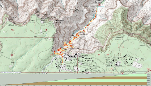
The trail down on the Hermit was familiar but, of course, longer than we remembered. It was a lot of work since you really have to pay attention to your foot placement. Anyhow, we eventually got down to the 95 mile long Tonto Trail. Tonto runs pretty much along the Bright Angel Shale layer of the canyon, so there are usually not big elevation changes. However, there are places where you have to go way up to get around cliffs and the like (water pour-offs that are 100s of feet high). Anyhow, the thing about the Tonto is because the builders attempted to keep it much at the same level (about 1000 feet above the Colorado River) it goes in and out of drainages and canyons. So a mile along the river can be 2-3 miles on the Tonto. Check out the map at the end to see what I mean.
From here we are on the Tonto Trail - a section we have not done.
First view of the river
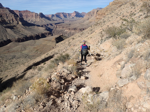
While the trail is plenty wide, a fall would have you rolling down very far.
Loving the smooth tread. There is lots of this on Tonto - but far from all of it.
Looking back downriver
Nancy is sooooo slow...LOL.
Looking down Monument Creek to the Colorado.
Camp is somewhere way up there in the canyon.
You can see the "monument" the creek is named for down there.
Time to head down into the canyon, from a smaller side canyon
The flora here tells you there is water nearby.
So where is that camp?
And there is the "monument" up closer.
another feature up creek
Looking up the wall.
Side view of the monument.
home for the night
Monument Creek. It ain't much, but any water out here is welcome.
Gravity filtering water using Sawyer Filters with CNOC bags.
Supper time in an outstanding environment.
This was a really great place to camp. Highly recommended.
This was the group campsite. Great view, but we decided to stay closer to the water.
We ended up with just shy of 9 miles and 4563 feet of descent.
Heading out. There were a couple of good shaded camp spots here.
Time to climb out of the canyon.
Up and up...
Our campsite is down there below the luxury pit toilets.
Just about out of that canyon.
And back on the Tonto - waiting for the sun.
One of the motivations of doing this trip at this time of year is that it was super easy to get permits. The fact that we were the only ones at Monument Creek the night we camped there is likely due to the fact that hiking in the canyon is less popular in the relatively cold winter months. In fact we only saw one couple hiking the second day until we got to Havasupai Gardens.
The thing with this route was that it was mostly along eastern and southern cliffs. Given the time of year, with the sun in the southern sky, very little of our hike time was spent in the sun. The cliffs do a great job of casting shadow this time of year.
Making good time on easy hiking sections.
Wouldn't be my choice to camp here. Very little place to camp and very little water.
Through and around another side canyon
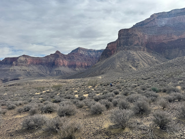
Visual drama is everywhere you look down here.
The trail will take us within 10 feet of those cliffs at times. DO NOT STUMBLE.
Salt Spring Creek down there. Supposedly the water is very minerally.
Had to go way around in order to cross the canyon.
Down to the "creek."
Nancy down in the Salt Creek. There was VERY little water down there.
I tried the water in a pool. Did not taste salty. Disappointed.
Up and out of Salt Creek Canyon.
Back to "good" ole Tonto times.
Another big go-around - Horn Creek Canyon.
Around the first of the two "horns" of Horn Creek.
While we were in the canyon there was a LOT of helicopter traffic. This is unusual in this part of the canyon because site-seeing flights are banned. They are allowed further west. These helis were working, bringing supplies to the folks working on the water line in the canyon.
For those whom are not aware, there is no ground water on the south rim of the Grand Canyon. The millions of visitors that area sees each year get their water from Roaring Springs - which shoots out of the cliffs near the top of the NORTH rim side of the canyon - over 16 miles away. Water is piped down from the north rim, across the Colorado River under the silver bridge (look down next time you cross), then up to the south rim. It is rather insane if you think about it. Anyhow, this system is ancient and breaks frequently - leaving the South Rim without water - sometimes for days. They finally got funding to fix the line and have a secondary source of water from Bright Angel Creek. This is a monumental effort given the location. Almost all of the equipment has to be helicoptered in - there is no easy way into the canyon. More info
here.
Later we saw one carrying what appeared to be a length of pipe.
Pretty cool place.
Back at it.
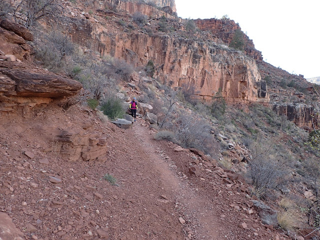
The Tonto is not always smooth.
But it is usually interesting
The word on Horn Creek has always been "don't drink the water unless you are very desperate and about to die of dehydration". Apparently it runs through a uranium mine and therefore the water is radioactive to some degree. And yes, they did allow uranium mining in the canyon at one time. Hopefully never again. Anyhow, the ranger at the Backcountry Office told us that they have tested it again and it is now safe to drink from. Hmmmmm. I ain't going to be trying it. At any rate, there didn't appear to really be any water in the creek when we were there.
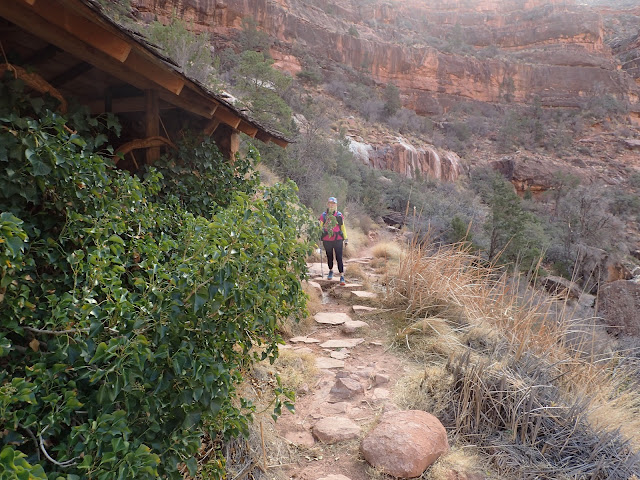
Horn Creek campground. Nice shade.
One of the three sided (no roof) pit toilets in the background there. Pretty basic, but great views.
Onward around Horn Creek.
It is all Tonto from here to Havasupai Gardens.
That dirt road goes out to Plateau Point - where they are running the water line.
The line is much smaller than you'd expect.
They were still working Friday afternoon.
Coming around the bend. The campground is in those gold colored Cottonwood trees.
Luxury camping. Potable water and a critter box.
It was a bit chilly though.
The other side of the canyon gets the sun
Today was a stout 11 miles, but only 2600 feet of climbing. Not too bad.
It was quite chilly (33 degrees for a low) at Havasupai Gardens on this longest night of the year. Given that it got dark and cold early, we spent a pretty long night in our tent. By the way, this was the first trip in our new tent. While our old one was was fantastic, it was also pretty darned small. The new one has entries on both sides so we don't have to crawl over each other if we get up in the middle of the night. Money well spent.
Anyhow, we still got up with daylight (7am). We knew what was ahead since we
done this section many times (and, about
2 months ago) - but always from Bright Angel Campground (about 1000 feet lower and 5 miles away). So this should be a breeze.
It tricks you into complacency with this easy tread and moderate climbing. But we gotta get to the top somehow.
The things you have to tell people...
And now we start climbing in earnest.
Making progress.
Yeah, I'm coming. Eventually.
The white on the wall always looks like snow. It is some mineral.
It is amazing how this trail is routed. It goes through what is know as the Bright Angel Fault.
Yeah, we were back down there somewhere.
You can see three mile house at the top of the trail there. That last 3 miles is a doozy.
This trail is just continuous climbing.
A much welcome, but brief, flat section.
Nancy is a little back spot on the trail down there.
Doesn't look like we've come that far - but it has taken a long time.
1 1/2 mile house.
The top is right there. But much effort remains.
Mules coming down. They said they had more at the start, but some folks bailed. Scared?
I love getting to the Coconino Sandstone. Means we are almost there. Check out the defined layer between the white sandstone and the red Hermit Shale.
Trail winding below us.
The first tunnel. Getting closer.
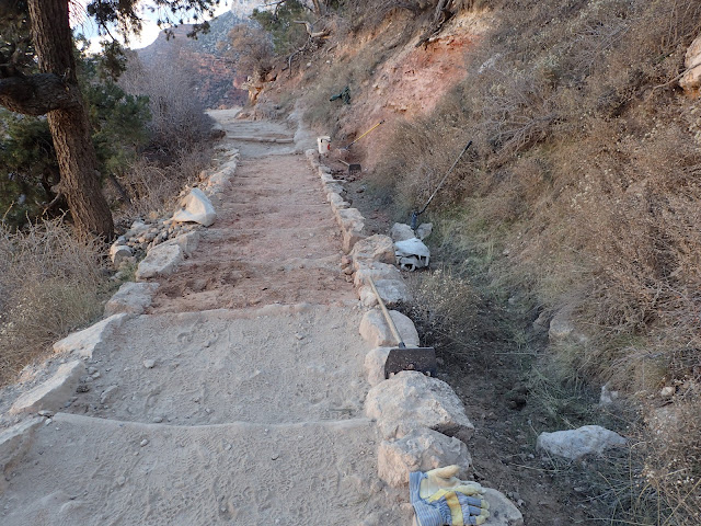
There was a National Park Crew out doing a little trailwork.
Kolb studio is up there on the left. Getting very close to the top.
Best. Sign. Ever.
One last look over this magnificent canyon.
Again, the things you have to tell people
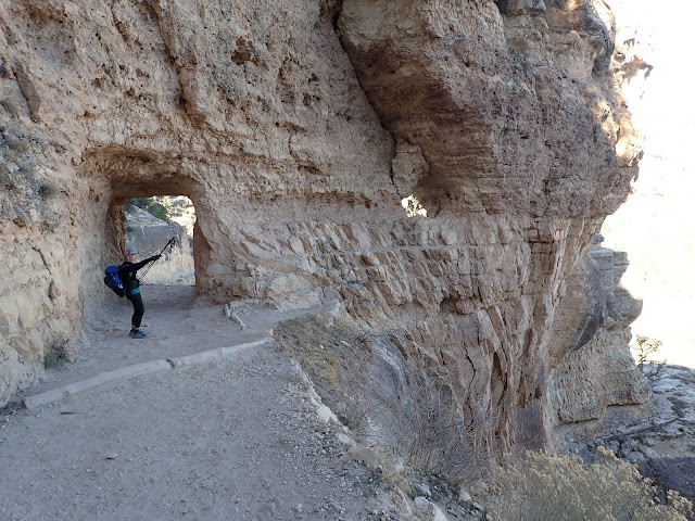
The second tunnel. Just a hop, step, and a jump from the top.
Looking back at that tunnel it is obvious that going around would have been "challenging"
Woodpecker was not at all bashful.
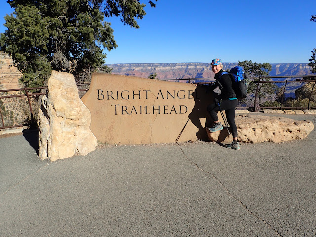
Obligatory.
Just as we arrived at the nearly empty Backcountry Office parking lot at train rolled by. I believe this is a holiday themed train you can take from Williams. Sorry, folks, but no snow on the rim this year.
A measly 5 miles, but just over 3000 feet of climbing. 33 feet of descent - lol.
While the weather was better than it would normally be at this time of year, it was still rather chilly most of the time. This is a route that I highly recommend. I would suggest doing it in warmer weather though. Full stats: 25 miles, 6600 feet of climbing, 6200 feet of descent.




































No comments:
Post a Comment