For those in the know, this trip would start at the Cross F trailhead in passage 22 of the Arizona Trail. The plan was to hike to McFarland Canyon the first day to a nice campsite by Sheep Creek. The next day would be through to Bear Spring in passage 23 where there was supposed to be a decent spot to camp and a fairly reliable spring. Last day would be through passage 23 to the Barnhardt Trail, which we'd take to our other shuttled car. Of course it didn't go down exactly like that...
Our hike weekend turned out to be at the start of a rather warm spell - with temps in Phoenix topping 100. Fortunately we were starting at about 3500 feet of elevation and going up. Unfortunately, the Willow and Sunflower wildfires had destroyed a huge amount of the tree cover in the areas we were hiking - so not a lot of shade. To make it a bit more roasty, we didn't actually start hiking until about noon - and the first 5 miles were all climbing.
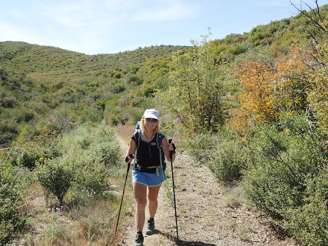
Chad trying to figure out how hiking poles work
AZT sign, but not actually the AZT - just an access point
Right away we start climbing
Now we are on the AZT
About a mile in the trail starts up parallel to a little stream. It was flowing, but just a little. There is still plenty of green along this trail and even a little shade, which was nice. Lots of cool rocks. When there is more water, this area has some nice small waterfalls.
Those plants were green a few weeks ago
It isn't a lot of water, but every little bit is precious out here
Up, we continue
Unfortunately we had to leave the water behind
Into the wilderness
Finally a little bit of downhill
The trail was mostly pretty rugged for a while. At one point we could turn back and see the Verde Valley - where our house is. We couldn't see all the way down to our house, but we could see the local McDowell Mountains and the McDowell Sonoran Preserve. It was pretty cool to see something we knew from such a remote location. The nature of the trail turned to more of an old roadbed when we hit the intersection near Mormon Grove Trailhead. I would guess this was an old mining road, since it continued that way out to Story Mine.
Some cool white/red rocks near Mormon Grove
Definitely nicer trail tread
Still climbing a bit
Gradual downhill from here to the end of today's hike
The manzanita took over when the trees burned
Heading down the last steep descent to camp
Our first night's camp was where the AZT went into McFarland Canyon. It has lots of flat space, trees, and a stream - everything you could want in a camp spot. There was a small mine on the other side of the creek and various rusted metal parts scattered around the area. Clearly someone used this as a mining camp at one time. For us it was just a relief to get out of the heat and soak our feet in the cool water.
The water is excellent!
Time to unwind with some wine and chips and guacamole
Sheep Creek is one of many other trails in the Mazatzal Wilderness
Plenty of room
The mine
During the first day's hike, Joe discovered that his 18 year old hiking boots had decided they were not up to this. The tread was coming unglued from the shoe. This was potentially a big problem. He decided he was going to gut it out and make it to the first night's camp and then head back. Fortunately, his car was at the start so he could just go back and head home. He did make it back to his car the next day without the boots completely failing, but he did miss the next day's death march - which I'm not sure he is sad about.
It may be time for some new boots
Chad, Nancy and I were up early to try and beat the heat a bit. We were going to be ascending to a little to over 7100 feet that day, which should be cooler. However, I was expecting very little protection from the sun.
Git goin'
We crossed our little creek a few times
Back into wilderness
Nice to be in the shade for a bit
Heading toward Mount Peely
plenty of wildflowers still
Half way mark of the Arizona Trail!
Some of these trail signs had seen better days
Heading up a creek fed by Thicket Spring
Sometimes the trail and a creek bed are the same thing
Hope you got your climbing legs on
Our destination was the Mazatzal Divide Trail
We didn't bother to check out the spring
This is the start of switchbacks up the side of Mt. Peely
Mt. Peely trailhead - for cheaters
Plenty of rugged sections of trail on the AZT
Taking a break in the shade and enjoying the views
You can see the shade is scarce. We'll be climbing up the side of the hill in the distance.
Not sure what "3" refers to
Many reminders of the wildfires that ravaged this area
That's the top, right? Right?
Nope. So, the climbing continues...
Those trees would have made this nice and shaded once upon a time
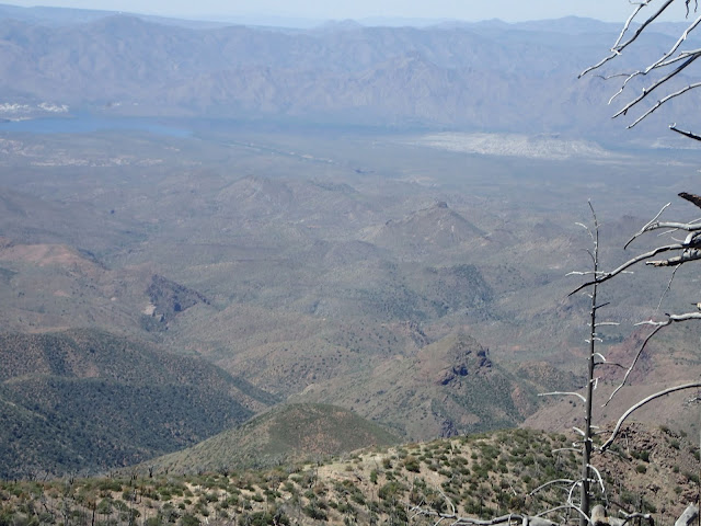
After climbing around Peely, the trail takes a big detour in order to remain more or less on a ridge. It was nothing but deep valleys all around. At a few points we got some big views off to the West. We could see Horseshoe Reservoir - which was about 13 miles away. There was one point where we could see the Superstition Mountains to the south - at least 35 miles away. Probably the most dramatic sighting was Mount Humphreys, in Flagstaff, around 100 miles away. It is hard to see in a picture, but we could see it with it's little white cap of snow on top.
The damage from wildfires is striking
Horseshoe Reservoir in the distance
Mt. Humphreys in the distance, with a cap of white
Some nice tread here
We made pretty good time on day two - despite the heat. We arrived at Bear Spring around 1:00, which seemed too early to stop. There were a couple of nice camping sites here and access to water, which is a rare combination along the AZT. As you'll see below, the spring wasn't much more than a small pool, with water slowly seeping into it, but any water is welcome. As far as I knew, there was no reliable water from here until a couple of miles down the Barnhardt trail - which was about 7 miles away. Given that we had done nearly 14 miles already that day, another 7 seemed like a bit much. After some discussion we decided to hydrate, max out our water capacity, and head out. We'd look for another good camping spot - which turned out to be easier said than done.

It ain't much, but better than being thirsty
Filtering water from the spring
Plenty of camping spots here. Not.
Mazatzal Peak
The trail leveled out for a bit - which was nice
We finally found a nice flat space where we could spend the night, but there was no shade and it was still pretty warm. We were not too excited to sit around in the heat. Given that Barnhardt Trail was only a couple more miles we decided to press on. We knew that it intersected with AZT at a saddle, so surely there should be a flat spot to make camp there, right? At this point we were around 17 miles in for the day. My feet were all kinds of hurting and had started some blisters - even in an area I had covered with Leukotape. Onward...
Nice camp spot behind the sign - but no shade
It really FEELS remote out here
The trail between Y Bar and Barnhardt was actually pretty cool
Brand new sign
We finally reached the Barnhardt trail and started looking around for a place to collapse. Nothing but manzanita everywhere - no place to camp. We could see an area a little further down the AZT that looked better. So, we headed out to see if there was an alternative. There was actually a really nice area for camping, under a big tree - but it was already occupied. Ugh. The area here had more clearings, but not much in the way of flat spots and there were lots and lots of rocks. We meandered around until we found something that would work.
We ended up doing 19 miles that day. My original plan was for 13.5. The extra miles took a real toll on my feet. The good news was that the final day was only 6 miles - with about 2000 feet of descent. Also, there were opportunities of waterfalls at a couple of points - if the water was still flowing.
Home for the night
Breakfast
Let's get it done
Waterfall watching
Not a whole lot of water, falling
Chad is thinking about spelunking up into that crack
Here is what that looked like a month before
Love seeing water out here
Heading down, for once
Some major folding in the rocks
the finish is down there somewhere
Finish line!!
This was another great adventure. Glad to have finally gotten a good look at the Mazatzals - although there is plenty more to see.
For anyone in the area, the Barnhardt trail is highly recommended in early spring. The big waterfall is only 3.5 miles from the trailhead. The geology on the trail is really dramatic and if you go after a rain or while snow is still melting on the peaks there is tons of water flowing all around. It is totally worthwhile.


