Ever since visiting Deer Creek on the Grand Canyon river trip we did last year I've wanted to backpack the Deer Creek/Thunder River loop. We convinced our friend Joe to come along on this "little" trip - promising only adventure and a strenuous walk in the park, As always, Nancy secured the necessary permits. The "usual" way to do this loop is clockwise, but we could only get permits to do it counter-clockwise. I think we all agreed that this was the best way to do it. Since the trailhead was a good ways off of any paved roads, and deep in the spaghetti of dirt roads on the Kaibab Plateau, we planned to take an entire day to get there. That turned out to be the best call since just getting there was an adventure on it's own.
It was raining when we got up to Jacob Lake. The directions we had from there were to take a couple of dirt roads to the trailhead. Since it was raining, those roads were a little muddy, but the first one was in pretty good condition.
Day 0
Aspens are in full fall color.
Unfortunately the next road we were supposed to take was closed. So, we consulted the Google Maps, which gave us an alternative that was longer, but should bypass that closed road. This alternative took us up a much less nice dirt road that was getting rather slimy. Good thing we had 4-wheel drive. Unfortunately that took us, the long way, back to the same closed road! Now we are starting to get concerned and returned to Jacob Lake Lodge where we could get the cell phone coverage needed to contact the Grand Canyon Backcountry Office. The helpful ranger advised us to go a completely different way. So back on the road – this time toward the North Rim and off on another pretty good dirt road. Which led to another dirt road. Which led to a much smaller road with a tree across it! After some consternation and scouting around we decided we could probably drive around the tree through the woods. It was rather tight, but we actually got through. What next? The route became considerably more "rustic." It was narrower, descended into a deep high-walled canyon, and featured some pretty good ruts with some rocks and really big puddles just for grins. However our "mall crawler" managed to make it through all that to Crazy Jug point - where we had intended to camp for the night. Nancy suggested, "your mission, should you chose to accept it, is to get through without dents or scratches". Mission accomplished.

"Oh, darn" - not exactly what was said - this is a family friendly blog.
Crazy Jug Point
Would have been a great camping spot
Unfortunately there was very little space to camp at Crazy Jug Point, and someone had already claimed it. Our starting point for the next day was about 1.5 miles away at the Bill Hall Trailhead. We didn't really want to camp at the trailhead, so we looked for alternatives along the way. Fortunately we found a really nice spot along the road.
Finally, we made it. Like the racing stripes?
Home for the night
All is good when the campfire is roaring
Day 1
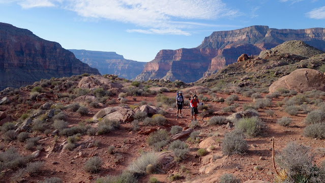
The rain and clouds from the previous day started moving out and the start of a weekend with perfect weather began. Time to do some hiking.
Time to get this show on the road
We decided to skip the viewpoint
Trailhead in the background
The hike started with some mild climbing along the rim
Last chance to turn back...
Dropping down from Monument Point
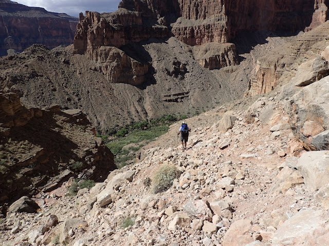
A rugged downhill set the tone for the weekend
Surveying the valley below
Hmmm, this looks interesting
It was actually not that tough
A bit of butt-sliding
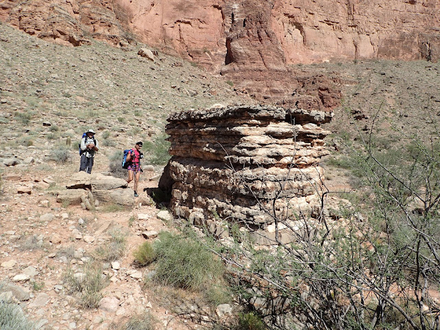
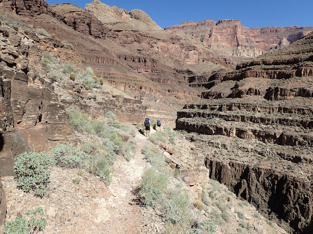
The Bill Hall trail starts down pretty aggressively to get you past the first cliff area. It then levels off to get you over to another section where you can switchback down to the Esplanade. The Esplanade is a mostly flat section that is quite reminiscent of Sedona. This was a really enjoyable section to hike across.
Below in the middle is the Esplanade
The views, O the views!
Many, many, many switchbacks down this section
Getting warmer. Almost down the first descent.
At the junction of Bill Hall and Indian Hollow trails
Are we lost? This looks like Sedona.
We started way back on top of those cliffs
Lots of slickrock to cross. Wishing for a bike.
Guess you could sleep here in a pinch
Cave dwellers
Adding one more rock to the cairn
All kinds of cool looking rocks
Getting close to the edge off the "Little Sedona" ledge.
We all enjoyed the hike across the Esplanade. It was essentially flat and just so interesting. However, we had descent #2 to do. Like the initial descent, this had to go through a section of vertical cliff. It started out as a cliff face that was "broken" so we descended down these rock filled switchbacks. Lots of effort by the trail builders to make this work, but it was tough going.
Snack break before dropping down
And down we go
Surprise Valley below
Nothing but rocks.
You can see how difficult the cliff face is to get down (unless you have a parachute).
Watch your head!
A series of switchbacks to finish this off.
Second descent completed
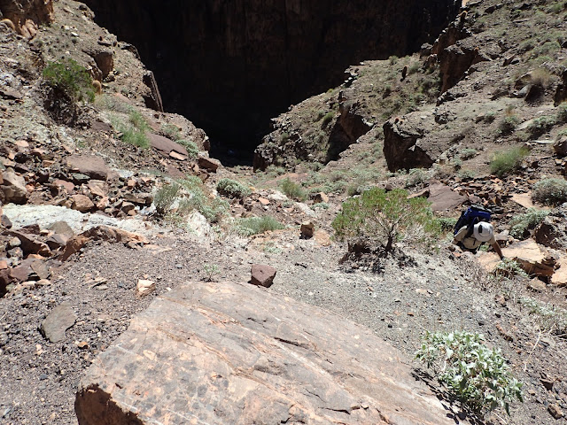
Once we got into Surprise Valley there was a trail junction. We headed right toward Deer Creek. We'd end up back here in two days when we climbed out of Tapeats Creek - to finish the loop. The stroll across Surprise Valley was uninspiring. It was the most "meh" part of the weekend. However, once we started our third, and final, descent of the day we found out what was meant when other hikers told us that the trail was "blown out". Apparently the strong monsoon storms this summer had really messed up the trail to Deer Creek. In fact, a flash flood had gone through Deer Creek Valley and had ripped out much of the greenery that made "The Patio" look like an oasis - but I'll get to that later.
This random chunk of rock was oddly rectangular.
Here is where the trail starts to turn to junk.
Without cairns it would be hard to know where to go.
Lots of loose rock.
Many sections of exposure on this trip. Watch your step!
Deer Creek below.
Through a jungle of reeds. Are we still in the Grand Canyon?
And finally! to home for the night.
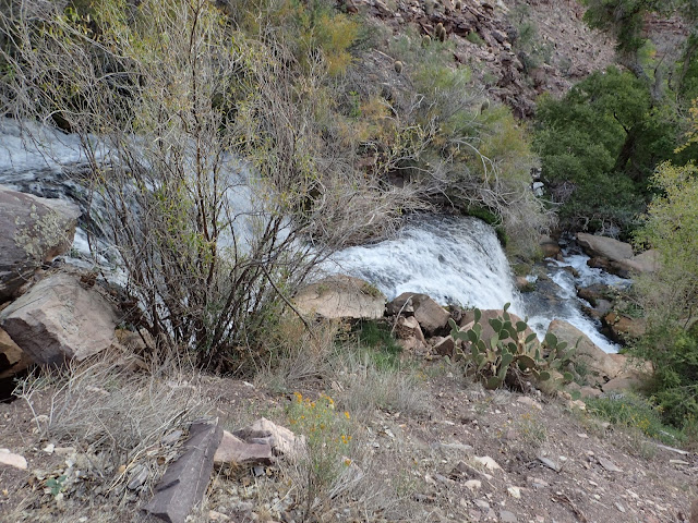
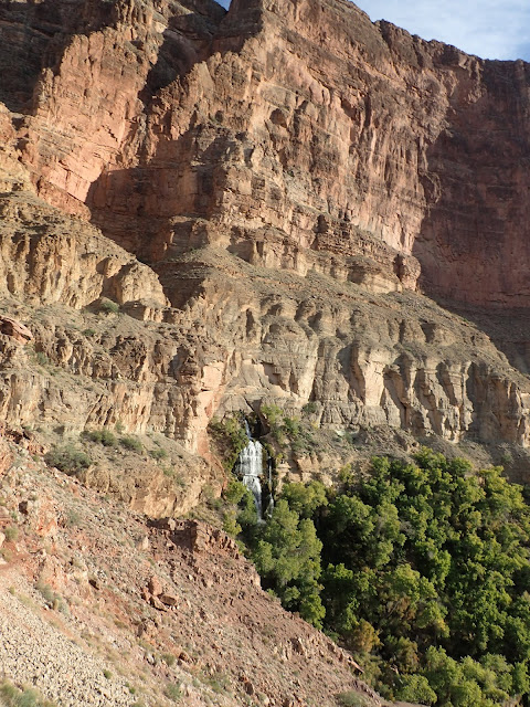
We got to camp in time for a late lunch. We decided to stroll down to "The Patio" to eat. It is shaded and very pleasant. As mentioned before, it did get a bit messed up from a flash flood but was still a great place to chill and take a nap. At this point the creek starts to cut into the rock and keeps dropping down as it gets closer to the Colorado River. So, as you walk along it, the canyon that the creek is in gets deeper and deeper, until it dumps out right near the river in a beautiful 180 foot waterfall.
Camp is about half a mile up the creek
Looking toward the Colorado River
Post lunch nap
The creek drops down soon after here - so don't fall in
After lunch we headed down the creek to see the waterfall. That meant we needed to climb down another 200+ feet from where we were to the river.
The creek starts to drop down after the patio
Creek is down there
Heading toward the Colorado
Getting deeper
This path is rather sketchy in sections.
The Colorado was really, really muddy. Like chocolate pudding.
Down to the river.
And there it is - Deer Creek Falls! 200 feet high.
The water was REALLY cold.
Looking up river.
Supper time!
Day one was done. It was about 9.5 miles down to camp, then another 2 miles to go down to the river and back.
Day 2
Today we'd drop down to the river and hike upriver to Tapeats Creek. From there is a little over 2 miles up the creek to where we will camp. There are 2 trails that parallel the creek, one on the west side and one on the east. Tapeats Creek was in a high flow state so it was recommended that we take the trail on the west side - that way we never needed to cross the creek. We found out later that this is the "sketchy" route and should only be "used as a last resort." At the end of the day I'm glad we went that way. It was pretty exposed, but also very rad!
Another beautiful day dawned and we started it with a climb up and over a saddle. We hiked the high route along the river for a bit and eventually dropped down to the river.
Heading up.
Looking back down at Deer Creek.
The view from the other side of the saddle.
Looking down river.
Some pretty good trail up here.
Getting warm.
The trail turned to the usual rubble when it headed down to the river.
Sit and slide.
There is a wooden dory down there.
And some rafts.
Another dory and more rafts - probably headed to "the patio". Glad we missed the crowd.
Once we got down to the river we needed to travel up river to Tapeats Creek. On a map it looks like you are just walking along a beach. In reality it is essentially a stroll over rocks. So many rocks! The only indication of a "trail" is the cairns that someone was kind enough to place.
Then there was a big 'ol 25-foot chunk of rock we had to go over on the way up river. It looked a little intimidating but was actually an easy climb with good hand holds.
Joe getting it done.
Nancy makes it look easy.
And back down the other side.
Down out of the rocks to some actual beach...briefly.
Snack time at Tapeats Creek.
When we got to Tapeats Creek we found some shade to have a snack and rest break. Nancy took the occasion to pull an 1.5 inch barrel cactus spine out of her leg. All part of the fun of desert life. From here we followed a trail up the creek for a little bit - to a dead end. We could see the creek went between cliffs in front of us but no way forward except through the raging creek. Consulting the GPS showed that we should have gone UP (of course) from where we took our snack break.
Wrong way,
Of course the right trail climbed steeply.
One of many times Nancy said "are you sure this is the right way?"
That was a stout climb.
Some pretty decent trail up here.
One last look at the river.
Heading upstream.
Watch your step!
This trail turned out to have a bit of a pattern. We'd climb straight up to a ledge and then follow that ledge gradually back down to the river. It did this 3 times.
This is where we could have crossed to get to the trail on the east side.
And back up.
It is so beautiful out here.
We are headed to the green all the way at the top there.
This felt more sketchy than it looks in the picture.
Back down to a prickly pear forest.
And up one last time.
Looking back down the creek.
Nice and easy...
And finally to camp.
Lunch time.
Our little piece of creek.
This was a really nice spot.
Joe found some shade.
Room with a view.
A nice, cool, shady rock for napping.
Don't fall in. The water was VERY cold and CRAZY powerful.
Joe brought the wine for happy hour
Puffy time. It gets chilly fast when the sun goes away.
Day 2 was "only" 7 miles, but some really rugged trail - so almost as much time as the previous day. However we were treated to some amazing views and a great campsite right next to the creek. Nothing quite like falling asleep to the sound of a roaring creek.
Day 3
Today is all about climbing out. Unlike many hikes we've done in the canyon this is not just one stretch of ascending. There will be 3 climbs separated by flat-ish sections. We will start by climbing out of Tapeats Creek which parallels Thunder River, up to Surprise Valley.
Thunder River is a fascinating bit of water. It is fed by a spring that comes out of the side of a cliff, then falls 1200 feet in about half a mile into Tapeats creek. It is essentially a series of waterfalls.
Up we go
A small bit of Thunder River.
A little rocky, but not bad.
Lots of little falls.
The spring is up at the top there.
All that water from one little hole.
Up close at the spring was quite dramatic.
Everyone gets their shot in front of the falls.
Video of the falls coming out of the spring
Back to climbing and away from water.
Looking back at the spring.
Up and away!
Looking back down at Tapeats.
Back to the "meh" of Surprise Valley.
Right here we closed the loop.
After the stroll across Surprise Valley we hit the intersection of the trail that we had gone the other direction on the first day. From here we were retracing much of what we did the first day, so we knew what was coming. What was coming was another good climb. I didn't take as many pics from here since it was the same trails we already did.
Heading up to the break in the cliff on the left top there.
Looking back down.
Back up on the Esplanade.
The cairns were essential to finding our way across the slickrock.
Heading up the final climb.
One last look back.
Made it out!
Last day was 9.5 miles and went a little quicker than the first day's descent.
We finished the hike, but our adventure was not over yet! We had initially planned to camp the night after and drive home the next day - since we didn't know how long it would take to get out of the canyon. However, forecasts in the week before showed lows that night in the 20s and a chance of snow - no thanks. We opted to get a couple of cabins at Jacob Inn instead. This turned out to be the right call. Also, we knew we didn't want to get out of there the same way we came so we did some creative route finding and actually found better dirt roads to get to Jacob Lake.
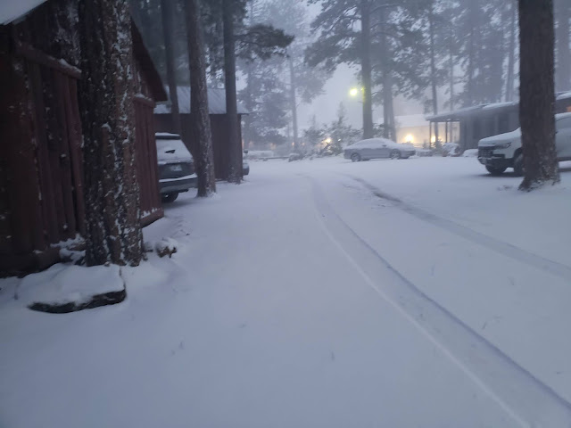
We had a nice dinner, slept in a warm bed and next morning woke up to:
By the time we got breakfast and were ready to go it was still snowing and there were a few inches on the ground. We heard that a snow plow was supposed to come through at some point, but decided not to wait.
Steady as she goes
The roads were slippery, but passable. We saw a pickup truck trying to get a trailer off the side of the road - apparently they jackknifed. Other than that, there was very little traffic. We took it real easy and as we descended off the mesa the snow turned to rain. From there it was just a drive home.
Little bit of snow on top of the Vermilion Cliffs
Even though we had some challenges getting to and from the trail, the timing on this trip was as perfect as could be hoped. It rained the two days before we hiked and snowed the day after. In the time we were down there the weather was just about perfect.
This was overall the most rugged hike Nancy and I have done in the canyon. But it was definitely a great one. HIGHLY recommended.