Monday, January 18, 2016

A Pleasant Loop

There had been a lot of chatter about the new trails out at Lake Pleasant recently, but we hadn't gone to check them out due to the drive/ride time ratio. John changed that calculus with one of his patented adventure loops. He sketched out a ride that would use the Black Canyon Trail, the Maricopa Trail, the Lake Pleasant trail system, dirt roads, and some other dodgy stuff to do a 53 mile loop around the lake.

Since he opted to do this on a Friday, we could not come along. However, he gave the loop rave reviews, so Ray and I decided we wanted to do it on Sunday. Ray conned Bart into coming along and of course Nancy was in as well. Nancy and I had intended on starting earlier than Ray and Bart, but that didn't work out. We ended up rolling into the ELH parking lot as Ray and Bart were getting ready. So we started the ride as a group of four.


Lets get going

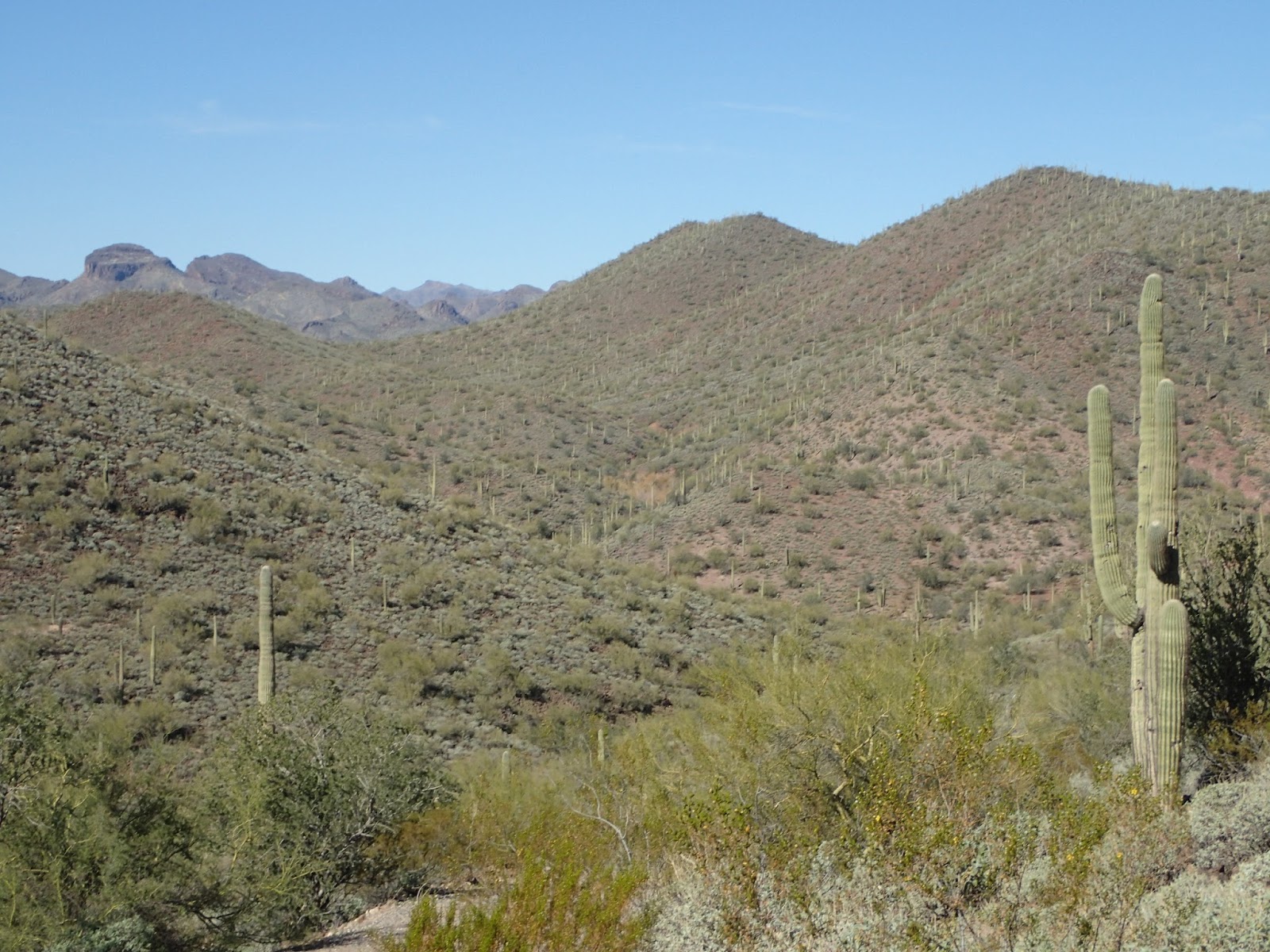
Unfortunately, the first part of this loop is on the section of Black Canyon Trail between ELH and Carefree Highway. For all the acclaim the trail gets, this section is awful and pretty much no one rides it - for good reason.

Off on some rather uninspiring trail

This pretty much says it all

Walking across a rock covered wash...


...and up the side of said wash.

Someone obviously had a problem with that sign

Don't want to get their bikes wet

Eventually we turned west off of BCT onto the Maricopa trail. Unfortunately, this section is also pretty blah. I was starting to say bad things about John and his stupid ideas.


Ultralight buzzing around

Once we got to there the trail turned to the north a bit, it actually started improving. We came upon some trail building teams - putting the finishing touches on some sections for an upcoming race. The trail had finally gotten fun to ride.

On we went, getting closer to the lake. Suddenly the trails changed. The flats gave way to some actual hills and some nicely designed trails going up and down those hills. Now we're talking.


A rare shot with Ray, Bart and Nancy in the same frame

Reminds one of the best sections of BCT

I gotta say that the trails around the lake that I had been hearing about lived up to the hype. They were well built, interesting, fun, and had great scenery. Worth the visit. Oh, and lots of climbing.


Finally actually see the lake

Interesting terrain

Views off into the Hell's CanyonWilderness area


Always interesting things to see


Eventually, we ran out of trail on the north end of the lake and had to hit dirt road. At this point Ray and Bart had gone hyperdrive and we never saw them again. The road here wasn't bad, but it had a lot of vehicle traffic - especially quads. However, we were getting further from civilization and closer to big views. Love that stuff.

Over on the very right is a notch we'll go through - eventually.


Nice view of the lake, from the north

Cool stuff in one of the fingers of the lake

Not the nicest dirt road, but rideable

Getting closer to the "notch" we'll ride through

As the main road turned off onto a road that was far less used, we headed east. This was lots of up and down as we skirted the north end of the lake. Eventually we dropped down to lake level and had to do some workarounds on the track where roads went right into the lake.

definitely at lake level

Guess I should go around

We did a little bushwhacking in this low area, but then started climbing a bit. Here is where it started to get real. No more nice roads. Instead we had jeep trails or things that used to be jeep trails. Not sure this area had seen a vehicle in many years. This is usually where the good stuff is and it did not disappoint. For all the time I spent pushing my bike, I had time to take pics of all the cool stuff - and of Nancy riding the stuff I was walking. D'oh.
We could hear water running down there somewhere

The road isn't too bad here.

The camera flattened out those two rock formations, but they were really cool in person

Wait for me...


Then there was the tailpipe gate. Gotta love the creative ingenuity of using whatever is available.


This gate was followed by a sea of babyhead rocks - going up. I see this particular section as a test of sorts. If, after riding for 4-5 hours you come upon something like this your reactions are likely to be one of two.
            Either   a. What the $#@ is this? Dammit, I don't want to deal with this.
            Or         b. Laugh - just because.
I'm of the opinion that folks who react with a. shouldn't be doing this sort of thing. But those who just go with b, get it and are prime candidates for a patented Schilling backcountry loop. It's often the stuff that is unknown that turns out to be the most "interesting".

The test

After trudging up "babyhead hill" the trail went back down on a marginally rideable section - of course.

At least the views are great


Shred it Nancy

Finally we made it to the Agua Fria. We knew this section would be a bit iffy since the amount of terra firma was dependent on water level. I think we pretty much lucked out since it was all passable. If the water was much higher it could have presented more problems.
That is actually the road (or gulch) down to the river

Random cool rocks

The locals made a nice trail for part of the trip up river

We got to where we needed to cross the river and it was, fortunately, much narrower then where we dropped down into the riverbed. Nancy just trudged across through the water, but I wanted to get across dry. Hopped across some rocks with a final leap to the last rock. Lost my balance backward and ended up stepping back into the river. Ah well,

From here we hit Table Mesa road. The sound of gunfire told us we were back in civilization. Motored up the road aways to the BCT turnoff and headed south towards Emery Henderson.This section was well know and just a matter of churning it out.

Looking back toward the Table Mesa Road area


This was a really good route. It certainly had everything: singletrack, doubletrack, pavement, dirt road, jeep trail, and WTF trail. There was heavy hiker traffic on one section around the lake and then areas that no one appears to have been in a long time. Add in sunshine and some pretty stellar views and you have an outstanding day on the bike.

One of the really great things about a trip like this is that we got to see some areas that we've never been to. Now I know what is on the other side of those mountains to the west when I'm rolling down BCT. And I had a far away glimpse into the Hell's Canyon Wilderness area - which Nancy is threatening to make me go backpacking in. Even better, I know there is much more out there left to see. Can't wait.


GPX file here

Sunday, January 3, 2016

Curmudgeon 100

Late in 2014, John challenged me with figuring out a route to do 100 miles on my local trails. I wasn't sure it was possible, but cranked up Topofusion to give it a try. Sure enough, I was able to put together 100 miles of riding on trails. So I reached out to some folks and found a few who were willing to give it a try. Nancy and I decided that we may as well start it at our house since it is only about a mile from there to the trails. Picked Jan 2, 2015 as a date and it was on. 

We had 6 show up and 4 finish that year. The course was very tough and the weather was VERY cold. It was not an easy ride by any means. Surprisingly, a couple of the folks who did it wanted to try again. So, if we were going to do it again, we needed to give the ride a name. Ray came up with the Curmudgeon 100 - I'm guessing that refers to his personality? Anyway, I liked the name and it stuck. 

Wanting a better experience than 2015's beatdown of a route, I created another challenge for myself and decided to route the ride entirely on the east and north side of the McDowells - no going over the mountains. With some of the new trails in Brown's Ranch and some creativity, a new course was created. 

For the 2016 version I cast the invite net a bit wider and ended up with 8 people in for the full meal deal and 1 who wanted to do a "partial". Again, Jan. 2 worked well. The forecast leading up to the event called for sunny skies and temps near 70 - already shaping up to be better than last year. 


The morning started out pretty chilly - but not as cold as it could have been. Everyone actually arrived on time - I was determined to start at 6. 


Getting ready

We headed out at about 6:03 - close enough. Rolled the mile or so on pavement to the entrance to MMP (McDowell Mountain Park). There is an entry point to the park from our neighborhood - so that was the last time we'd ride on pavement until the end of the ride. The drama started early as John tagged a Staghorn Cholla. Joe and I stayed with him while he did extraction - the rest of the crew motored on. We then headed up to the intersection of Chuparosa and Pemberton where Nancy was waiting with Sean. Since he lives close by Sean opted to meet us there rather than at the house. Brian rolled up soon after. The fast boys (Ray, Steve, Bob) had jetted ahead - anxious to get cranking on the miles.

Sean - ready to roll

Joe is all excited

That cactus came out of nowhere

We rolled on, to Escondido. The sky was just starting to lighten. I love being out on the bike during this time - watching night turn into day. At this point Sean had turned on his hyperdrive and left us in the dust - didn't see him again. So it was, me, Nancy, John, and Joe - just like 2015. Brian was taking his time and doing his own thing, so we didn't see him for the rest of the day.

The sun starting to come up on the Escondido trail

Nancy climbing Scenic as the sun continues to rise

View from Scenic

View from the competitive loop parking lot

On the loop of the Sport trail (competitive loops) Joe had a little mishap on a high berm. This caused a bent derailleur, which he bent back by hand. However, he noticed that the derailleur hanger had a crack in it, so he did not want to mess with it any more. I was sure that thing was going to snap off at any moment. Amazingly, it lasted the whole ride. Pro tip for you gearie types: Carry a spare derailleur hanger with you. Weighs next to nothing and can save your ride. Or get a single speed - just sayin...

After doing the sport loop we hit the jump line and pump track - just because it was there. Then on to the long loop. Somewhere in the long loop John dropped back. He would battle a broken seat and some fatigue early in the ride, before finding his mojo later on.
Gotta hit the jump line

And the pump track


I was surprised to run into Bob on the way up Delsie. He was doing some saddle adjustment on his new singlespeed. Yeah, he brought a new bike on a 100 mile ride without sorting all that stuff out first. That's one way to do it.
The "Oasis"

Bob rocking the rigid SS


Nancy and Joe heading up to Bell pass

At this point Joe, Nancy and I were riding together - with Bob joining us from time to time. As I approached the "summit" of the Bell pass part of the route I saw Steve coming toward me. Apparently he had gone the wrong way on that part of the loop. Same mileage, but he had to do the grunt up Prospector - which is tougher. So, bonus climbing/HAB for him.

As we passed Dixie mine, we noticed these big metal structures. Given that there is nothing out there but the abandoned mine, we couldn't figure out what this was for.
Bob suggested that maybe they were setting up for a Styx concert

The miles rolled on and on and on. As we approached the cooler cache visions of lunch started to dominate my thoughts. We rolled down Gooseneck until finally reaching the cache with about 55 miles under our belts and it was right about noon. Way better/faster than last year.


Best part of the day

Soaking up sun along with fuel

We still had another 50ish miles to do, so we didn't linger. Steve left first, then Nancy, Joe and I. Bob would come along later and meet up with us at the Brown's Ranch trailhead.

Bob, Joe and Nancy getting water

After the BR trailhead Bob, Joe, Nancy and I pretty much formed a train for the rest of the ride. For me it was a bit of a push to keep up with the group, but the pain was worth it. We made excellent time through Brown's Ranch. Ran into a couple of folks we knew. Saw our friend Spencer out there - that was cool.

As we ripped though BR I noticed that the sun was far higher than last year when we were in the same general area. I knew we should be able to take some time off of the 15 hour finish we had last year due to an easier course and better weather, but wasn't sure how much. Nancy and I thought we could get under 12 hours since we had both done other 100 milers in that time. My goal was to make it back before we needed lights and the stretch goal was to make it back before sunset. These goals helped me keep the pace we were setting.

We arrived back at the cooler, which meant we had about 12 miles of mostly downhill left. My GPS said 1:13 till sundown. Yeah, I think we can do that. Bob and I toasted with a couple of beers for the final push, then we were off. 54 minutes until sundown.

Cheers!


Almost back


We ripped down the Pemberton, rolling a pretty consistent 18mph. I'm glad there were few other people out there. Near the end of the Pemberton section I lost my rear tire and took a spill. When I got up my GPS read 100.0 miles. Sweeet. No harm, no foul - onward. We continued to burn down the trail to the gate in our neighborhood.

When we hit the gate the sun was still shining. Stretch goal acheived! We eased down the mile or so of pavement to the house, Got out the chili that Nancy had put in the slow cooker before we left in the morning and had started the stories/recap/refueling part of the ride. Ray had already left since he finished at 3:40 (how does that old man do it?) and was tired of waiting for us. Steve had finished a bit ahead of us. Sean had finished before us too, but finished at his house. Brian had done his custom loop and headed home earlier. John finished a bit after us, but wayyy before last year's time. All in all a VERY successful ride. The new course is a keeper and will probably only require some tweaks for next year - especially since they are still building new trails at Brown's Ranch.

Thanks to all who came out. This was super fun.

Made it before sunset and under 12 hours

GPX file here