We asked around to get some folks to share the adventure, but only Chad Brown was able to commit. Since we were not really able to finalize the details until the week of the trip, we had to wait to get our permit at the Backcountry office at the rim. Their process for getting permits in advance involves faxing and snail mail - so 20th century.
Day 1
Hoping for the best, the three of us departed our place at 4:30am Saturday morning. We arrived at the Backcountry office around 8:30 and attempted to secure a permit. Unfortunately, Horseshoe Mesa (camping spot for day 2) was full up, but we could camp below the mesa at Hance Creek or Page (aka Miner's) spring or anywhere around there. Ok, whatever, let's get going.We parked our car and dropped $30 on a shutttle to the New Hance trailhead - about 10 miles down the road. That was well worth the money since we ended the hike right at our car.
The New Hance trail is about 6.5 miles from the rim to Hance Rapids. Descriptions of this trail call it one of the toughest trails from the South Rim - I believe it.
Off we go.


Into the void
We soon came to that first big "WOW" view that you always get when the canyon is laid out below you.

Once you get over the enormity of it all, it is time to descend. Things quickly "got real".

The "butt slide" was used often

Hiking poles proved quite useful


Carefull...


This would make a fine camping spot

It is not all rugged - there is more delicate beauty out there

But then there is plenty of gnar too


Even a little climbing on the descent

To make it interesting, there were all kinds of surfaces. Sticky sandstone, loose rubble, soft and sandy red soil. The MOST interesting was the steep sections with loose rubble. I fell a few times. Nancy and Chad were more graceful.

Steep? Yeah, there was steep.

Lunch break

In a few places rock slides has pretty much obliterated the trail, so we had to go OVER the rocks.


Looking back up to where we came from...

..and down to where we were headed.
It was getting pretty warm so we took a little break at this point that would have made another great camping spot. The valley between the red areas below is essentially where we are headed.


Down across a descent trail surface. We'll cross that wash to the other side.
When we got down to the wash, we could have followed it to Hance Rapids - except that it had a drop of about 50 feet. So we went across and followed the contour on the other side.

You can sorta see where the wash drops off.
Eventually we did drop into the wash and followed that to the river.


Even in the wash there were challenges
Finally, we made it down to the rapids. The first order of business was to find our camp spot for the night. We found an excellent little sandy spot under a tree. Given that it was pretty warm at that point the shade was very welcome.


Home for the night
Once camp was set up it was happy hour. When you travel with Chad, you go in style. He lugged a huge block of cheese, a 3 liter box of wine (that weighs 6.6 pounds) and some salmon down into the canyon.
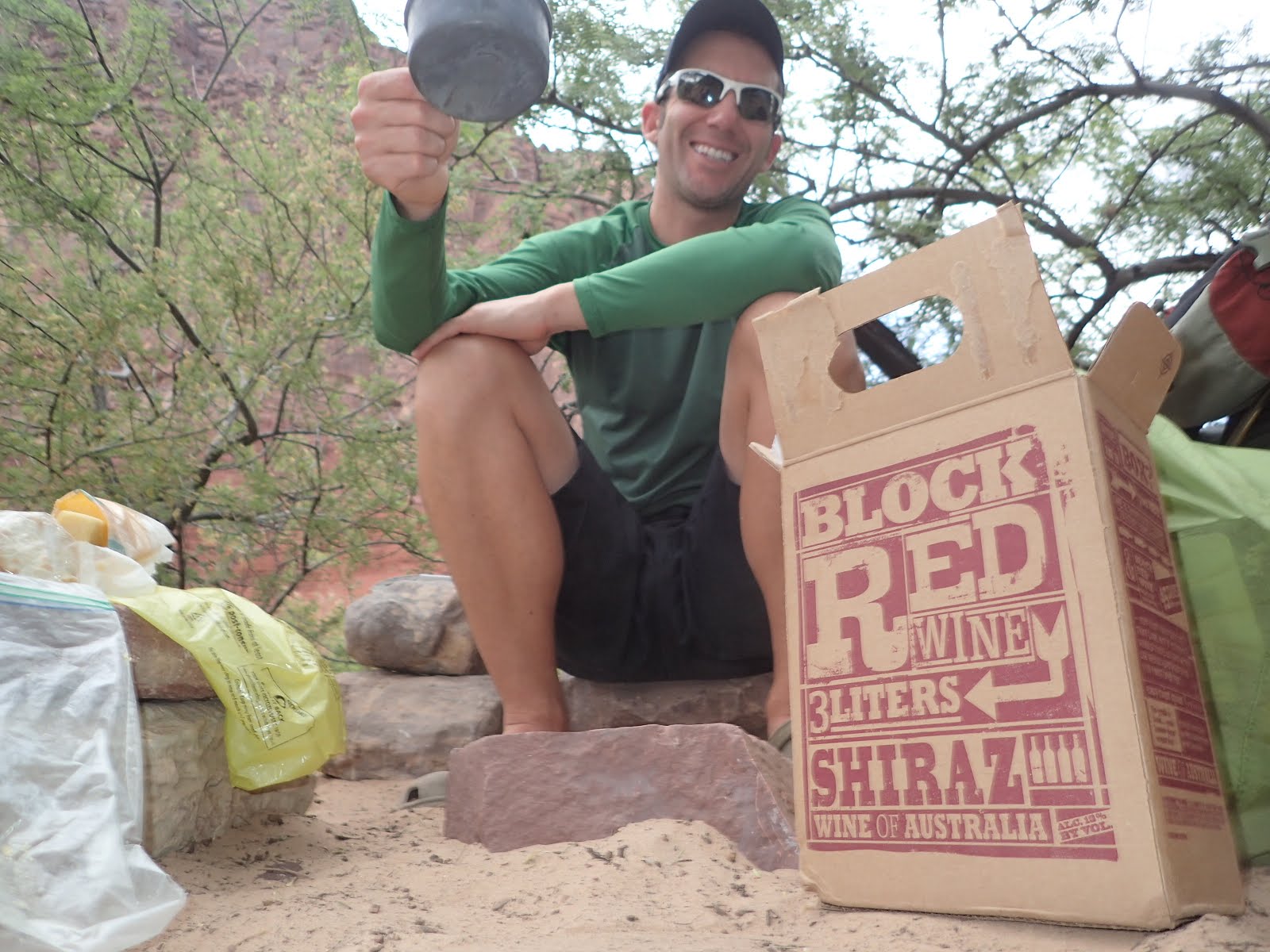
Cheers!!
After a bit we moved the party to the beach


Campfires are not allowed in the canyon, so we wrapped up the party early, had some dinner, and got to sleep soon after dark. It had been a long, strenuous day. Yes, descending can be hard work.
Day 2
Up early, we took care of business - filtering water and eating breakfast.


Then off we went. The trail started out in sand, but quickly moved to what was essentially a field of rubble. We may have gotten on an "alternate" trail. It was pretty hard to tell since it was mostly rock.


Where the heck is the trail??


Looking back at the river as we ascend
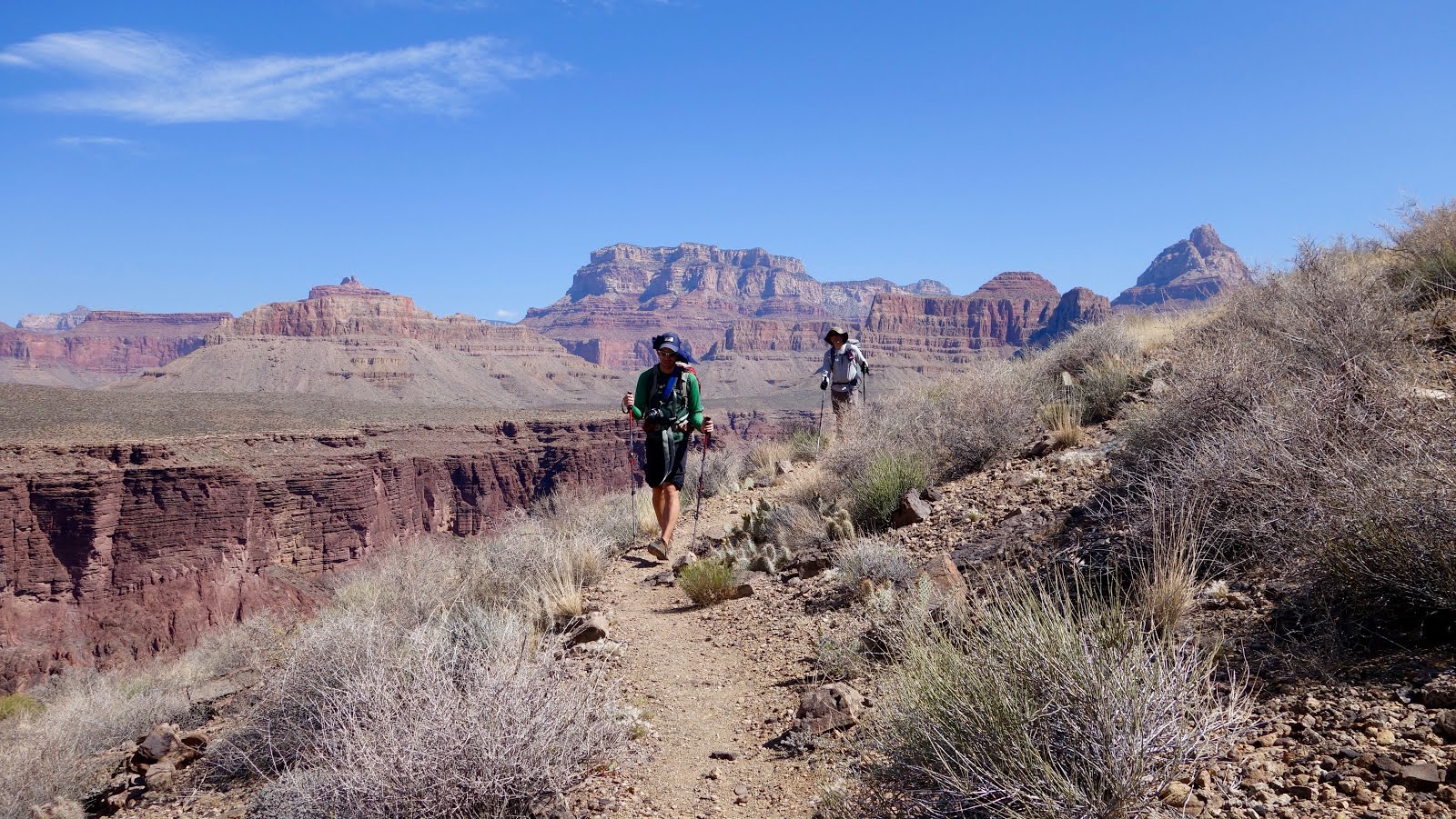
After a bit we got to some trail with a much nicer tread. In the picture below the mesa on the right is our destination. We have to travel way up this canyon before we can cross it though. So, miles to go before we get there.


Looking back toward the river

Such a great place to be

Following the contours

Looking down into this canyon is rather disorienting

You can't really tell, but Chad (in the distance) and I are on the edge of a VERY deep canyon. It is much deeper than what you can see in the picture. We were taking pictures of each other, while Nancy took a picture of both of us - very meta.

Looking up the canyon, you can see where Hance Creek flows.

There were a lot of these ledges. I'll bet they make great waterfalls.

The views are always great

Looking back down the canyon that Hance Creek flows through it is easy to see why we couldn't cross earlier. We had to go up a ways until it was much shallower.

And finally to Hance Creek. Not much water, but enough to cool off with.

Heading up from the creek toward Page (Miners) spring.

When we got to the turnoff for Page Spring there was some discussion. At this point we were less than a mile (and about 400 feet of climbing) from Horseshoe Mesa. We could see it above us. However, our permit was for anywhere below the mesa. It was suggested that we could camp at Page Springs. However, it really didn't look like there was anywhere to camp since we were essentially on a slope - and we really wanted to be up on the mesa.Then, given that it was about noon the discussion went to "should we just press on through and reach the rim today. After much back and forth we tabled it to check out the spring.

And Page spring was more of a seep than a spring. With next to no flat areas to camp. We decided to go up on the Mesa and just see what was what. Maybe there would be a ranger and they'd let us change the permit. Or maybe we'd continue on and camp on the rim. Or whatever.

It looked nice, but not much water
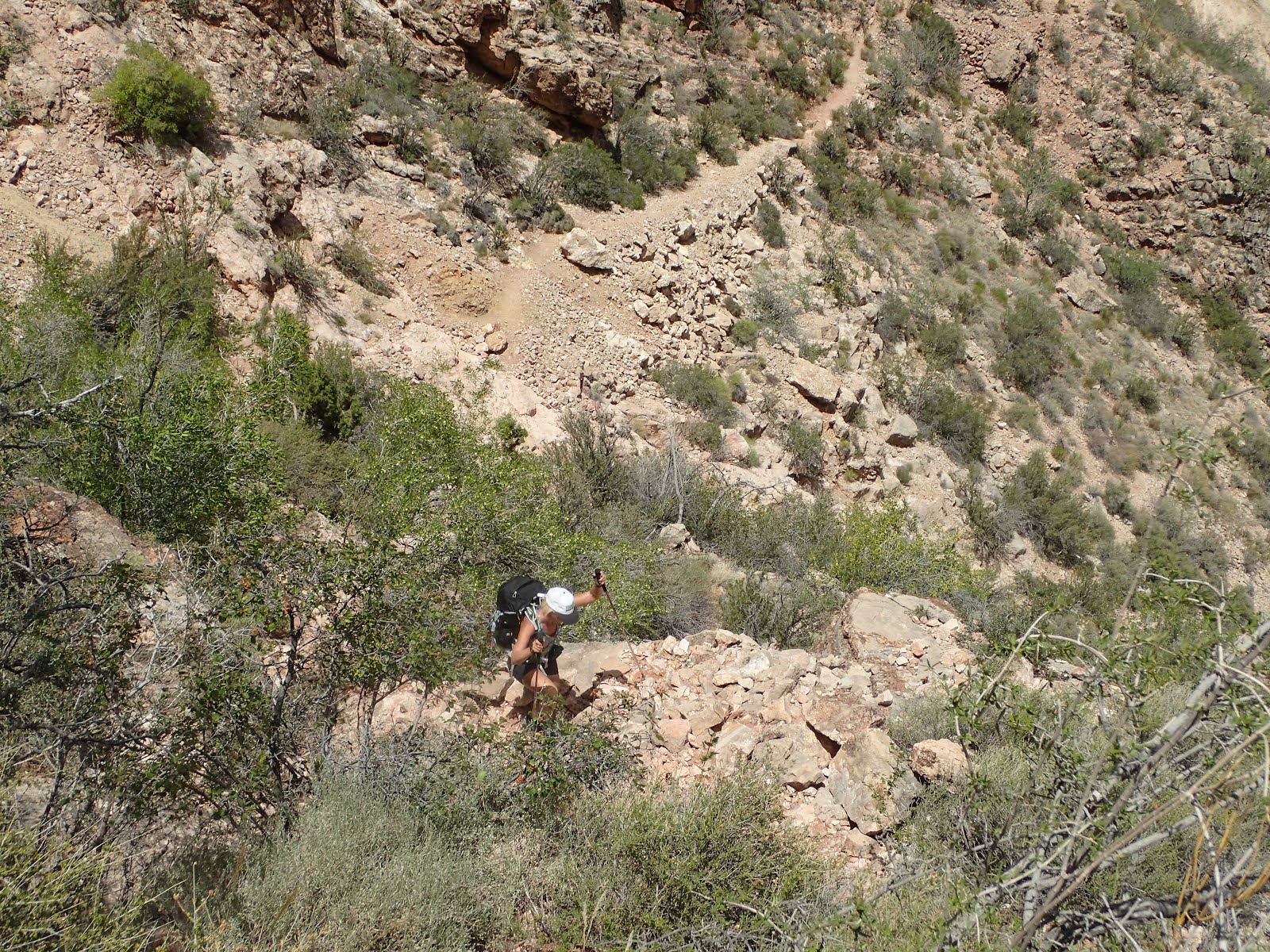
So, up we went to the mesa. The climbing was steep, loose and gnarly. Kinda like the previous day's descent. On the way up we came up on an old mine. Can't imagine trying to drag minerals up to the top of that.


Tools of the trade

Switchback Maaaaaaaania!
Our victorious ascent was met with a rather daunting sign.Turns out there was (and still is) uranium mining in the canyon. And the water that we had obtained at Page spring was right below there. Hmmmmmm.

When we got our permits for this trip we were told that the mesa area had a capacity of 29 people and that due to a scout group reserving the group site up there the quota of 29 had been filled. Which is why we couldn't get our permit for the mesa. When we reached the top we looked around at the individual sites and the group site - not another soul was on the entire mesa. Now it was still early afternoon so we figured maybe folks hadn't rolled in yet. After all, it was only about 3 miles from the top.
So the discussion of what to do next came up again. No way we were going back down off the mesa. The route was sketchy going up and would be dangerous going down. And the route down the other side to Cottonwood looked quite long. Since the day was very warm, we found some shade near a masonry structure left over from mining days and broke out the box of wine. Because why not.
So the discussion of what to do next came up again. No way we were going back down off the mesa. The route was sketchy going up and would be dangerous going down. And the route down the other side to Cottonwood looked quite long. Since the day was very warm, we found some shade near a masonry structure left over from mining days and broke out the box of wine. Because why not.

As we pondered our next move over the fine box of Shiraz a group of two guys and two girls showed up. Apparently they had been at some financial convention thing in Vegas and had decided to take a side trip to the canyon. They seemed to be a little surprised to see us sitting there with full backpacking gear - sipping wine. Chad told them no way he was carrying that box out of the canyon, so they may as well help us kill it. They were game. Not only did they finish it off (before it finished us off), but they carried out the box for us. After a bit they went on their way and we went to claim a camping spot - and see how things developed.

A bit of shade and some food

The loo with a view

And the view from the edge - right near our camp spot
As the day wore on, and no one else showed up, it seemed more and more likely we would not have any issues camping on the rim. Except one. Nancy and I did not budget water very well at Page Spring. I thought for sure we would be pushing through - not spending the night on the mesa, so took only enough water for that. The day was pretty warm and we drank more coming up to the mesa than expected, so we were a bit short. However, with some rationing we figured we could do this.

We are right there
As day turned to evening, two of the very few people we had run into on the trail turned up on the mesa. So, this mesa, with a quota of 29 people, and no permits available, would sleep 5 that night. So much for worrying about permits.
As the sun went down we were all pretty tanked and decided to make it an early night. The wind started to kick up, as it does in the evening on the canyon. Nancy assured Chad and I that it would die down once the sun went down. About 4 hours later, her prediction came true. In the mean time we had some pretty fierce gusts. It was then quite obvious why these camp sites were all designed with mini wind breaks - which were pretty ineffective.
Day 3
We were up at first light. And Oh what a way to wake up.

Room with a view
We did a quick breakfast and headed out on the last stretch, which turned out to be a little tougher than I expected.
The climb across the mesa started fairly mellow.


Then we started going up.


Then it got steep and stayed that way.


Of course there was chunk

View from the Coconino saddle
As we got further up Grandview trail it became less chunk and more "constructed". It was really interesting to see the cobblestone like construction of some of the very steep sections. In the picture below you can see me standing on a section that is shored up by logs. Doesn't look very safe.


I had the last of my water about here


Horseshoe mesa down below


Interesting bit of rock on the way up

You can see the cobblestone tread here

But here the trail is just kind of a mess

Victorious!
Starting the climb out early worked out really well. We had shade for a bunch of the way up and finished in time to get a breakfast bagel back at GC village.
So, the Cliff's notes version.
I highly recommend this loop in the direction we did it. Climbing up New Hance and going down Horseshoe Mesa where we did would both be pretty tough. We could have done it in two days, but were more motivated to be outside than do miles. It is a rugged route - bring hiking poles. If you like getting away from crowds, this is an excellent choice.
I highly recommend this loop in the direction we did it. Climbing up New Hance and going down Horseshoe Mesa where we did would both be pretty tough. We could have done it in two days, but were more motivated to be outside than do miles. It is a rugged route - bring hiking poles. If you like getting away from crowds, this is an excellent choice.
Now I want more. Probably looking at something on the west end of the canyon next.