We ended up being in CB the first week in August. The weather was PERFECT. It was mid 70s each day and no rain. If it were like this all year I'd move here.
Below are the rides we did. Hoping this can be a good resource for anyone who may be interested it riding here. Keep in mind that the climbing and elevation is no joke for us flatlanders. However, the payoff is worth it. This was an amazing week.


Finally you get into the woods and to an intersection of a trail that heads up into the wilderness. At this point you are thinking, awesome, time for some downhill.

But you would be wrong. So wrong. A few feet of downhill followed by steep, loose uphills. You can see where the motos have torn these trails up a bit. Fun for them, but just a slog for bikes. As we got above 11,000 feet I really felt the elevation. Had to take many pauses to get my heart rate down. For us older flatlanders riding at this elevation has its challenges.


Finally, after this point, there was some downhill. I'll say that the climbing on Teocalli is pretty tough overall. It was good to finally be done with that - at least for a couple of minutes.


All good things come to an end. As did the fun on this section. We ended up in the valley and crossed the Slate river on this fancy bridge. Next we'd head up toward Gunsight Pass. I really did not do my homework on this one. I knew it was about 7 miles to Scarp ridge but for some reason didn't look up the elevation gain. I figured 1000, maybe 1500 feet. It was actually a little over 3000 feet of gain. Ooof.


At the top of Gunsight Pass we were not even on Scarp Ridge yet. That still required a very steep climb up to the ridge. You can see the trail in the picture below. We were on the other side of that gate. It didn't take much for us to decide "nope".

 panorama


 looking back from just below Starr Pass

 that last pitch was quite steep


On the road back we were passed by some other bikers who had done a similar loop. Nancy remarked on the cool framebags on their bikes and it turned out that two of them are the owners of Goodday Bikes/Curiosity Bike Bags.


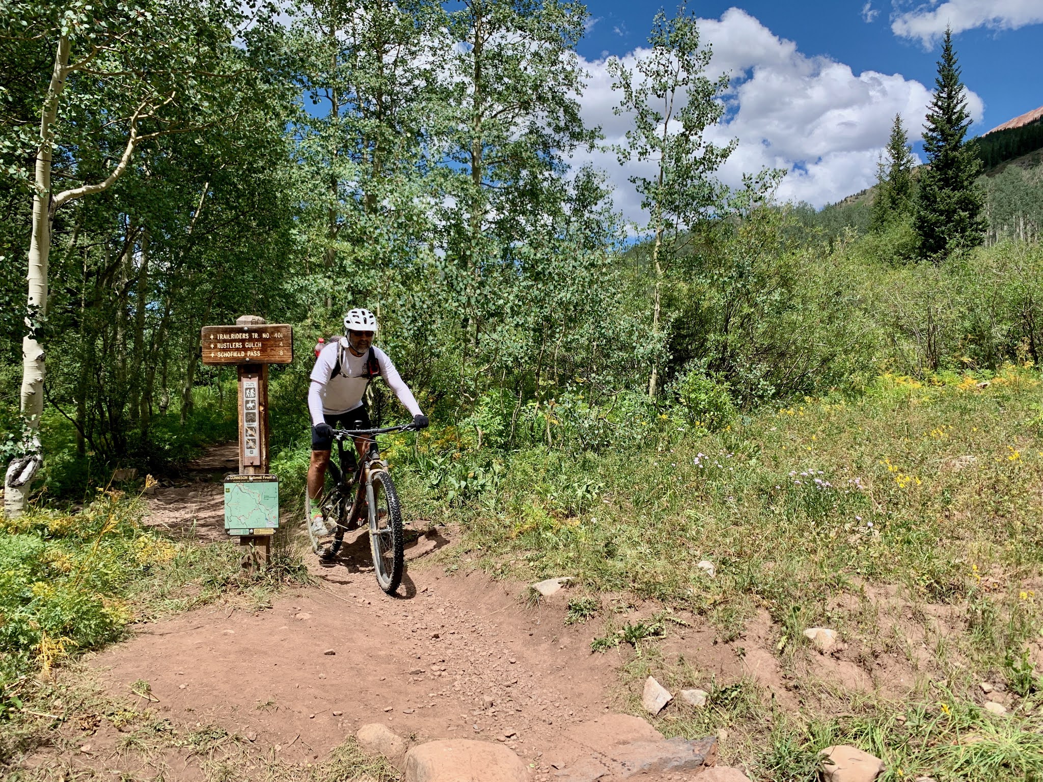
We finally made it up to Schofield Pass, where the 401 trail started. The sign at the 401 trailhead was completely covered by stickers. Not wanting to be left out, I added a couple.


Day 1
We kicked off the trip with a double. Teocalli Ridge and Strand Hill. These two rides were quite different in terms of effort, but they were right next to each other. So, why not?
We parked at the Brush Creek trailhead, which was not the best choice. We should have driven down the road another mile or so and parked at the Canal trail parking area.
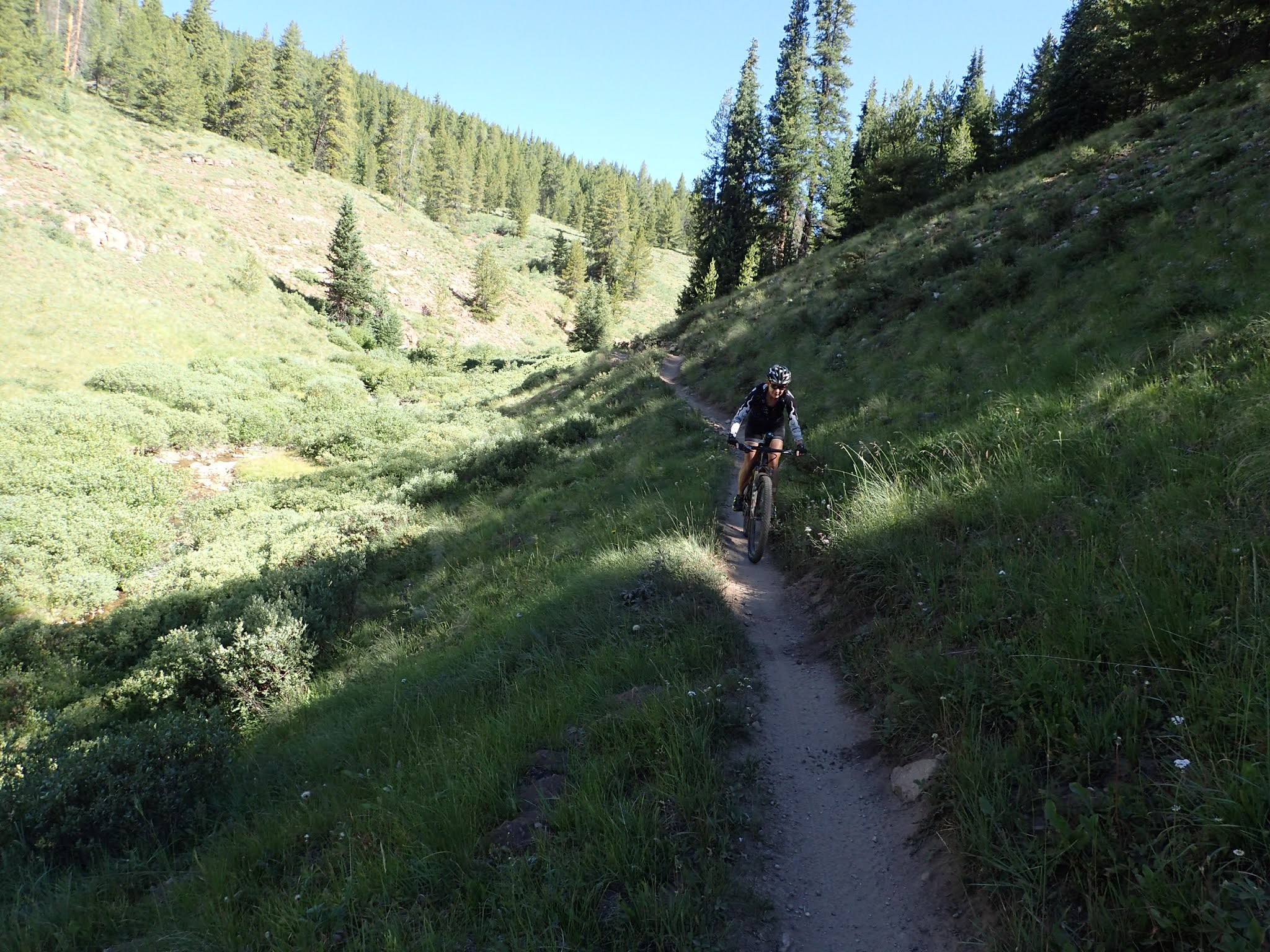
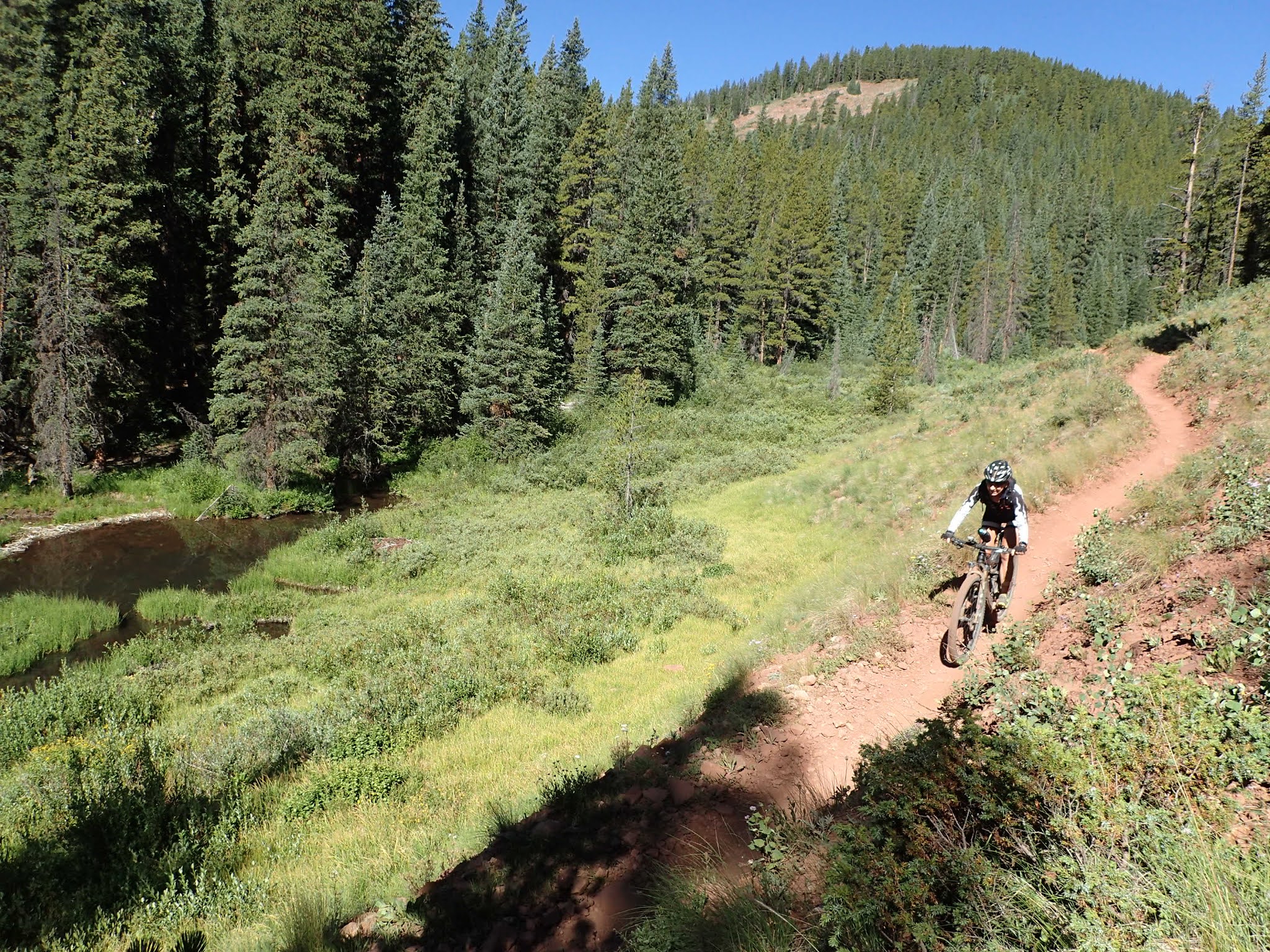
The ride started on flat road, which eventually turned upward. It climbed pretty steadily for a while then crossed a creek. Unfortunately a beaver had dammed the creek, causing it to overflow into the road. So we basically rode up the creek (without a paddle) for a bit.

view from Brush Creek Trailhead

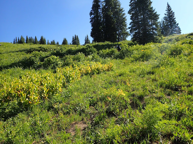
Some easy climbing to start us off
The views
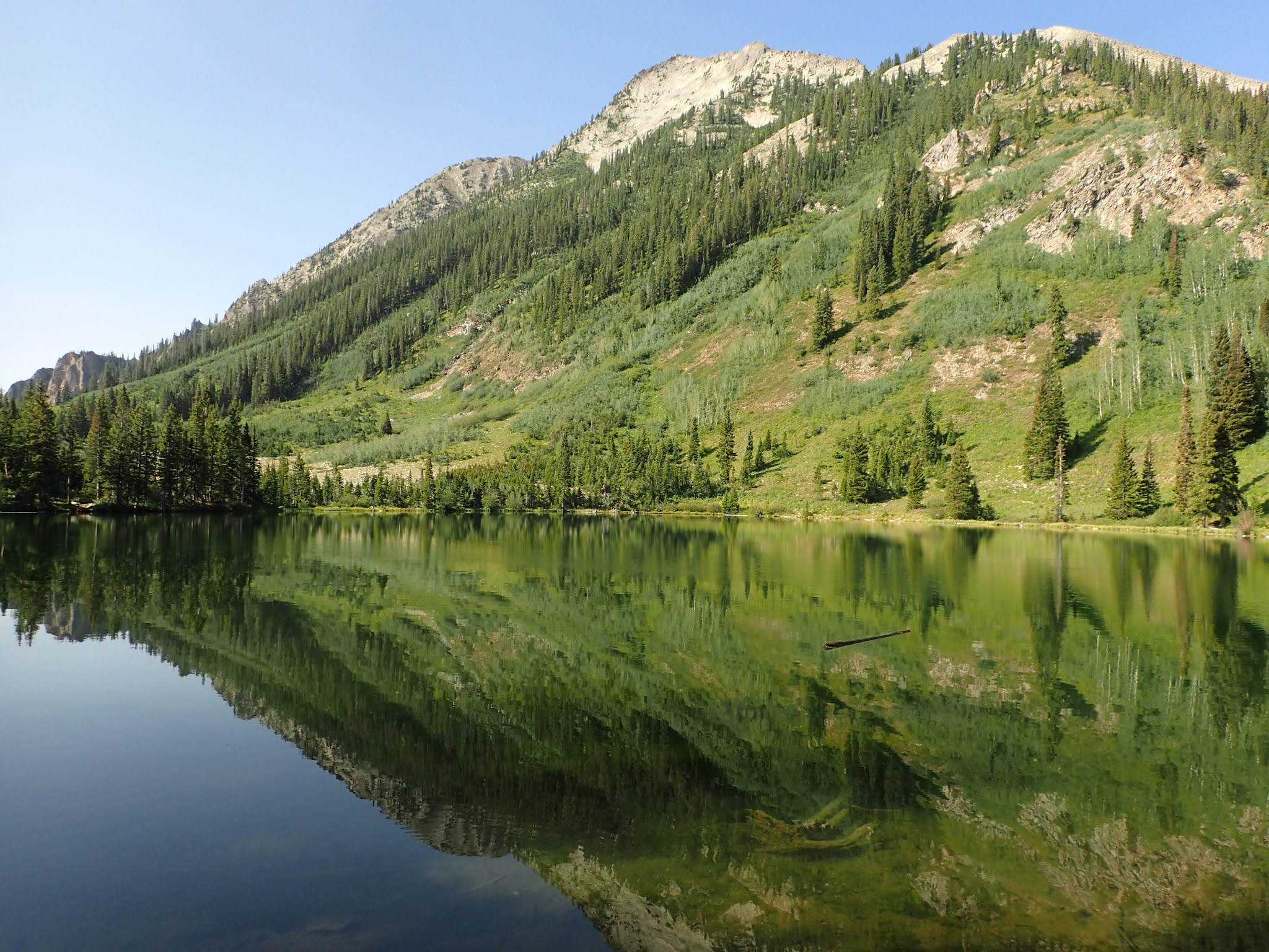
I'm just going to get this out of the way at the start. The views on many of these trails were just stunning. The magnitude of how beautiful this place is just can't be captured in pictures. We tried, but the pics just don't do justice for how magnificent it is out there.


Thanks beavers
We continued to grind up dirt roads until we hit the Teocalli Mountain Trail. Then it started to get real. Some steep singletrack led to a trail that traversed the side of Teocalli Ridge. This trail was quite a bit of work.


oh, but the views...

up and up...

looking back down the valley we rode up

assume the position

cranking ever upward


After a couple of these rutted slogs we reached another apparent high point. A few moto guys from Georgia stopped here and chatted. Then they motored. on. It was a nice place to stop and admire the next valley over.


hit it!!

Some nice downhill

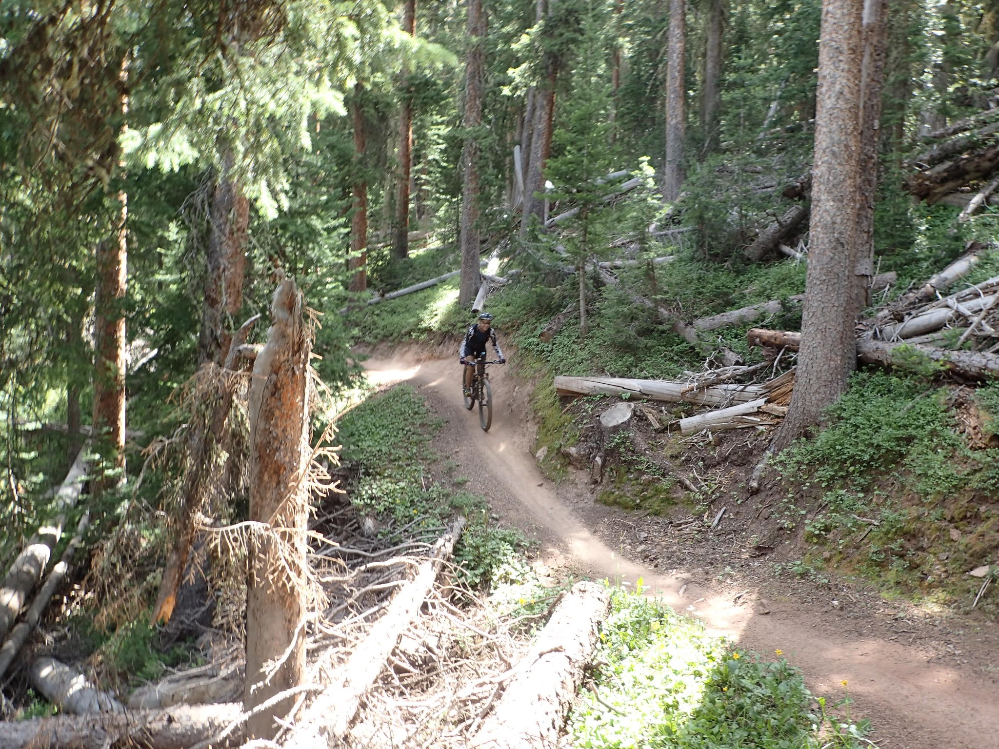
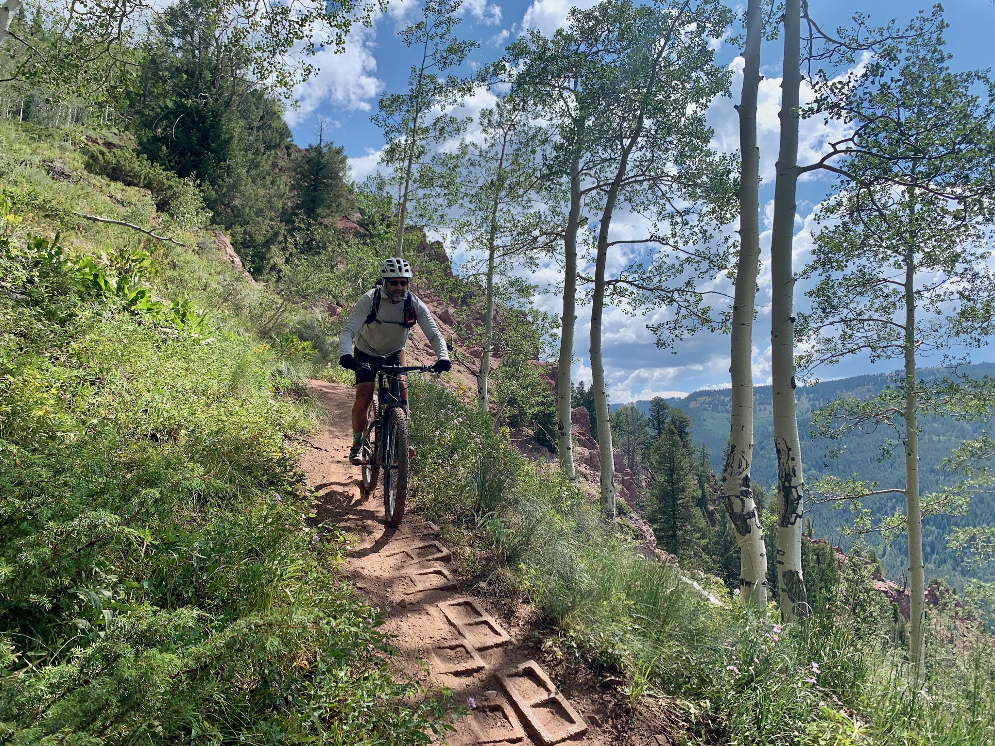
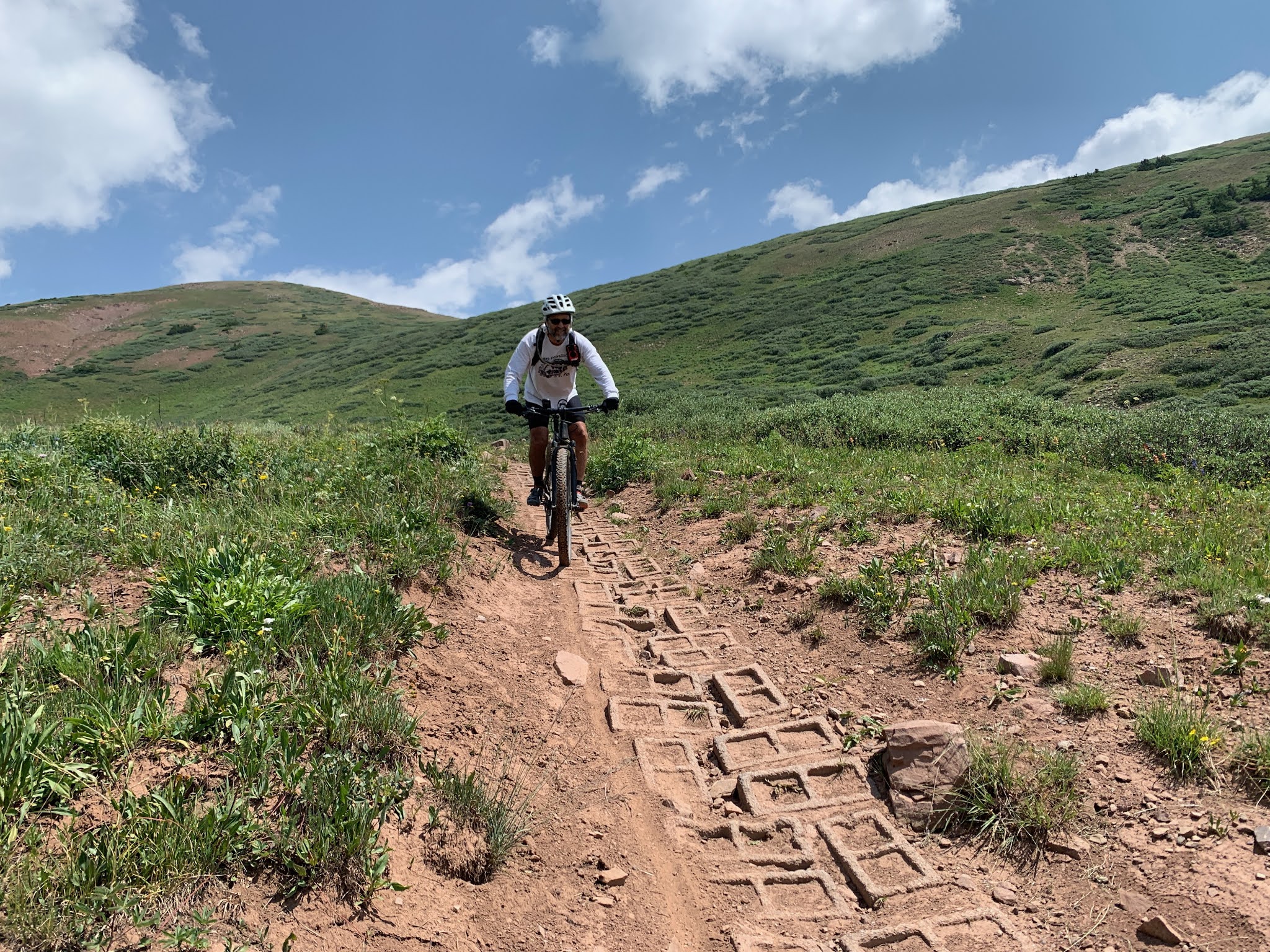
Heavy use of cinder blocks on these trails to keep the soil in place
weeeeeeee

back in aspen


still gotta get down there
I could do this all day...
Sadly, the trail ended before I was ready for it to end. With the ridiculous amount of climbing we did on the front side there was still a lot of elevation to get back when the trail ended. Unfortunately, that was all on steep dirt roads - not nearly as fun as the trail itself.
I was glad to have done this loop because of the great views and that downhill was a hoot - but too short. But this is probably not a loop I'd do again.
As we made our way down back to the car, we came to the Canal Trailhead. That is where Strand Hill hooks in and was our next ride. So, up we went on Canal - for some much more mellow climbing.

These cows were very interested in that pickup
After a nice climb through some meadows we hit an intersection. Fortunately a local told us we should do the loop counter clockwise. She was so right. That direction had us climbing a steep dirt road (boring) and descending down some super fun single track. That descent on Strand was so much fun.


again with the aspen

time for the reward

fast and smooth


this was so much fun

and of course, the views
Day 2
The second day I had planned a nice loop that we could do from our place. It was Lupine/Gunsight connector/Upper Lower. This is a classic Crested Butte loop - but not very long and not a ton of climbing. However, Chad had told me that we needed to check out Scarp Ridge. I noticed that it was not far from the Gunsight connector trail, so I added in a track for that to make it a bigger day. It was only like 7 miles up to Gunsight pass and Scarp Ridge - how hard could it be? Well, brutal is how hard it could be. But more on that later.
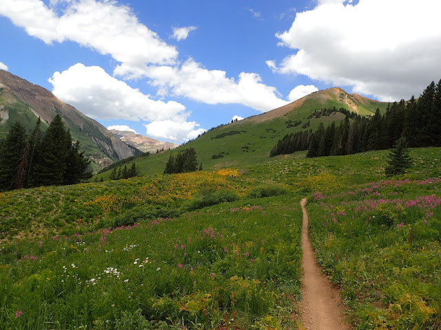
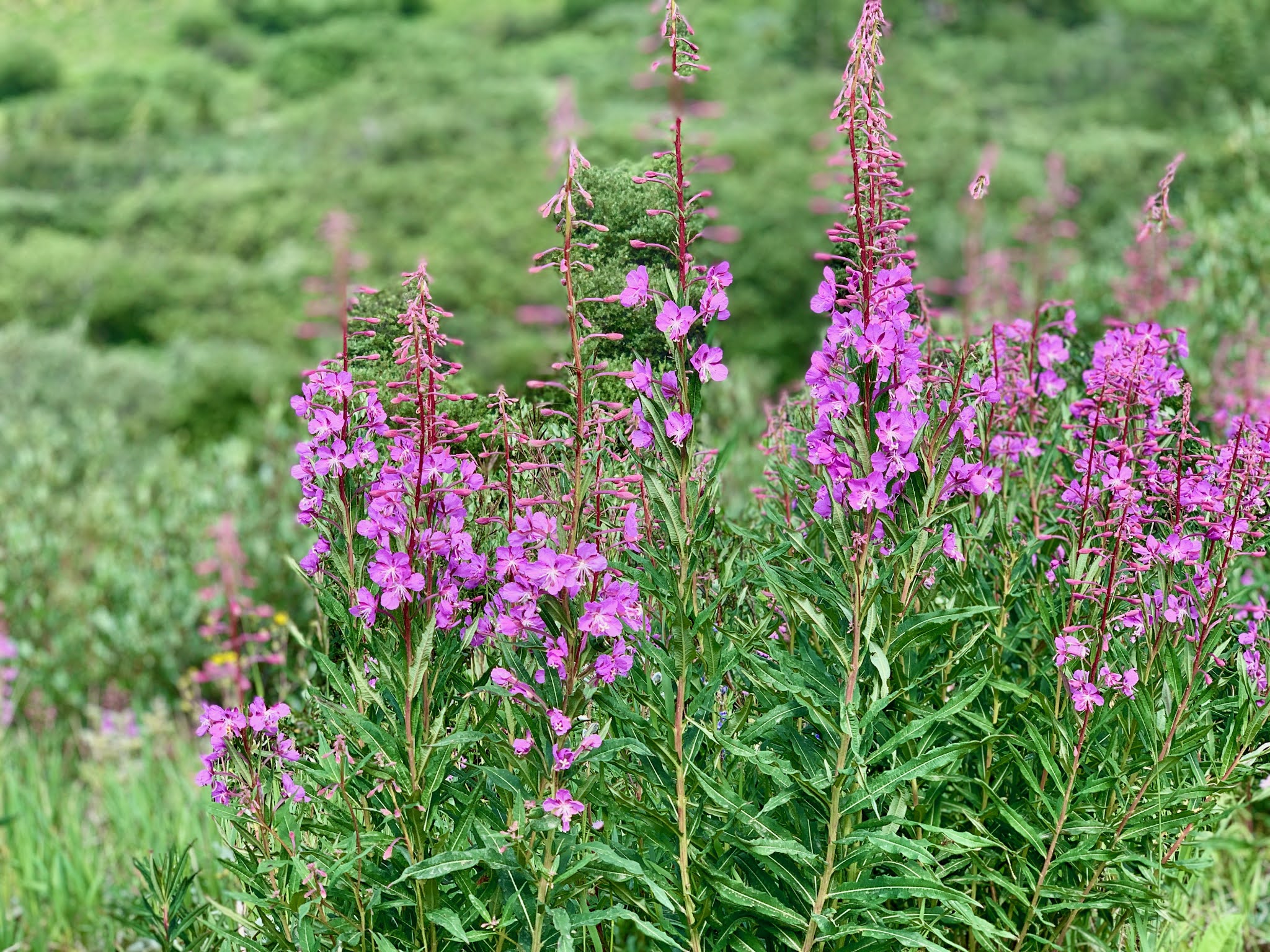
Lupine started out pretty nice. While we were out of peak flower season there were still plenty out there.


love these ramps

Lupine goes for a while along the hillside with nice views of the valley below, but eventually dumps down into the valley. This is where you need to take the Gunsight Connector trail and do a bit more climbing. The payoff is totally worth it. Once you do a bunch of climbing up dirt roads the trail takes a turn down and becomes a dirt based roller coaster.

This section is unofficially called Lando

yippee ki yay


getting close to the bottom


We started the climb on a newish trail called GB. It was really nice and got you very close to one of the feeders of the Slate River.


smiling now. Just wait...
That trail dumped us out onto an old mining road that headed up. The road was a bit rocky, but the grade was not too bad. It was pretty much rideable. And it kept going up, up, up.


going up

getting a little chunky
As we went up and up, with no respite in site, I began to realize that I wasn't really sure how big this was going to be. I asked Nancy if she wanted to head back. I think she paused a second before saying no.
Eventually the trail leveled out a bit into this big valley where a mine once was. There was a stream coming down from a little pond - where the rocks were all bleached white. Not sure what was in the water in that pond, but i wasn't drinking it. This was a really scenic area. However, looking up we could see where the rest of the road went to the top of the pass. All the way up there - really? We'd done plenty of climbing the previous day and figured this was just a matter of grinding it out. However, once the road started climbing from here the surface was essentially all rocks. That, combined with the grade and being over 11,000 feet meant that we walk essentially that whole last section. And it was a very slow walk. A few steps followed by a pause to catch my breath. Ugh.

very cool mining valley

don't drink the water

yeah, that is Scarp Ridge up there

and this is where it starts getting interesting.

making slow progress

getting there

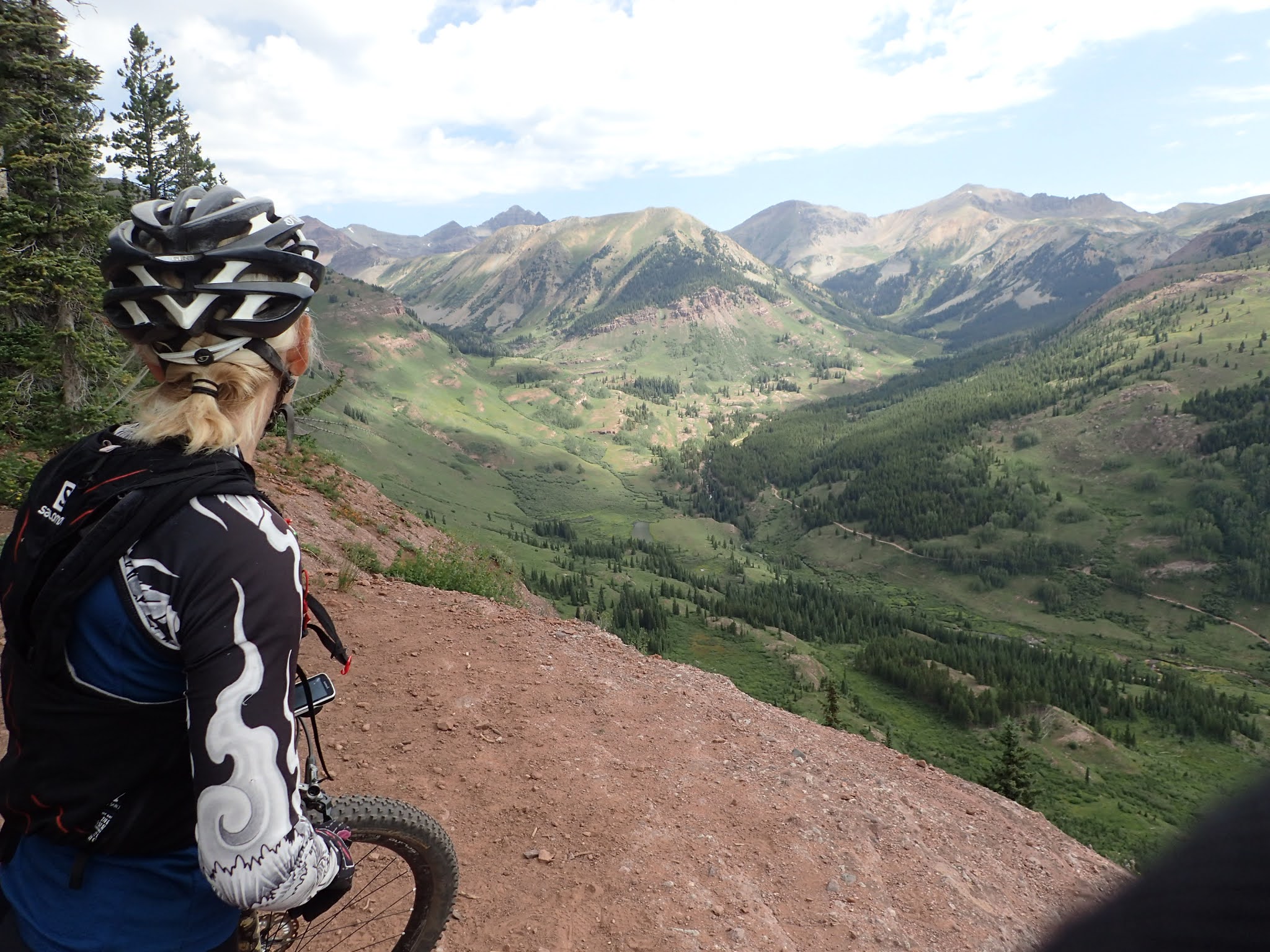
Nancy crests Gunsight pass

I'm done for the day

the other side of the mountain

looking down toward Crested Butte

 panorama
The original plan was to go back down the way we came up and take Upper Lower back into town. But the top part of that road was so bad that we both would have been walking parts of it. I wanted nothing of that. A little research found an old dirt road (Trappers Way on google maps) down the other side of the mountain that essentially went into town. No idea what condition it would be in, but couldn't be worse than what we came up.
It started out a bit rubbly and went down at an aggressive pace, but was rideable. So that was nice.


After a while we came upon some construction and the road suddenly turned to a nicely graded dirt road. Score! We road past some buildings that appeared to be active mining or some such thing. Eventually we made it down to Rte 12. We passed through a gate that said the road was owned by US Moly Corp and it was closed to the public - oops. We headed down the road and a random trail to drop into town for a big ol' sandwich.
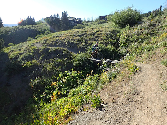
At this point in the story the ride should be over. However, we were staying in Mount Crested Butte and this was in Crested Butte - about a 500 foot elevation difference. Fortunately they have a nice trail that will get you back up the hill - but you still need to pedal.

Day 3
I had planned to do a loop of 403/401 the next day. However a friend of Nancy's who lives in Boulder (Elorie) had given us some suggestions for various routes. One of those was a loop of Crystal Peak. This sounded pretty good and was in the same starting place as another route on our list - Reno/Flag/Bear/Deadman's. We naively decided we'd do Crystal and then do Reno after. The Crystal loop turned out to be as difficult as it was spectacular. Reno would have to wait for another day.
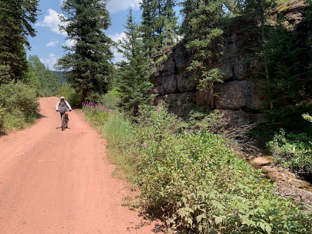
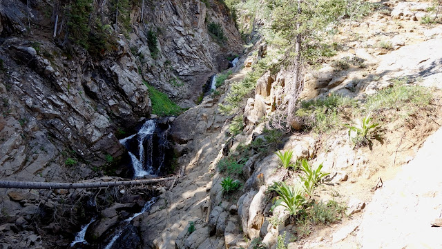
It was a bit of a drive up a dirt road to the Deadman's trailhead, but a really nice area. We headed up the charmingly named Cement Creek Road. It was actually nice riding up the road looking waterfalls and the scenic creek that ran beside the road.

That eventually took us to Upper Cement Creek Trail - which was really great. The trail was smooth and the area was just beautiful. We rode this until it dumped us back on to Cement Creek Road.


Eventually we got to Crystal Peak trail. This would wind us up through woods, then more open meadows to our first pass, at about 12,000 feet. This trail was really well built and with stronger legs and better lungs should be totally rideable to the top.


flower time


looking back where we just came up

and the other side of the pass
The trail we took up was for non-motorized traffic and was in excellent condition. Much of the remaining trails were open to motos, and we did see a few out there. Of course the extra power from a gas engine is much harder on the trails. There was a ton of cinder block usage to try to keep the tread in place - with some success.

That looks like it would be fun, with a motor
We gawked at the views for a while but eventually decided it was time to move on. We were not yet even at the high point - Starr Pass. To get there we'd go down a bit and climb up some pretty darned steep trail.

heading down

I would have traded bikes with those guys in a second

Still need to go up to that pass
 looking back from just below Starr Pass
 that last pitch was quite steep
We didn't spend a whole lot of time on Starr Pass. Just enough to note that we were at 12,347 feet - which is definitely one of the highest passes I've ridden over.

and back down the other side


from here we head back up to the last pass - Double Top

is there maybe an easier way?
There were some good steep sections going up to this last pass and lots of cinder block trail. But it was not too bad.

We made it to Double Top and rejoiced knowing that the rest of the ride was mostly down hill.

you can see the trail coming down from Starr Pass

Coming down the other side of Double Top
The trail coming down from Double Top was really nice in spots and steep/rubbly in others. It eventually hooked up with the Hunter's Creek trail, which was more fun.


Eventually we joined back to Upper Cement Trail, which was pretty much a nice gradual downhill grade to the road.

the trail winds nicely down along the creek

Down the road to finish at Deadman Gulch Trailhead. Even the road back was scenic.


On the road back we were passed by some other bikers who had done a similar loop. Nancy remarked on the cool framebags on their bikes and it turned out that two of them are the owners of Goodday Bikes/Curiosity Bike Bags.
Day 4
After 3 pretty big rides, I wanted a "rest" day. Not much resting got done, but we did do some easier stuff.
We started with a hike of less than 5 miles up to Three Lakes. That turned out to be a good choice - fairly easy, but still great scenery.


nice reflection on Lost Lake Slough

interesting rubble field near Dollar Lake

Dollar Lake


lost lake slough, from above

This little waterfall fed into Lost Lake

getting a closer look

lost lake had a logjam where it emptied into a creek

the water is clear enough to see the fish


After the hike we had lunch and decided to revisit Lupine/Gunsight connector since that was so fun - and we had never actually finished the loop (Upper Lower/Woods Walk). No pics since we had already done it and we were just riding to enjoy it.
Day 5
Since we had a "rest" day, we decided to go big this day. The plan was to do Snodgrass/403/401. 401 is usually done by itself, but we wanted to check out the other trails and they made up a nice loop. That was an really good choice since 403 turned out to be the highlight of this loop.
We started off on the Snodgrass trail which is sometimes open and sometimes not. We lucked out that it was open. It basically went along side of Snodgrass Mountain to deliver us to Washington Gulch. There was climbing (duh) and some nice downhill on this trail.

Mt Crested Butte below

yay - open

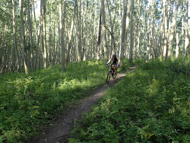
back in the aspen

heading down to Washington Gulch
We had a nice long climb up a dirt road in Washington Gulch. It started mellow then got down to business.

getting "away from it all". I guess.

you can see the final climb up Gunsight Pass in the distance

time to climb

just another scenic valley

steep - yay


done with the road. ready for more climbing on a really nice trail

We weren't even at the top and the views are still epic

get it

and up...

sunshine, nice trail and amazing views

Word is that the climb from Washington Gulch on 403 was reworked a while back. The work showed. Almost made it enjoyable to climb - almost. We did eventually reach the high point, which had a convenient rock pile to soak in the ridiculous views and gather energy for the downhill.


Then it was time to head down. The trail started out a bit steep and loose, but mellowed out to more fun downhill. It finished very steep with some gnarly bits.

fun and fast


yeah, more flowers and stuff

it gets pretty steep from here


umm, no
We made it down 403 to Gothic road. We headed up this valley for more fun climbing on the dirt road. Of course it was steep at times. As always, there was stuff to look at along the way.

appropriately named Emerald Lake


ours is down in the lower left
One would think that the amount of climbing done on Gothic road to get to this trail would be the end of that. One would be wrong. So, time to switchback up the side of a mountain. Not any pics of that, because it wasn't picture worthy.
Finally we hit the high point. From here it is around 3.5 miles of pretty continuous downhill. This is what people do this ride for.

time to head down


switchbacking down the hill

a somewhat dodgy section


we climbed up that road to get to this trail

looking back up the valley
The descent ended on a REALLY nice section with some switchbacks through aspen. I enjoyed this far more than the sections along the hillside. You could get some bonkers speed on some of these parts. However, all good things end and we headed up for more climbing.

up we go

and back down
Eventually, the trail ended and dumped us back on Gothic Road. Gothic road is named after a former ghost town of Gothic. The town has been repurposed into the Rocky Mountain Biological Laboratory - which is pretty cool.

Gothic

We cruised down Gothic Road, stopping occasionally to look at the sights, to the end of our day's ride.

Day 6
Back to Deadman Gulch trailhead to do Reno/Flag/Bear/Deadman's. This ride turned out to be more about the ride than the views. We did have a little scenery near the top of the first climb, but were mostly down in for the rest of the ride. There were three climbs and three descents. The descents were great fun and made the climbs worth doing.


The initial climb was mostly on a pretty good dirt road

Some decent scenery near the top of the climb


time for the reward for all that climbing

fast, fun, open

and it just keeps going


water everywhere - even though it didn't rain all week


time to regain some elevation for the next extended downhill

once again we head down


calorie break


start of the last climb - up Deadman Gulch

nice little stream to the side keeping us company

and the beavers did what they do


all that is left is a downhill with tons of switchbacks

fun stuff

up in the pines

then down in the aspen

fini
Day 7
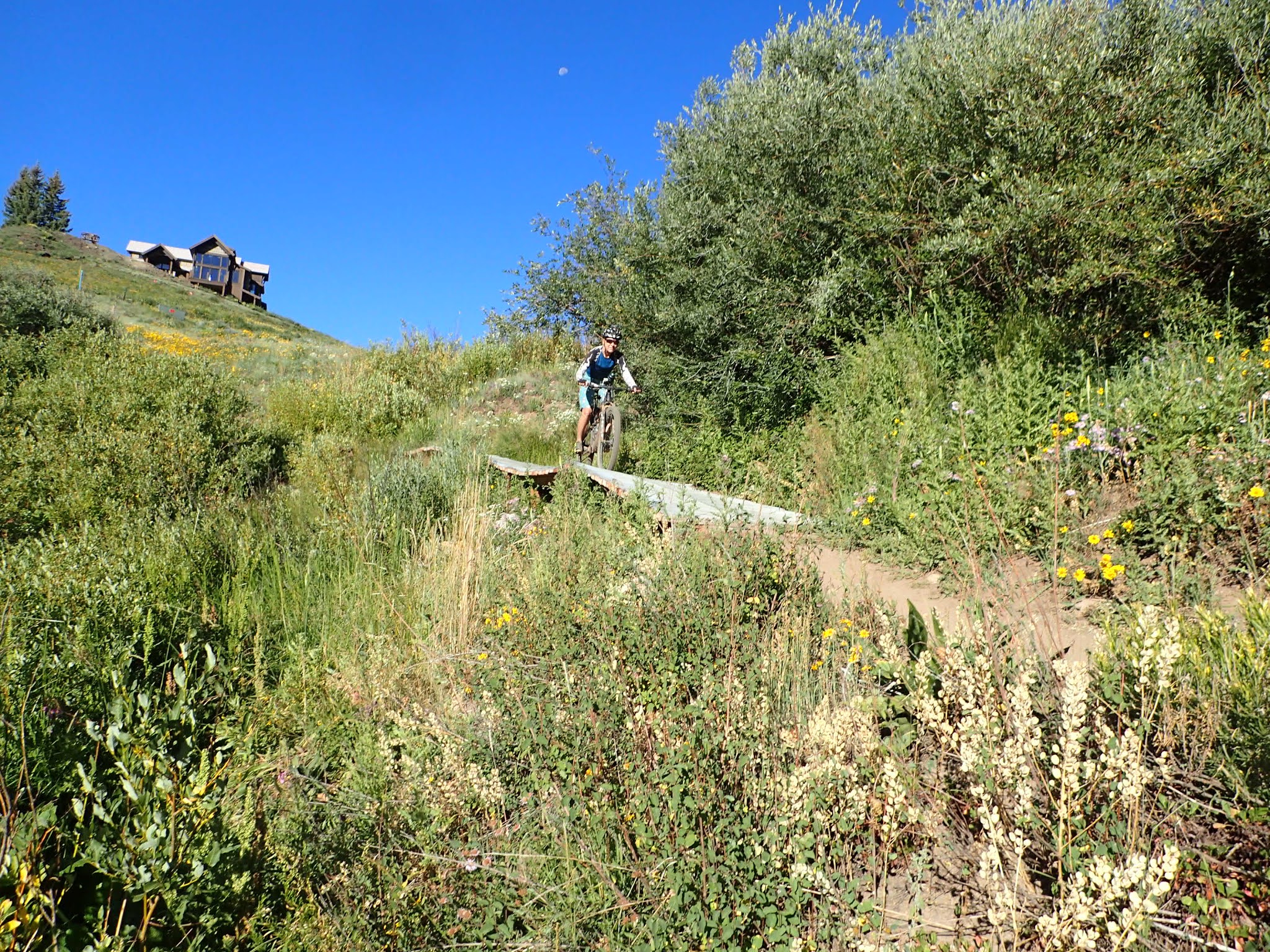
We decided to do an easy early morning ride on our last day. We found a recommended loop on some of the Mt. Crested Butte ski resort trails that sounded like it would be good. The loop turned out to be better than we expected, with some nice views and good trail through a mix of different areas.