Nancy wanted to do a bikepacking weekend, so she called John to see if he had any good ideas. Turns out he was wanting to take a spin on the White Rim Trail in Canyonlands National Park, Utah. The next weekend didn't look good so the two of them planned to do it the weekend after. Joe was invited, so we had a foursome. FYI, John's writeup of the weekend is here.
The plan was to drive up Friday, ride the rim Saturday/Sunday and go home Monday. After some discussion, we decided to also shoehorn in a shuttle of "The Whole Enchilada" on Monday and head home right after.
Nancy and John came up with the idea to rent a pickup so we could do the 8 hour drive together. The day before we were to leave Hertz cancelled the prepaid pickup rental and offered us a car instead. Clearly, this was not going to work for 4-bikes and 4-people with camping and bikepacking gear. Joe offered the use of his Volvo wagon - we'd put two bikes on the roof rack, two bikes on the rear rack. We had to pack light, but this worked.
The next drama on this trip started early. Joe's hitch rack is located in such a way that his exhaust is right about where the wheels on the bike are. He created a heat shield to keep that from being an issue. However, there was a whole lot of adjusting of the rack to make John and Nancy's bikes fit on there. On our first stop for fuel Joe noticed that the heat shield was not where it needed to be. The heat from the exhaust had melted Nancy's carbon rim.
I think we have an issue here
That won't buff out
After some frantic texting and calling Nancy secured a replacement wheel from one of the six bike shops in Moab. Fortunately we were headed to a mountain biking mecca - so parts were easy to find. The mechanics at Chili Pepper bikes were super helpful and got everything fixed up while we got a late lunch at Moab Brewery, next door.
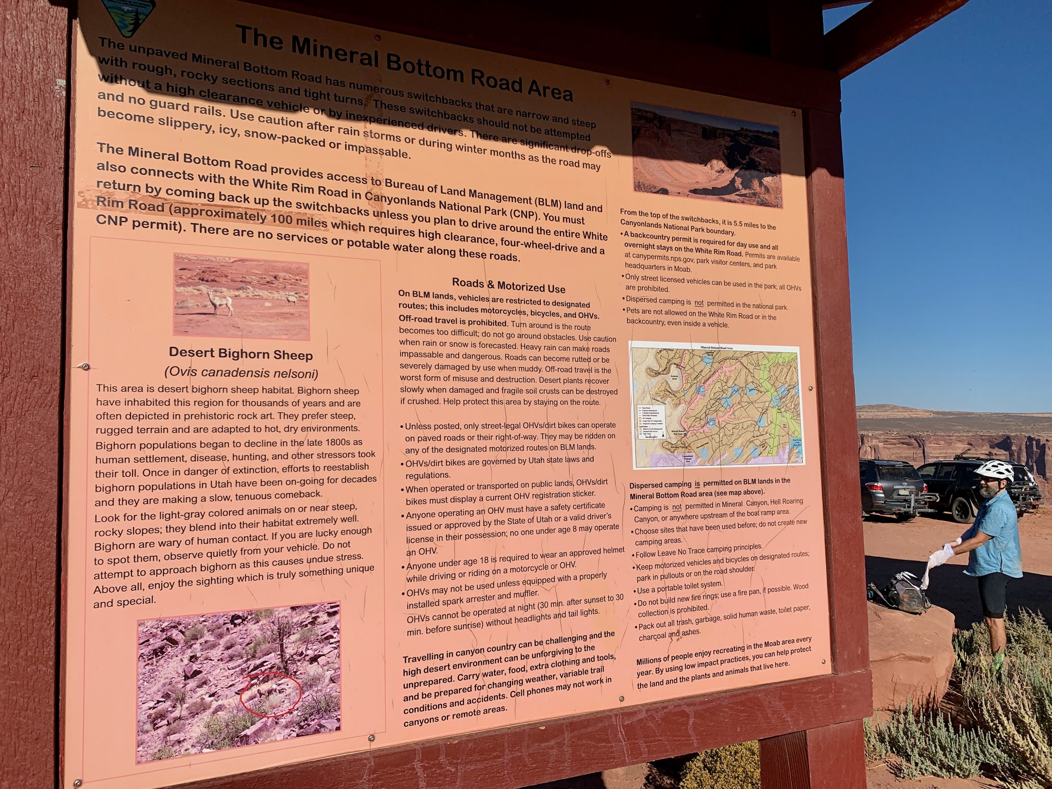
With the fact that this trip was last minute we had to make some compromises on lodging and such. Finding camping at this time on year in the Moab area is pretty tough. Unfortunately the camping spots we were able to secure had us on the wrong side of town both nights - so a bit of driving was required.
First night was at Devil's Garden Campground in Arches National Park. It was a really nice campground, but we didn't actually get there until after dark. First we decided to do the 3 mile round trip to the Delicate Arch. For the record, it is much bigger than it appears on Utah license plates.
trucking up to the arch
pretty dramatic
finally at camp
cool rocks in our campsite
We were up before dawn and left Arches just as the sun was coming up. We calculated that we'd have time to (in theory) finish our first of two days in the light.
The White Rim Trail is ~100 miles mostly on dirt road through Canyonlands National Park with the last 25 of those miles are outside of the park on dirt roads and a little pavement. The start drops down from the main park to a shelf about 1000 feet below. Below are the Green and Colorado rivers - another 1000ish feet below. Due to us doing this last minute we were unable to get permits to camp in the park. This meant we needed to cover ~80 miles in order to exit the park. The plan was to camp at Mineral Bottom - which was just a mile or so off route and on BLM land - where we could camp anywhere. Then we'd do 20ish miles the last day - including about 2000 feet of climbing.
packing up
Nancy's ride with a new back wheel.
 Let's go!
last minute adjustments
that looks fun
away we go
buckle up for a great descent!
hope you aren't afraid of heights
losing altitude quickly
down at the "bottom" ledge about 1000 feet above the Colorado
lots of undercut ledges
You can just see a bit of the river down there
first stop - Musselman Arch
looks more like a bridge than an arch
cool views everywhere
There are a number of camping spots down here. They require permits and are very limited. They are just cleared out spots with a pit toilet. No water.
First campsite we saw
you can't beat the views out here
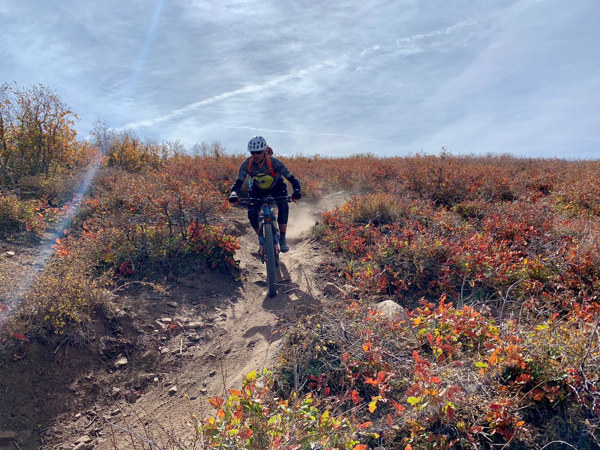
This route is popular with trucks and motorcycles. Most of it can be navigated with a standard SUV. However, there are spots that require better clearance and good grip. There are a lot of companies that do 3-4 day bike tours of this route. They provide sag support and some will even cook for you. The big challenge of this route is that there is NO water for the first 65 miles or so. The river is "right there", but down a big cliff. Being experienced AZ bikepackers we thought we had this part of the trip wired. But it was warmer and drier than we expected and we all wished we had brought more water than we did.
we opted not to visit the crack
Below the rim this route is relatively flat. There are moderate ups and downs. If you look at the overall elevation profile you see definite spikes at the beginning and end, and two little spikes in the middle. Those little spikes are not so little. The first one, Murphy Hogback, took a real mental toll. It was higher, looser, and steeper than any of us expected. We pretty much pushed this entire section. Keep in mind our bikes were loaded down and weighed in the neighborhood of 35 pounds (Nancy's rig) to 50 pounds (John's).
The driver of the SUV in this photo (puff of dust in the upper left corner) stopped and offered me water. I gladly accepted.
ouch
view from the top of the hog
assume the position
This hill was a real gut punch physically and mentally. It required some recovery time at the top. There is a great campground at the top. At this point we were all fairly low on water and experiencing a good bit of dry mouth. We still had about 20 miles until we got down to the river. Fortunately those miles trended pretty much down hill.
recovering at the top near the rare tree
and down the other side
down, down, down
We came upon a Rim Tours group camping at the Candlestick campsite. The guides were prepping dinner for the folks on the tour. Not one of them offered me a beer. But they did offer something of greater(?) value - water! While filling up our water bottles the guides gave us details on the closest place to access the Green River - Potato Bottom C campground . This was important because we were in dire need of a water refill. This was still about 10 miles away, but mostly downhill. Let's get this done!
getting closer to the river
]
so close, but still unreachable
a beautiful sight in the desert
We finally made it to Potato Bottom. Holiday River Tours was there cooking dinner for their customers - again, not one of those guys offered me beer. We traipsed through their campsite to a little trail that went through the brush to the river. This 1/4 mile was the only singletrack we did on this ride.
time to filter water
felt good standing in the water
singletrack! (pic by John)
After loading up on water and cleaning off some of the trail dust, we headed out to tackle the second "spike" on the ride. This one looked similar to Murphy Hogback on our GPS track, but was actually more rideable and less of a kick in the backside.
Because it was getting very near sundown we discussed our strategy. We were probably about 15 miles from Mineral Bottom - where we had originally planned to camp. After some discussion we decided that we had enough water to dry camp, so we'd just find the first reasonable spot outside of the Canyonlands Park - only about 8 miles away.
time to climb
looking back up the river
HAB (Hike-a-Bike) time
getting dark
it was pretty obvious why they had to route the trail up so high
kayakers camping on the sandbar below
getting dark (pic by John)
out of the park (pic by John)
We went down this "spike" pretty much in the dark. There was some really deep sand - which made it rather dicey. When we hit the bottom the trail was pretty good for a while then a sandy mess and finally decent. Right before we exited the park we came upon a park ranger who had some kids sitting on the side of the road. It appeared they had poached a campsite and got busted. Good thing we didn't try that - though it was discussed. We hit the park boundary and started looking. Found a decent looking place and ended our day. 76 miles, 11.5 hours. A solid day.
This is the view I woke up to
pretty nice place to wake up
breakfast in bed?
The first order of business on this day was to find water. The river is bordered by very thick vegetation. It is pretty much impossible to bushwhack through, so we had to find a place where there was some sort of path or other access. After a couple of false starts we found a path to a very nice beach.
this would have been a great place to camp
cool bands of color
From here it was some more flat dirt roads, then the big climb out to the rim.
up on the left is the top
grinding it out
Somebody is going to have a bad day. That is motor oil
this person had a really bad day
outstanding job cutting this road in
switchbacks to the top
Nancy and Joe did see some bighorn sheep the previous day
We made the top of that big climb, but still had a bunch of boring miles on a straight dirt road that climbed gradually. Eventually we cut over on a different dirt road to hit the paved road that goes into the park.
mind numbing
obligatory stop at the visitor's center
Done! loading up
hell yeah!
This was a pretty legit loop. It would be better to do with some sag support due to the water situation. Really hard to carry enough water for that distance - at least when it is warm like this.
We were all pretty beat, but our weekend was not done. We had a 7:30 shuttle the next minute for the TWE (The Whole Enchilada Trail). For those not familiar, The Whole Enchilada is a classic Moab shuttle route. You hire a van to drive up as high as the weather (snow/rain) allows and then ride back into town. We were lucky to be there when the route was open all the way to the top (Burro Pass) at about 11,000 feet. We'd end at about 4,000 feet in Moab. So it "trends" downhill. However, there is still about 2,000 feet of climbing on this route. So, a fun ride - but far from easy.
Our campsite the night after White Rim was at
Dead Horse Point - close to White Rim, but about 45 minutes from our shuttle in the morning.
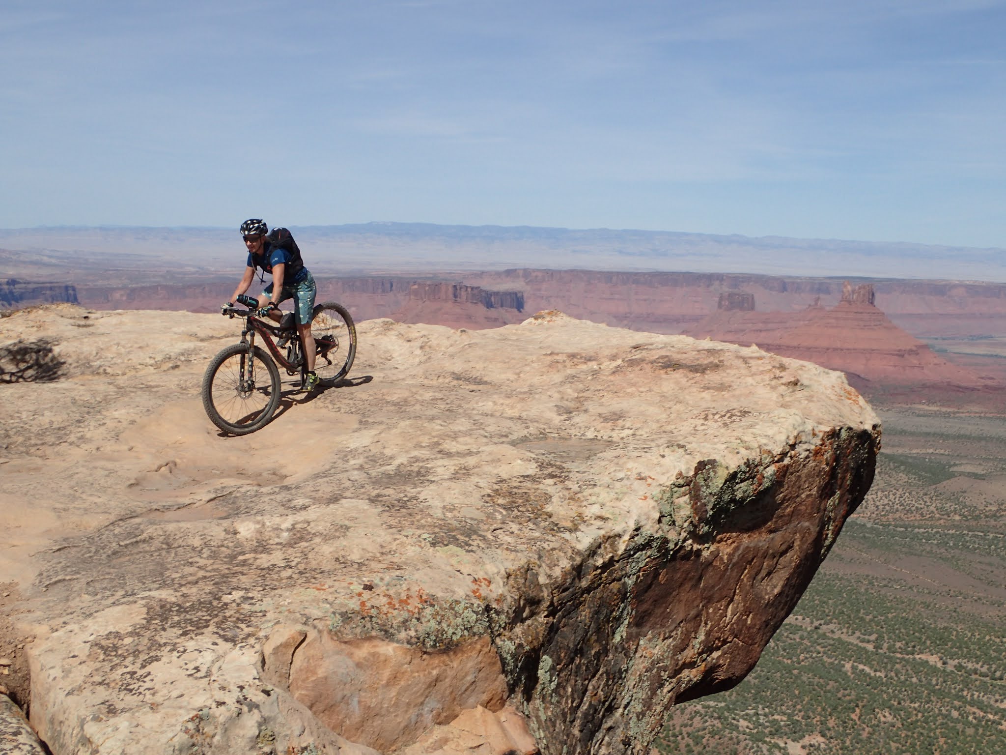
While John, Joe and I chilled - Nancy wanted to go to the point to see the views. Fortunately she took pictures.
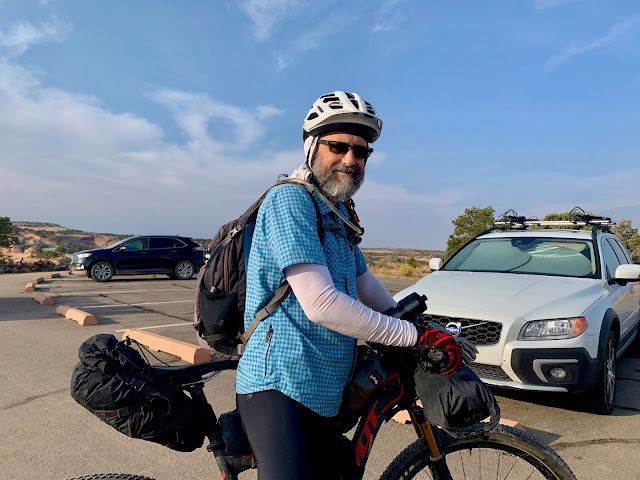
After a very windy night, that saw us all pretty much covered in sand, we broke camp before dawn and headed to the shuttle.


They filled two of these vans
At the meetup for the shuttle there was a bunch of other riders. One of them turned out to be Stefan. He used to do the
AES races. He ended up doing the whole ride with us.
When you start at the top you have a stout climb (being over 10,000 feet doesn't help) to Burro Pass for your warm up.
The aspen were turning to gold
 reminded me of Colorado
uppity up
that is the top
one of the rare times Stefan was behind me (pic by John)
and down through aspen
you can see forever
gold carpet
After descending down from Burro you come to a much more moderate climb from Hazzard County trailhead. That leads to a super fun downhill. It weaves down this hill for a good long way. This was one of my favorite sections of the day. Just so fun.
we'll be heading down there
Kokopelli trail head
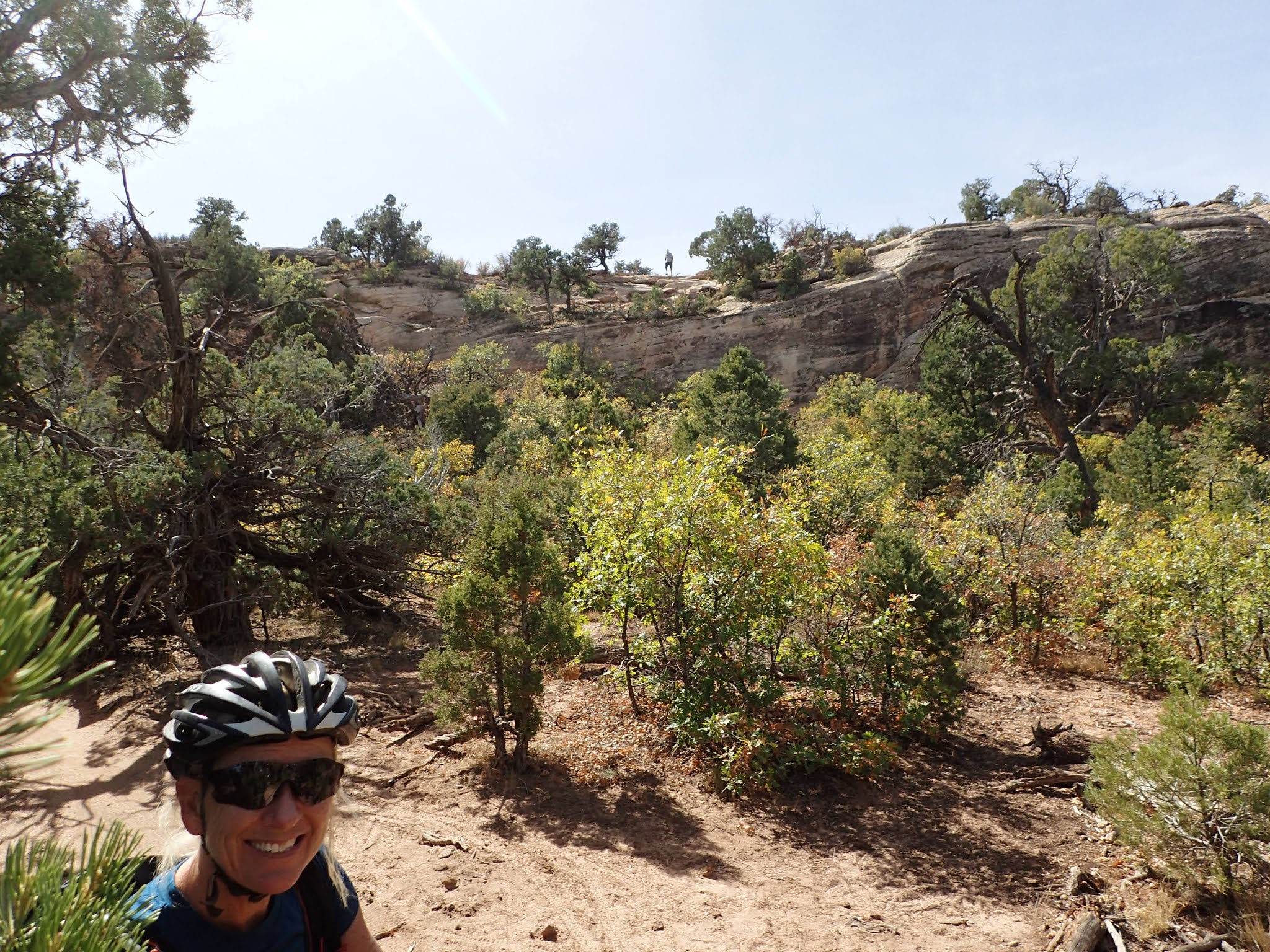
From Kokopelli Trail the route continues down about 2 miles on a dirt road. We decided to detour on a trail called Jimmy Keen. JK bypasses the two miles of dirt road, but adds about 6 more miles of twisty trail. This was a pretty fun cross country-ish trail. Not essential, but I enjoyed it.
John getting air
on the rim - looking back
this trail follows porcupine rim for most of the way
all kinds of fun rock features integrated in the trail
this is a standard place for pictures
John explaining how to go down "the snotch"
this is the smart way to deal with "the snotch"
easy peasy
lots of swoopy downhill turns
you can see someone standing at "the snotch" in the background
reminds me of Sedona
more fun features
riding on the edge
The Colorado below. We'll get there...
some sections are better off walked
The next 4 pics are John gathering his nerve and riding a section with a high penalty for failure.
back down to the river
bike path back to town (pic by, well obvious)
TWE took a bit longer than we expected - but worth it. We got some food and got on the road. This final shot that John took as we went through Monument Valley seems like a perfect way to end the trip.


 Let's go!


 reminded me of Colorado