After bailing (due to being sick) on the second day of the 10th running of Queen's Ransom I was ready to get back out and do some bikepacking. So when John sent out email looking for folks to do the Sky Island Odyssey - West loop, I was IN (and Nancy is always in).
The plan was to do this in 3 days. After some re-arrangement of schedule, Nancy and I thought we could make it work. Unfortunately, a few days before we were to start John got sick and had to pull out. Nancy and I were still on to get out for a ride, but the scheduling had gotten more complicated. So we decided to go with Plan B - the Sky Island Odyssey -East loop, which we could do in 2 days. Weather was looking excellent, and after a cold/wet winter we more than ready to go.
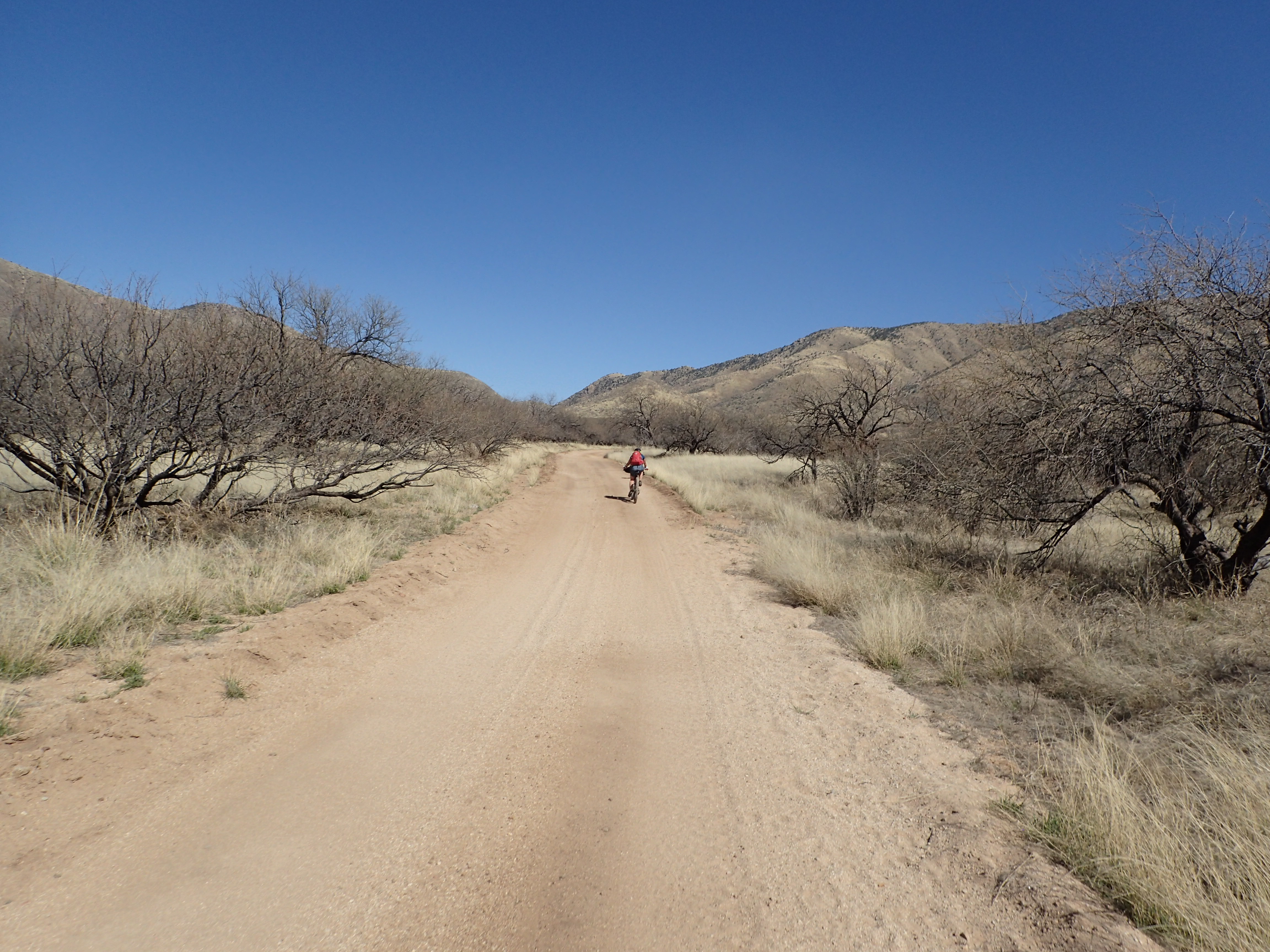
We concluded it best to spend Friday night in Patagonia so that we could get an early start on what we expected (correctly) to be a long day. As we approached Patagonia, not far past Sonoita, we noticed a bunch of smoke out in the hills. And it appeared to be right near where we expected to spend our first night on the trail. Nancy found a website that showed two fires in Gardner Canyon - which was right on route. Arggh!
We brainstormed some alternates and eventually settled on a Plan C which would take us down to Parker Canyon lake and then ride the AZT back to Patagonia. The next morning, after a hearty breakfast at Gathering Grounds, we asked one of the locals if they knew anything about the fire. She didn't know, but suggested checking a local news site. After a bit, Nancy discovered on Twitter that this was a prescribed burn and it was scheduled to end on Friday. So, back to Plan B - Sky Island East!
The fire is VERY close to where we would spend our night out
We left the car at
TerraSol for safe-keeping. Now, let's roll.
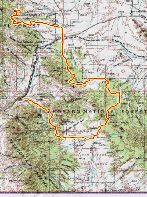
After a mellow roll through town we headed up into the hills.
Going up.
The rocks look a bit like HooDoos.
Happy to be out riding.
Adjustments.
This area had a lot of short trees - that looked like some sort of grove. Maybe once they were? Or maybe it just looked that way?
This area is quite remote and quite dry. However, we did see the occasional ranch. They had quite a drive to the nearest store. Also, there were clearly people living in these hills long ago.
Adobe Ruin
Continuing on...
I noticed water coming out of this hole in the rock...
turned out to be a cave full of water.
This is, unfortunately, a very Arizona thing.
Water!
Seasonal creek. Given our wet winter it was running strong.
Assume the position.
Back grinding out the climb.
.

Lots of up and down in this area.
After much up and down, some of it quite steep, we finally crested the last hill. This gave us a big view of the valley to the west. Interstate 19 (heading down to Nogales) was down there as was the day's supply stop in Green Valley. On the map this was a descent of about 2000 feet. However, it included a number of climbs on the way - so we had to work for it.
Finally heading out of the hills - down toward the valley.
Another seasonal water source.
Looking back to the hills.
We did see cattle up here.
Small mine up on the hill.
The little mine above is contrasted with the huge Twin Buttes strip mine down in the valley. As we descended we could see the mine and a very large retention pond in the distance. Interestingly, there were a bunch of houses down the hill from the retention pond - which didn't seem ideal.
in the distance is Twin Buttes mine
Once we got down to the valley we turned north on the Juan Bautista De Anza trail. It was interesting from a historical point of view, but pretty dull from a riding point of view. But it kept us off roads for a while.
Not the most exciting trail.
Can't imagine making that journey on foot.
Unfortunately we had to jump off the trail as we got close to Green Valley. We saw firefighters putting out a small brush fire along the service road.
Lunch at Safeway.
After getting food and water in Green Valley we headed back toward the mountains. We had a 16 mile climb in front of us. Fortunately the grade was very consistent and mostly not too steep. There was a bit of sand on one of the sections, but we've dealt with worse.
heading way up there
Off the road into a mix of dirt and sand.
That low point is our destination.
Share the road! Moooo-ve over.
Getting there?
Looking back.
Into the forest of few trees.
The grade kicked up a bit.
Green Valley is back down there.
Lovely. Garmin showing lots of colors for the climb.
We finally reached the top of the climb and did a short downhill. At the bottom of that hill I noticed that the Arizona Trail crossed the road. This was a section we had been on many times. It was nice to be back in familiar territory. We knew that we were not far from
Kentucky Camp - which was our water supply for the night. We also know there were some burly climbs between here and there. Onward.
a very "western" scene
We stopped at Kentucky Camp to top up on water but decided not to stop there for the night. It is a popular place for through hikers on the AZT, but we were looking for a little more seclusion.
One of the excellent rollover gates on the AZT.
Home for the night.
The chair was WELL worth carrying all that way.
Day 1 ended up at 68 miles and over 6000 feet of climbing. Even though it was dirt roads and pavement it was still a tough day. I was pretty worked.
The night was pretty chilly, but warmed up quick when the sun came up. Today we'd head out of the mountains to the east and then south into the Canelo Hills - pretty close to where the Arizona Trail race begins.
The roads in this area tended toward rocky...
...and occasionally steep.
So this is what the fire was all about.
You can see where they burned brush. Fortunately the smoke had dissipated.
Looking back toward the mountains.
Coming out of the mountains was a long, grassy downhill.
The mountains are now a memory.
After a quick stop in Sonoita to top off water and for coffee/snacks, we headed south toward the Canelo Hills.
This area is less mountainy and more hilly.
The obligatory trail through a wash.
Not all smooth.
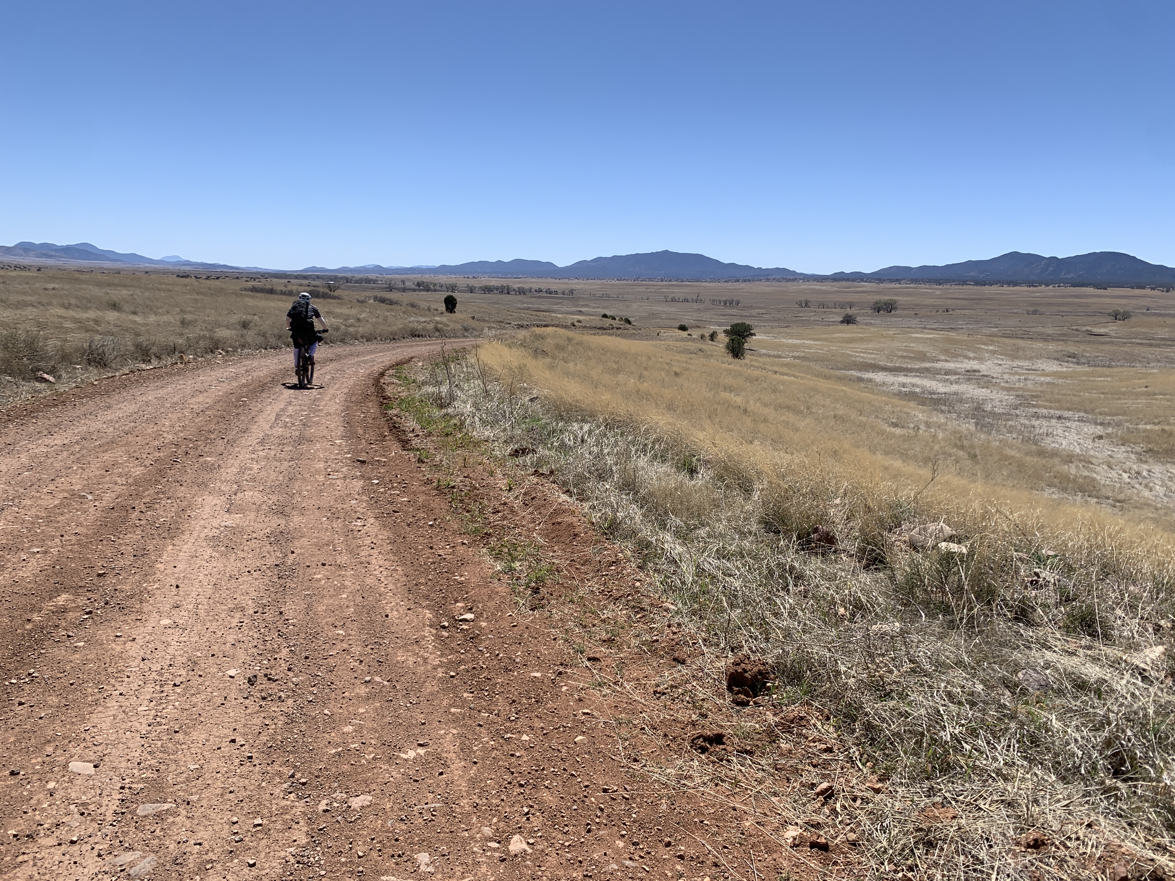
I think that most people have a preconceived notion of what southern Arizona is like. But it is likely not correct. Down in this area of the state there are some pretty big areas of wide open, grassy prairie land in between mountain ranges. Makes me think "big sky".
Wide open prairie.
On a rural road for a bit.
Still plenty of climbs in the hills.
We were not the only ones enjoying the sun.
Climbing up to Canelo Pass.

Top of the world!
Once we crested Canelo Pass we had a long downhill into the prairie. And after that a long, gradual uphill and ended on about 10 miles of downhill along Harshaw Creek.
Heading down there.
We saw some bikepackers going UP this hill. Was glad to be heading down.
Looking back at the hills. The last15 miles seemed longggg. But the expansive views great.
Pretty dry for a river. But after a last 4 mile climb to the top of the grassy plateau. We enjoyed 10 glorious miles of solid downhill to the finish
Ghost tree in Harshaw Creek.
Where the AZT used to come out of the Canelos, above Patagonia. Curious how the sign became bent.
Day 2 was definitely easier than day 1. Ended up with 57 miles and 3300 feet of climbing.
POSTSCRIPT
The official route is suggested to run counter clockwise. Nancy and I both agreed that we liked it much better clockwise. While it would certainly be easier to do this in 3 days, the 2 day pace worked really great for resupply. Late lunch and water fill up in Green Valley. Water/camp at ( or near) Kentucky Camp. Brunch and resupply in Sonoita.
Also, while it is certainly possible to do this on a gravel bike, I think it would be pretty awful. There were lots of rocky, loose, steep ascents and descents that would not be fun with skinny tires.


 Top of the world!