Early this year our friend and adventure buddy, Chad Brown, mentioned that he was getting permits for Yosemite and asked if we'd be interested in going. While I'd rather bike than hike any day of the week, there was no way we could turn that invitation down. Chad ended up getting permits to leave Yosemite Valley (at Yosemite Falls) on May 31 and return via Little Yosemite Valley on June 6. While Nancy and I were quite excited to do the longest backpacking trip we've ever done, there was some concern. That time of year normally sees the upper elevations of the Sierra Nevada mountains covered in snow. Tioga pass sometimes doesn't even open until July. As it turns out this year's snow pack was about 25% of normal - bad for the watershed, but excellent news for our trip. Knowing we'd have to carry a week's worth of food + bear cannisters (required in Yosemite) I decided I needed to get my hiking game on. About 2 months before the trip we started doing 10 mile hikes each weekend plus a 3 day backpack in the Grand Canyon a few weeks before. Unfortunately, family duty conspired to keep Chad and another couple that he had invited from doing the trip - so it ended up being just Nancy and I.
After much planning and guessing about how far we'd go each day, a tentative route was mapped out. Many trips to REI later we were geared up and ready to go.
35 pounds with 1 liter of water. I later moved the bear cannister to the inside of the pack.
Nancy decided that she wanted to do the tourist thing in Yosemite Valley the day before we headed out to the back country. So we did the 12 hour drive to Yosemite, spent a night at the lodge, then went to see the sights.
The view from Tioga Pass
It did rain on the drive in
May as well live it up before roughing it
Given Covid, things were (like everywhere else) weird in the valley. There was no shuttle service so the only way to get around to the different parts of the valley was to walk (too darned far), drive (parking was a major hassle) or rent a bike. The answer was obvious. Even when shuttles come back, biking around the valley is really the easiest way to get out and see everything.
No carbon fiber frames??
If only they had this in a larger frame...
Our first stop was Mirror Lake, which was formed when part of Half Dome came down into Tenaya Canyon and blocked the creek. In not too many years this will fill in with sediment and become a marsh.For whatever reason someone stacked all these rocks near Mirror Lake
From there we headed down to Yosemite falls - which is actually a series of 3 falls. Our trip the next day would start with the climb to the top of these - about 3200 feet of climbing in 3.3 miles.The bottom falls
some really nice paths to cruise down
We'll get a closer look later
The Merced river is serene in the valley
juxtaposition of bare granite and green meadows
We continued down the north valley to El Capitan. This 3000 foot tall expanse of granite is world renown to climbers.
El Capitan
That's a big slab of rock
Just 2997 more feet to go
It really is imposing from the base
some info on the main routes up
Bridal Veil falls was closed since they were working on the trail, so we headed back up the south side of the valley. There was a bit of smoke since they were doing controlled burns.
Starting fires for a change
It was hot, so Cathedral Beach was popular
The Ahwahnee Lodge is the high dollar accommodations in the valley. Nancy went to check out the architecture. Completed in 1927, this National Historic Landmark incorporates art-deco, Native American and Arts & Crafts design motifs, from its stone fireplaces and wall tapestries to its stained-glass windows and hand-stenciled ceiling beams. Some of The Ahwahnee’s star-studded guests over the decades have included Eleanor Roosevelt, JFK, Queen Elizabeth II, Gertrude Stein, Will Rogers and Walt Disney.
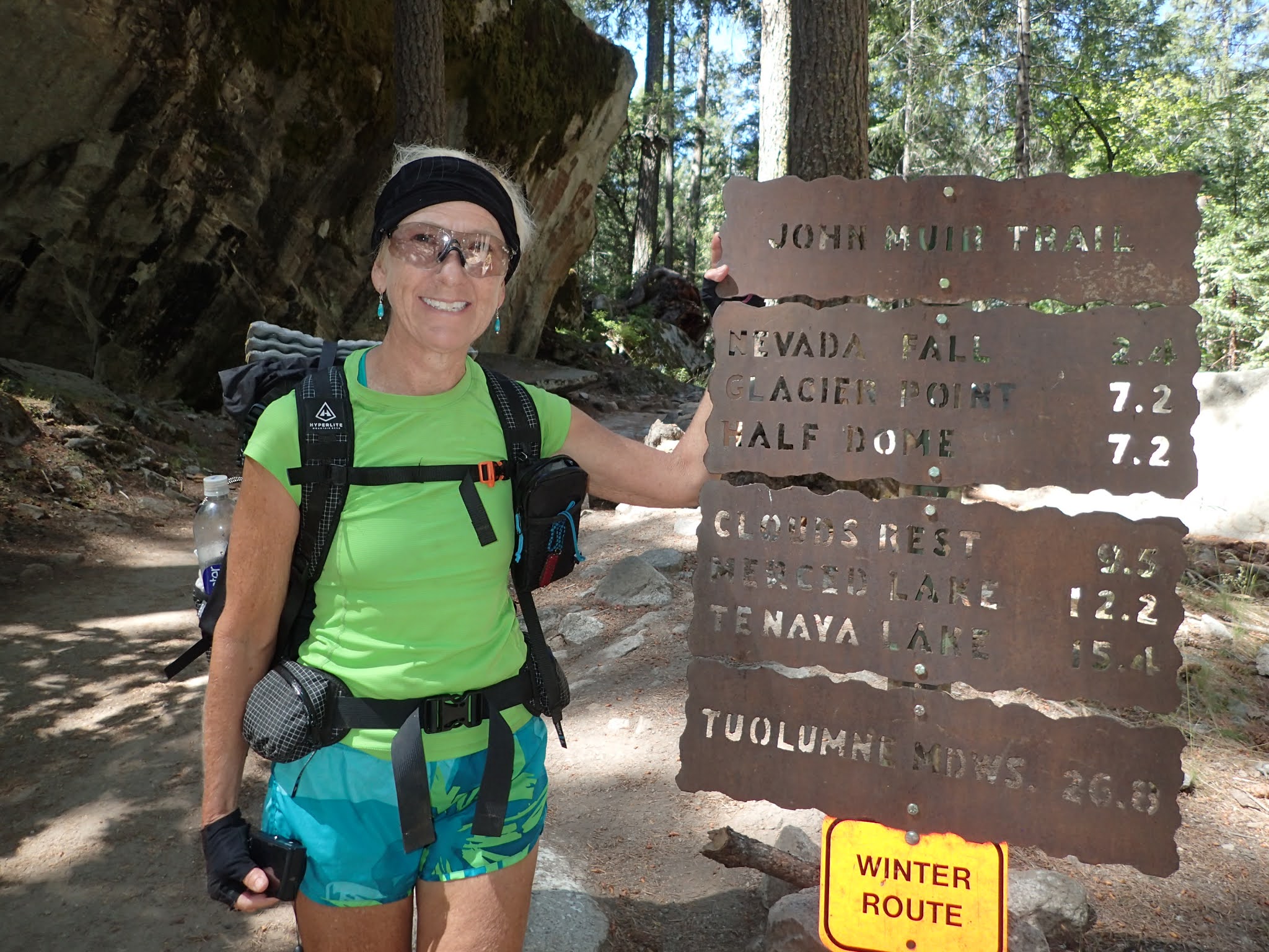
We skipped the whole Mist trail since that would be our exit point in another week. Turned out to be a nice treat at the end of the trip.
Day 1
The plan was to climb the falls, then find a place to camp somewhere near there. We figured the climb would be tough and we'd make it a short day. You can't actually camp near the falls, you have to be 1/2 mile from the rim or 4 miles in on the trail. We had ideas for a couple of spots lined up.
Here we go
Up...
...up...
...repeat.
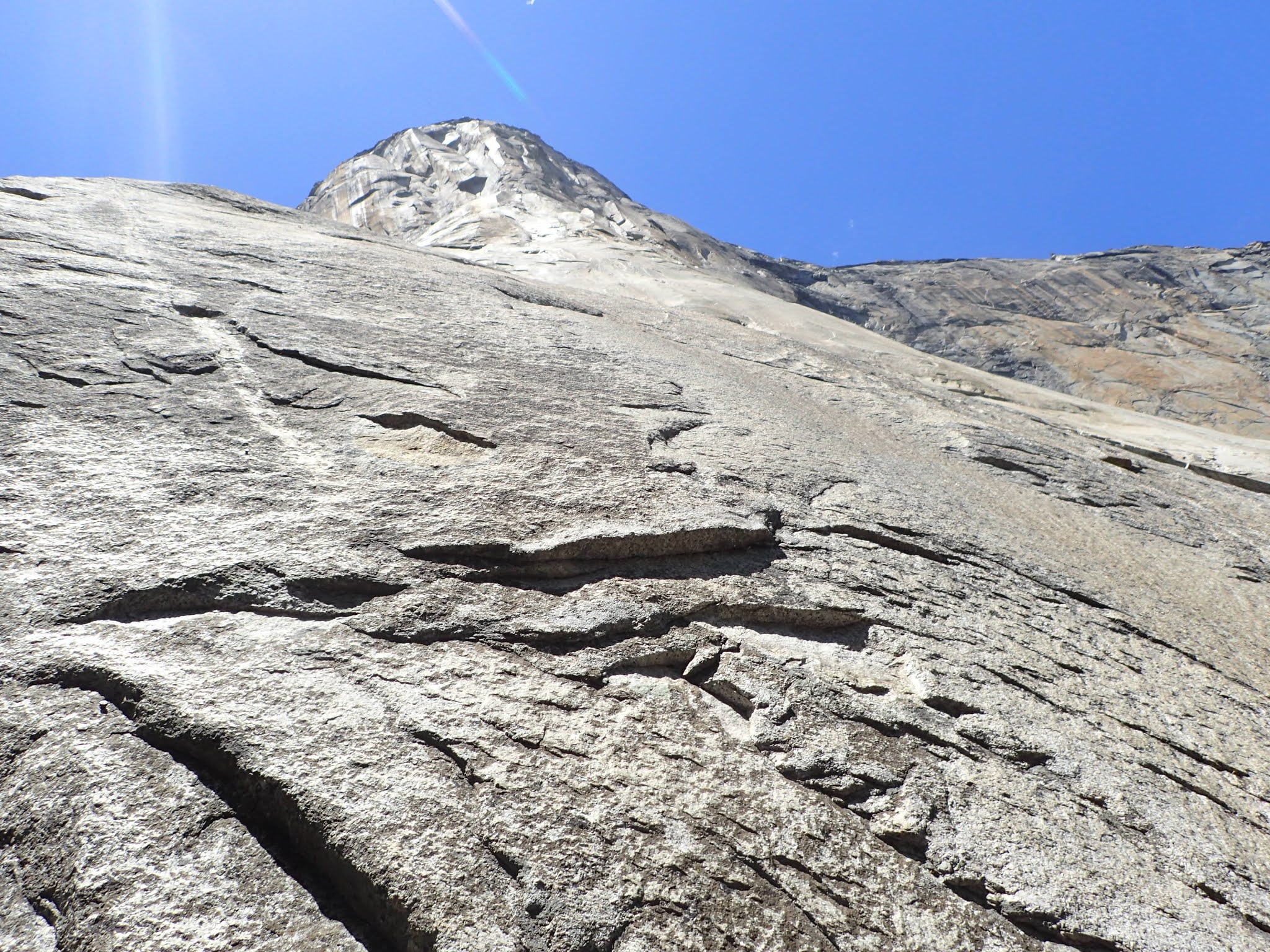
Half Dome in the distance
upper Yosemite falls
There were a few day hikers going up the trail to the falls with us - but not too bad since it was early. Most of those would go to the falls then head back down. A few would go on to Yosemite point. But after that we only saw two other guys - and they were backpacking. It was good to get away from the Instagram crowd.
almost paved
There is a bobcat under that big rock
made it to the top
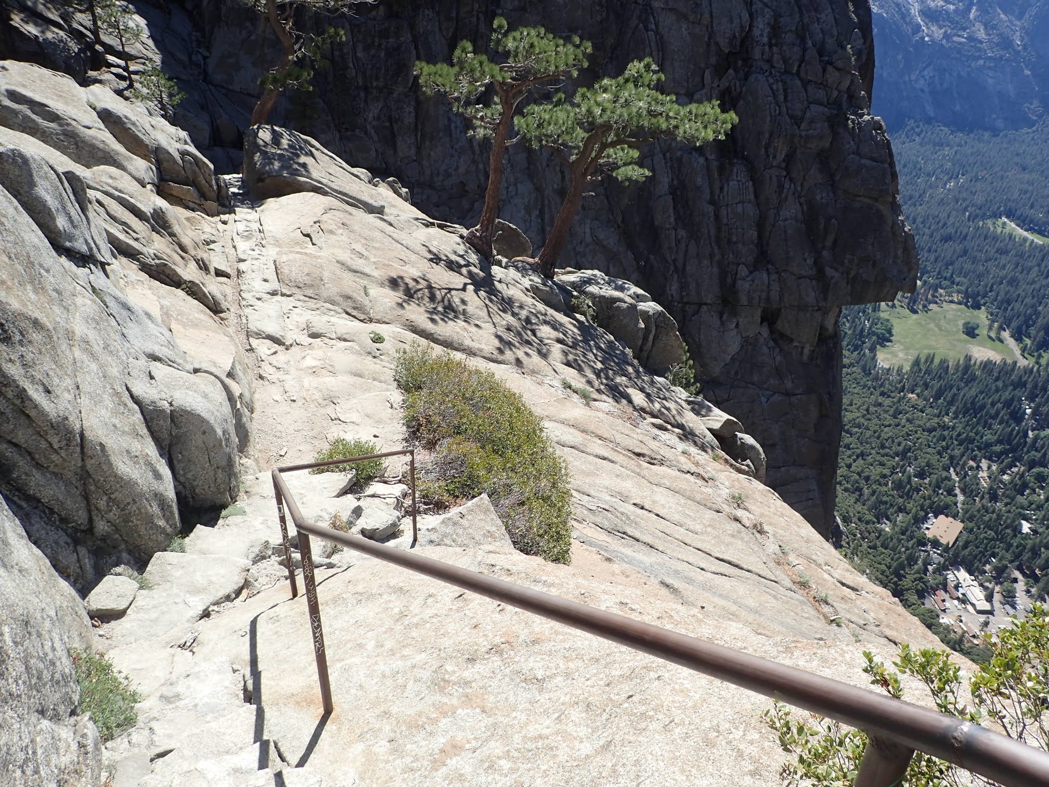
nice little trail down to the top of the falls
scared of heights??
Look ma, no railing
down the water goes
nice view of the valley
the "practice" falls, before it heads down for real
We made the top of the falls a bit quicker than we expected (< 2.5 hours). Since it was still pretty early the thought of stopping there for the night was not appealing. We'd move on down the trail and see what else was ahead.
Next stop, Yosemite point
Crossing Yosemite creek meant more climbing
Yosemite point
Half Dome is omnipresent
Yosemite valley
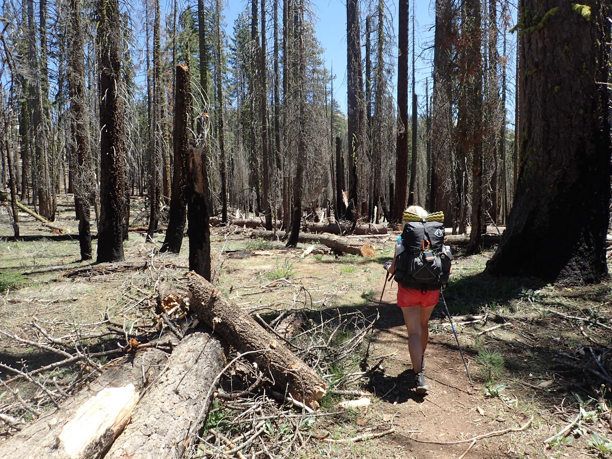
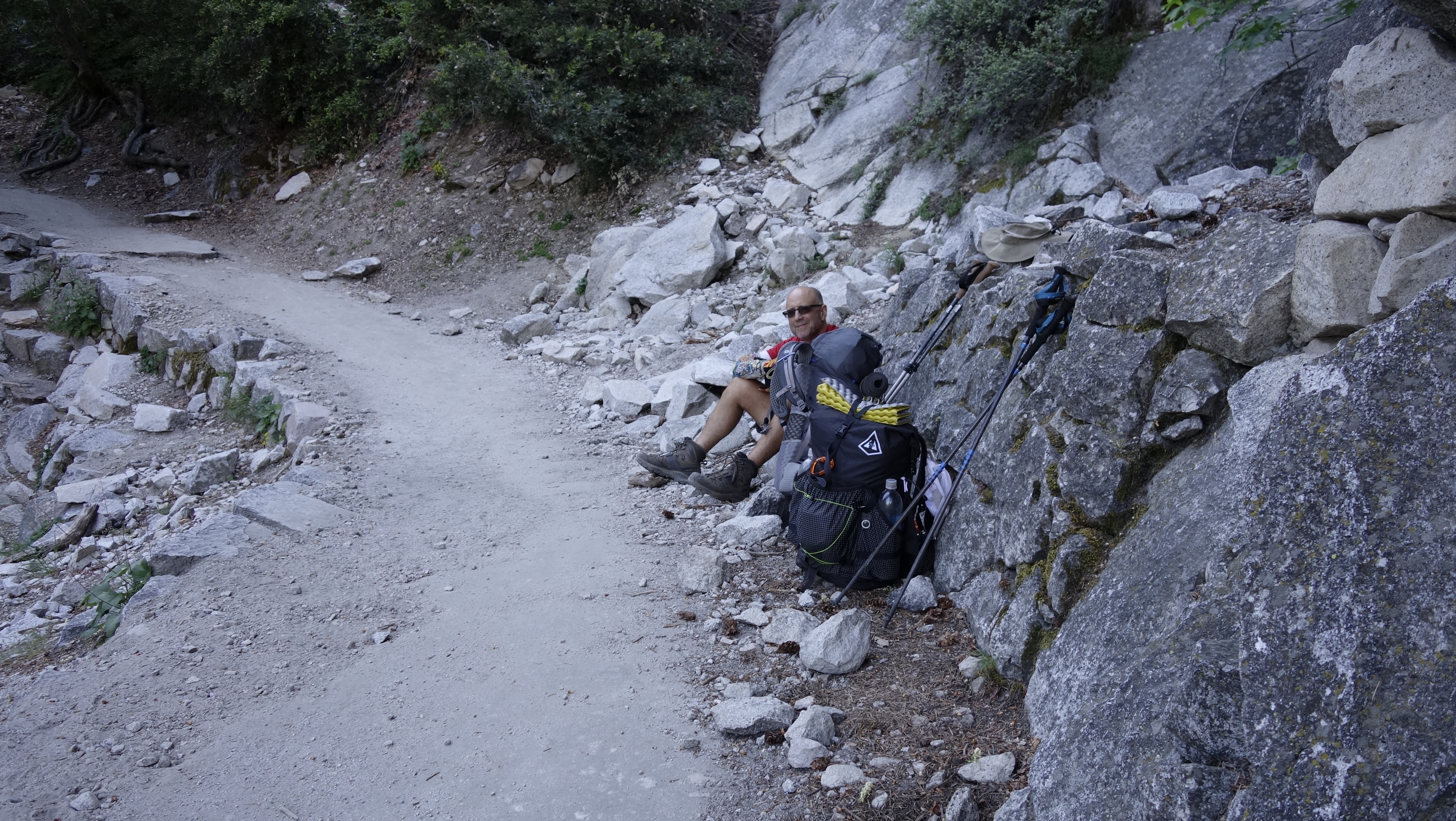
After Yosemite point we continued on, looking for a good camping spot. At mile 8 my feet were hurting pretty good so it was about time to be done for the day – so much for a short day. We filled up water at Royal Arch Creek and found the next reasonable spot to spend our first night. Yosemite is a series of steep valleys and ravines. The makes finding level camp sites more of a challenge than we expected. Ended up at a random place in the woods just over a mile from the trail to North Dome. These woods have seen plenty of fire
Of course there was blowdown
make fun of my compression socks, but they felt good
It was still relatively early in the day and we were strategizing about the next day. We were only a few miles from where I had originally planned to spend night #2. We knew we wanted to go to North Dome, which was about an extra mile off the main route and not all that far from where we were camped this night. We decided to do an out and back hike, without packs, to North Dome that night so we could just motor by the next day. In retrospect, we should have just rested a bit, then backpacked up near North Dome for this night. There were some decent camp spots near the dome.
The trail down to North Dome was steepish
Last camp spot before you go out on North Dome
Views of Yosemite Valley from North Dome
We have many miles to cover before we get closer to Half Dome
mostly just rock up here
big pine cones
The pine trees in this area make the ones in AZ look puny
Chill time
Unfortunately we were too early in the season for a lot of wildflowers. But we did see some.
These were familiar from AZ
Food.
We tend to use the various freeze dried options for dinner and breakfast (alternating with oatmeal/dried fruit) when backpacking. It is the most efficient option from a weight/calorie/protein point of view. We usually do bars/fruit/nuts/etc for lunches. There are a lot of different freeze dried options out these days, but I still find Mountain House to be pretty good overall. Only downside is they tend to come in 2 serving sizes - which is good for me, but too much for Nancy. In her search for single serving sizes she came upon a couple of new companies - Heather's Choice and Packit Gourmet. They were not cheap, but they were actually pretty darned good.
Eating out of plastic bags for the next week
The day ended with 8.6 miles and 4870 feet of climbing with packs plus our unloaded 2.2 mile hike to North Dome.
Day 2
Since our original plan was totally blown we had to figure out our goal for the next day. We looked at a map and came up with Plan A, B, and C possible camp spots. Option C was a stretch goal to get to May Lake. We were up with the sun which made its appearance shortly after 5 AM this first day of June.
Breakfast time!
7:30 AM. On the trail again. Of course the day started with climbing
passing from the rock of North Dome to the forest
We head around Indian Ridge toward Snow Creek
first snow - but not the last
Snow Creek had some really picturesque sections
Bear cub on the Snow Creek trail
Bears? Really?
The footbridge over Snow Creek
The crossing over Snow Creek marks an option for hikers. From here you can take a crazy switchbacking trail back to Yosemite Valley or head north for lots of climbing toward either Tenaya Lake or May Lake. Our route took us toward May Lake. Normally there is a High Sierra camp at that lake, but due to Covid they are all shut down this year. They do have an area for backpackers to camp as well.
"Only" 7.5 miles to May Lake. We can do that - right?
good place to filter water and rest my feet
The area to the south and east of the Snow Creek footbridge was off limits to camping because a bear and her cub have been hanging out there for a few years. They have learned that they can push bear canisters over the cliff into Yosemite valley (the bridge is about a mile from the edge). That is pretty much a foolproof way to get into those and that gets them whatever food is inside. Bad bears. Interestingly enough we saw two largish groups camping right on the borderline of the off limits area. Guess they liked living dangerously. We saw no one on the trail after that until the May Lake trailhead.
Saw various tags on trees. Not sure why
and up we go again
Snow creek is in the valley below
We filtered many gallons of water in our week on the trail. Sawyer filters are awesome.
big tree blocking the trail - poles included for scale
Glacial Erratic. Left when a glacier melted.
It reminded Nancy of a Jelly Belly Bean - she must have been hungry at the time.
May Lake is up there somewhere
It looks like they are quarrying granite from here
obviously gaining elevation
One more mile to camp - all uphill
The push to May lake (13.7 miles) hurt pretty good. But it was an awesome camp spot with only one other person on the other side of the campground. The lake was beautiful and at over 9000 feet, it was not nearly as warm up here. The other guy in the campground was a regular up there and he had lots of good info on other trails we could check out. He has Nancy convinced we have to go see a bunch of waterfalls in Glen Aulin.
Styling.
Nancy's daily yard sale. Somehow she fit all that into her pack.
Notice Nancy's bear cannister is much smaller than mine
Pretty nice place to spend the night
Yes, that is a snow bank behind me.
Day 2 - 13.7 miles, 3950 feet of climbing
Day 3
Nancy started the day taking pics of the reflection off the lake.
While I was eating breakfast...
...a marmot came to visit and started chewing on my pack.
Our goal for this day was Sunrise Lakes. It was a bit of a haul, but there was lots of downhill on the way there. We traveled down to Murphy Creek and paralleled that all the way, past Polly Dome, to Tenaya Lake.
This is where people stay when the camp is up and running
The trail out from May Lake was really nice. Lots of flowing water and a mixture of dramatic granite and lush vegetation. We really enjoyed this section of trail.
We reached Tenaya Lake and the relative luxury of a picnic table. Time to have some lunch and get water. Even better, there was a nearby trailhead where we could get rid of our trash. The downside was that Tenaya is right off Tioga road, so we were back in tourist land. I suppose having to deal with a few people was a decent trade off for our little picnic area.
quite a dramatic lake
Tenaya Creek running higher than the stepping stones
The trail south from Tenaya was moderate, but soggy. About 2 miles from Sunrise Lakes it got real. I had seen the switchbacks on the topo map so I knew there was a climb. But it was longer and higher and hurt more than expected. Only a couple of pics as I was in suffer mode.
it may not look bad, but it was tough
I had heard good things about these lakes and the pictures looked great, so I was excited to get here. We got to the first lake, saw that the primo spots were already taken, then went up to the second lake. This one didn't seem all that much better, so we went back to the first lake and set up camp on top of some rock.
Unfortunately this seemed to be a popular staging place for people who want to climb Clouds Rest - kind of like Everest base camp. Some of the other folks there were cool, but there were some of the loud, weekend warrior types as well. Definitely not the vibe I was looking for. Add in a swarm of mosquitos and you were talking about a situation I was not liking. Unfortunately we were in Yosemite in that post snow melt time when mosquitos were very active. The other places we camped they were manageable. Here they were ravenous. Once we got our tent set up a little bit of rain rolled through - hardly enough to get us wet.
After the small storm finished we decided we'd had enough of our annoying neighbors, and the mosquitos. We broke camp and headed down the trail less than a mile to find a quieter campsite with slightly less mosquitos and a pretty nice view.
a little rainbow action
and better views
yeah, this will do
Day 3 - 13 miles, 2200 feet of climbing
Day 4
Today would be the summit of Clouds Rest. Half Dome gets all the glory in Yosemite, but Clouds Rest is higher and has a fabulous 360 degree view of the area. Also, it has a pretty cool approach from the north. We decided to get up and head out without breakfast, hoping to get to the top before the crowds. We would make breakfast on top of the world.
No shortage of water
Clouds Rest peeking out above the trees
Views to the south
heading up
step carefully
Our strategy actually worked well. We were first to the top and never even saw the goofballs from Sunrise Lakes. We had the top to ourselves for about 20 minutes before a day hiker arrived. We cooked up some breakfast and soaked in the views. That was pretty frickin special.
The day hiker had started about 4am in the valley. That's a hella long, tough hike from the valley. Also, a marmot showed up, but he was not getting any of my breakfast.
Tenaya Canyon
Looking back toward Sunrise Lakes
breakfast time...
...and that means Starbucks time
A very different view of Half Dome. Doesn't look like much of a dome from here.
The peak in the middle is Mt Hoffmann, which is next to May Lake
From this viewpoint, we could mostly see all of the places we had been and where we were headed. Pretty cool.

time to head down
the Dome
The descent off Clouds Rest took a while. We had heard there were some good campsites near the intersection of the John Muir and Clouds Rest trails. That would set us up for a relatively short hike to Half Dome the next day. As we got down to that intersection we came across bear #2. Although it is clearly brown, it is a Black Bear.
The first campsite we came across looked pretty good, but was occupied. On a whim Nancy asked the couple there if they were leaving. Turned out they were. So we hung out while they finished up and left us with the best campsite of the trip and an already burning fire - score.
There is a nice creek down that hill
This big rock pile was nice to get out of the dirt. And it held a second fire ring.
Day 4 - 7.6 miles and 1600 feet of climbing, 3425 feet of descent
Day 5
Our original plan for this day was to climb Half Dome with day packs and return to our campsite for another night. Given our usual early start (6 AM), and the fact that we were close to the Dome, we ended up adding in a stroll down to the Mist Trail. Due to its popularity the Mist trail is supposed to be one way going up. Travel down the valley is supposed to be on the John Muir trail. Given that we decided we'd go down John Muir to Clark Point and cut over to the Mist trail. That was a good choice. This ended up being our longest (15 miles) day - but without full packs.
I feel so light this morning
The approach
Some words about Half Dome. First, I've wanted to do this for many years - so I was pretty pumped for this day.
Second, there are multiple ways to hike to HD. If you start in the valley it is a 16 mile hike with 4800 feet of climbing - so pretty darned stout. One option to break that up is to hike up Little Yosemite Valley and spend a night in a campground near the Merced River. That is around 3 miles from HD, but still required a good amount of climbing to get there. I think this is what most people do. We did it a 3rd way, since we were already in the backcountry. Our camp was about 1000 feet above Little Yosemite Valley and we were only about 2.5 miles from HD. This, combined with getting up early-ish gave us a jump on the bulk of the folks going up there - which was really great.
We actually ran into a couple of groups that didn't have permits
plenty of climbing before the cables
looking back down
lots of warnings
poles are useless at this point
pile of gloves for those who forgot
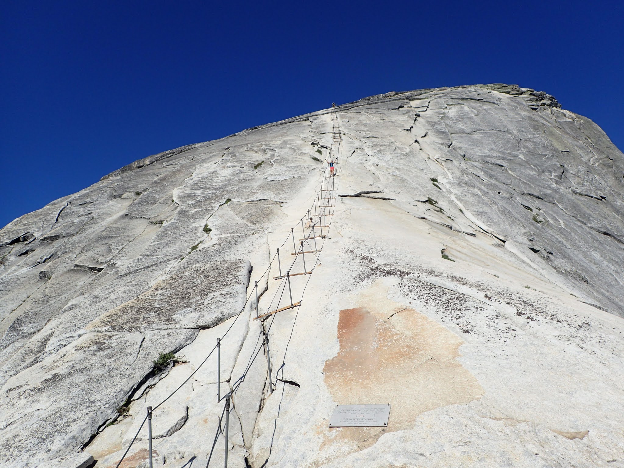
Since we were early we had the cables mostly to ourselves on the way up. A mom and her son were coming down, but they opted to go on the outside since they had carabiners attached to a harness - with the carabiners clipped to the cable. That was actually a pretty smart way to go - especially when the crowds come. It is pretty awkward to have two way traffic on the inside of the cables. When we met people coming up on our way down, I'd just sit down on one of the boards underneath the uphill cable and let them pass. It was effective, but slow.
there she goes
I was a bit hesitant to take out my camera on the ascent, so most pics of the cables are from the way down. The max grade is supposedly 60 degrees, but your brain tells you closer to 90 degrees.
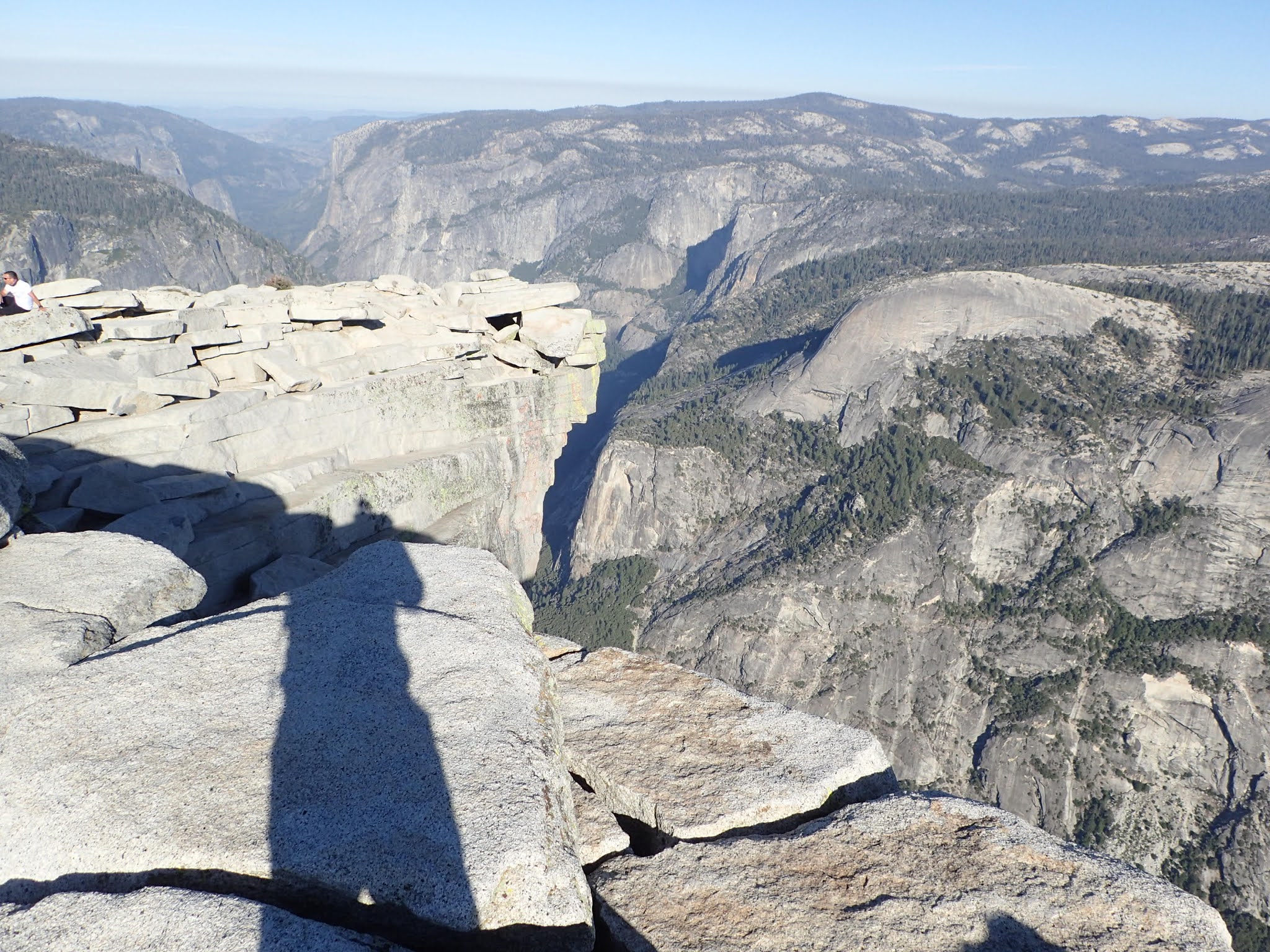
It is really big on top of the dome
Tenaya valley - clouds rest on the right
the "diving board"
fortunately we had a beautiful day
it appears to just drop off from here
hold on!
not much traction
I mean, look at that
That's me down there waiting for Nancy
Even thought HD doesn't have the stellar views of Clouds Rest, getting up and down via the cables made it a real charge. Everyone was totally jazzed when they got back down. Worth it!
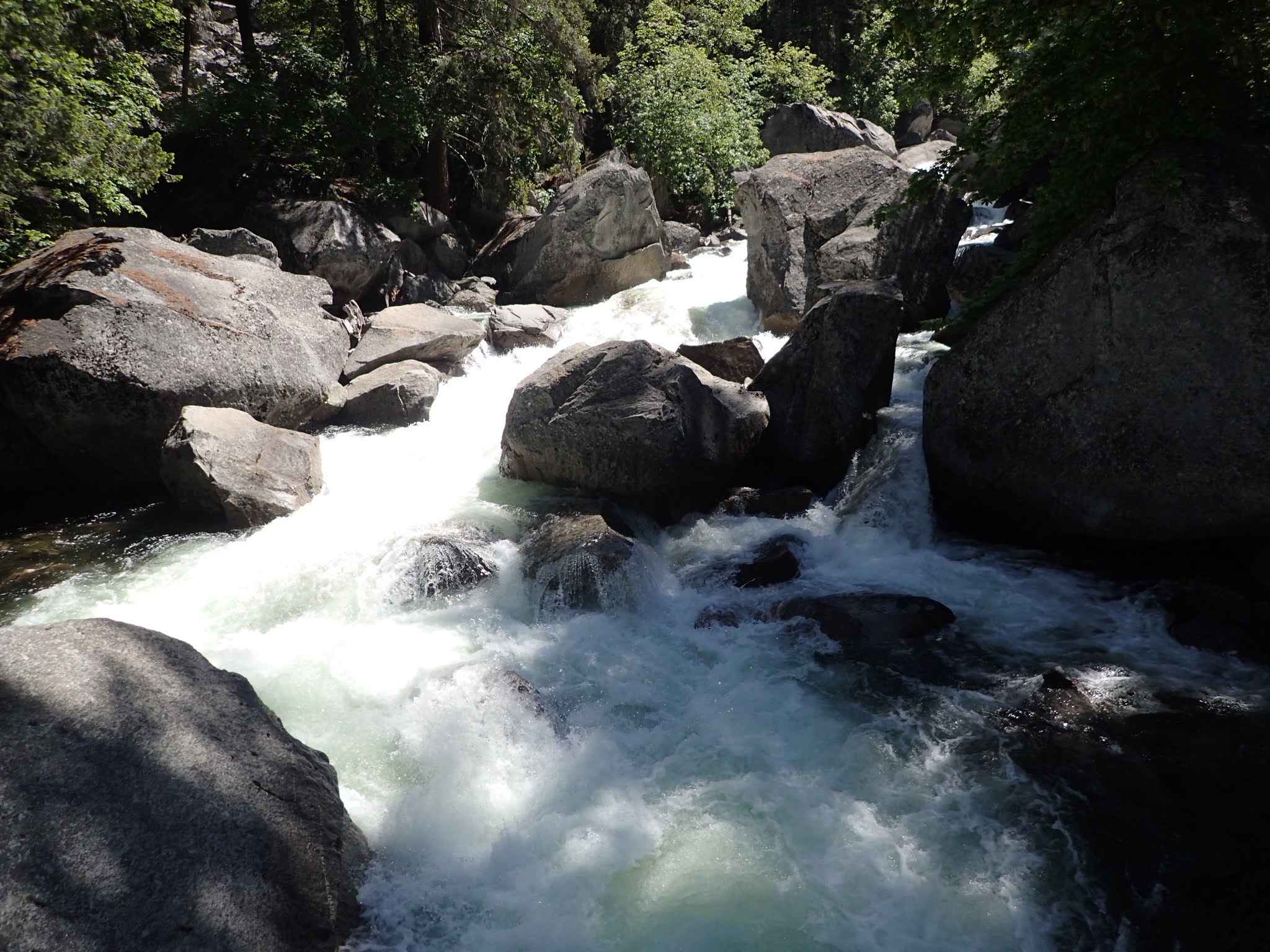
Next up was the section between Yosemite Valley and Little Yosemite Valley. The Merced River flows down this section with a vengeance. This is one of the most popular places in the park because of the falls and the overall drama of the river losing lots of elevation quickly.
another hot day, so need to get more water
the bridge over Nevada falls
the mist from Vernal falls gives the Mist Trail its name. You can see the trail up on the left side - very small.
Vernal is less dramatic than Nevada falls, but still cool
corral your kids
Nevada Falls from the Mist Trail
top of Nevada Falls
From right to left: Nevada Falls, Clouds Rest- peeking out from the side of Liberty Cap, Liberty Cap, Mount Broderick, Half Dome - towering above Broderick
Here are a couple of water videos to help give an idea of the intensity of the Merced in this section.
Silver Apron, beneath an unnamed fall
Nevada Falls
As we arrived back at camp after a long day the bear we had seen earlier was exiting our camp site. We assumed he was inspecting it. Since nothing was disturbed we must have stashed everything correctly.
inspection passed
dinner time on the rock
Day 5 - 15 miles (day packs), 4900 feet of climbing
We covered a lot of ground this day and saw a whole lot of cool stuff. It was another excellent day.
Day 6
This was the day we left the wilderness for the craziness of the valley below. Even with COVID restrictions in place, Yosemite Valley is pretty crowded with people. I can only imagine what it is like in "normal" times.
ok, let's do it
water dripping down on the John Muir trail was like rain here
Yosemite Falls - where we started
even going downhill requires breaks
Nancy's new friend
Once we got to the valley we found the car, dumped our gear, got out of those darned boots, then headed to Curry Village to get some real food.
that's a weight off my back
Fresh vegetables!!
yeah, don't leave twinkies in your car
Next up was figuring out where we could camp for the night. With a Wilderness Permit you are allowed to spend the night before and after at the "backpackers camp". Other campgrounds are usually full up with reservations far in advance. It took a little while to figure out exactly where that was and how it worked, but we got it sored out and settled in to camp. The camp was behind one or the car campgrounds and was hike in only. The day was really pleasant and we had the luxury of a table, fire ring, a nearby creek, and even toilets. What could possibly go wrong?

Nancy made a nice fire
This was an excellent place to camp - until it wasn't. As the day got later, more and more backpackers showed up. At one point the number of sites filled up. Then more people started arriving. Sites doubled and tripled up - people were putting tents wherever they could find room. We had one person put a tent sort of near the entry of ours, but with a little space. Fine. Turned out they were halfway out of the boundry of the campground and were forced to move their tent - practically on top of ours. Sheesh. Needless to say our perfect campground turned into less than perfect. We were out of there first possible thing the next morning.
Day 6 - 7.8 miles, 3463 feet of descent
Day 7
On our way out we did a couple of side hikes off of Tioga Road.
Tuolumne Grove is a small grove of Giant Sequoias. They were truly impressive
big ol tree
Second hike was to Lembert Dome. This gave us some really nice views of Tuolumne Meadow. Plus another chance to climb up a big chunk of granite.
Tuolumne Meadow
Excellent scenery is just everywhere
half mile of cars coming into the park as we left
On the way home we decided to spend a night in Death Valley - partly to make the drive a little less of a drag and also because Nancy had not seen Death Valley before. We stayed at a nice little place in Furnace Springs - where it was 116 degrees. On our way across the valley the car registered 250 feet below sea level at one point. That was pretty wild.
bit of a sand storm from these sand dunes
yeah, no kidding
And once again we were home. This trip definitely reset the bar on what I thought I could do on a backpacking trip. One thing it made clear was that there is MUCH more in the Sierra Nevada's that we need to explore. We've already identified some other, shorter, routes in Yosemite that we want to check out.
A HUGE thanks to Mr. Brown for getting the permits that made this trip possible. I know he'll be taking another crack at it so I hope this recounting of our experience helps him to have his own excellent adventure.