As the years went by and I watched others do the race, the idea started to form that maybe I could do this. I usually regained sanity quickly and just moved on with life. However, last year our friend John threw down on the big race and actually finished. I found myself obsessively stalking his dot on Trackleaders and thinking "I should be out there too". So, taking leave of my senses, I resolved to be one of those dots for 2017.
The next year was spent planning, acquiring equipment (lots of equipment), and picking John's brain for tips and tricks. John was an excellent source of suggestions about equipment and strategy - in addition to constant encouragement.
I have to mention that Nancy really wanted to come along on this journey - she is always up for adventure. However, the life of a college professor does not allow one to take off for 2 weeks during the school year - she already gets summer off. She ended up doing the 300 - just for fun. However, she ran out of time and had to bail in Oracle to make it back to teach. She's already scheming how to arrange it so she can do next year's 300.I'll be happy to be support for that.
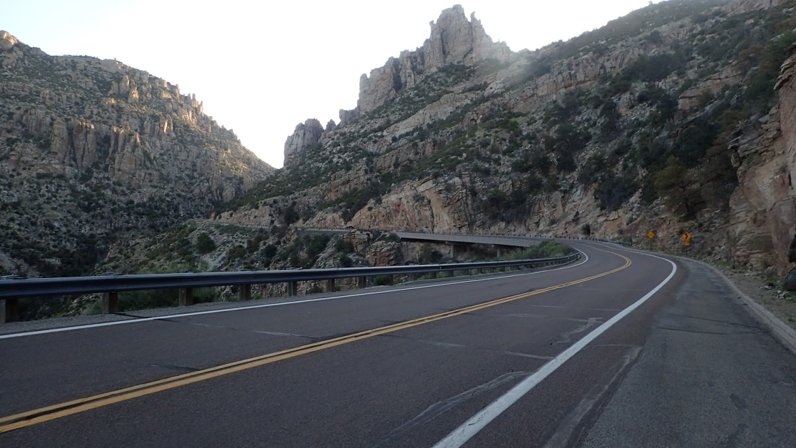
This year's 750 race was marked by a heavy dose of pre-race (and during race) drama. It started with a very wet Arizona winter. That meant a LOT of snow on the north rim of the Grand Canyon. This caused two issues. First, we got a warm spell. That caused a considerable snow melt which caused a rockslide in the canyon. This slide wrecked part of the trail and damaged the water pipes going into the canyon. Word was that the trail would be closed at the Redwall bridge from 8am-4:30pm every day for about 3 weeks. That would be very inconvenient, but we could still get through. In addition, trail runners were reporting many feet of snow on the north rim and that the road was not plowed. So, short of snowshoeing our bikes the 40 miles to Jacobs Lake, we would not be able to get through. This induced the race director to suggest that if we could start two weeks later, that would be the safest way to go. Fortunately, ADOT posted a video of the road being plowed - about a week before the race - whew.
Additionally, there were detours around areas in the northern part of the state which were still likely to have snow on the trail - or at least a lot of mud from melting snow.
There would be more drama after the race began.
Day 0
One of the tricky things about this race is logistics. You have to get to the starting line at the Mexican border - which is in the middle of nowhere. Fortunately, our friend Ray volunteered to take John, Nancy and I down to the start. They'd drop me at the border for the 750 start and they'd go to Parker Canyon Lake (14 miles north), where the 300 race starts. It was really nice to get that detail worked out early - one less thing to worry about.
The day before the race we all met up at the Picketpost trailhead. This is the finish line for the 300, so the 300 riders tend to leave vehicles there. We loaded up Ray's truck with bikes and headed south.

Pickups are quite handy for hauling a lot of bikes
On the way down we stopped in Tucson at Sies Kitchen. The line was long, but it was worth it. Got an excellent lunch and a burrito to go for dinner. I will definitely go back there.

powering up for the ride
Later that day we arrived at the Arizona/Mexico border for the 750 start.There were only 2 other riders out there at that time - but more would arrive later.

That road dead ends at the border fence

This is the border

I am an illegal alien - in Mexico

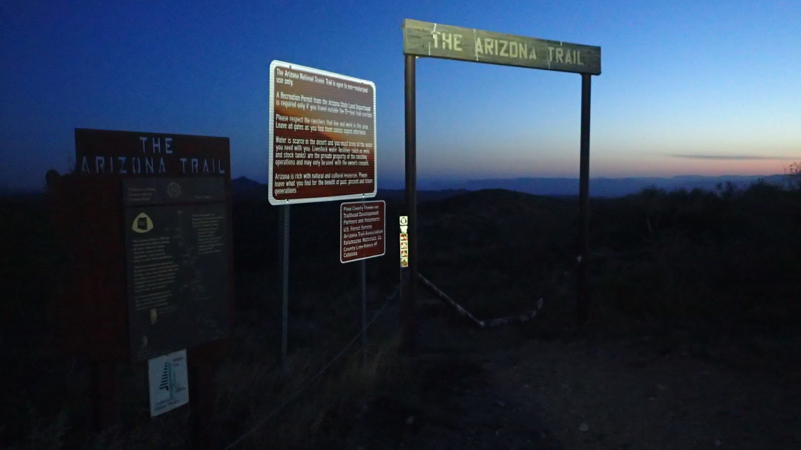
Starting line

This was home for the night before the race - with a view of Mexico

Other racers arrived and made themselves at home

A little motivational poster left by Rhino - he started a day early
By the time night fell, there was a pretty good crowd down at the start. There was lots of socializing and a surprising amount of beer flowed. I chatted with a bunch of people and not one of them was from Arizona. Most of the racers were from out of state and even some out of country. That really surprised me given that I always considered this just a little local race. I guess it is going big time now.
That was my first night "out" - and it lead to the discovery that my inflatable sleeping pad had sprung a leak. Ugh. So, I could get about 2 hours out of the pad before it deflated. This was not good news. I would spend the rest of the trip sleeping badly due to this problem. Sleeping on the ground without a pad is pretty darned uncomfortable.That is the down side to an inflatable pad.
Day 1
Next day dawned with clear blue skies. A beautiful day to be out riding. We all gathered at the border fence, Kurt gave last minute instructions, and we were off. The 750 start is mostly on dirt road for about 14 miles and then it joins up with the trail where the 300 racers start.
Last minute instructions from a many time vet of the AZTR

And the fast folks quickly dropped me

This cow was wondering what all the fuss was about

Hike a bike time

Kaitlyn taking her bike for a walk


Another ugly section of rocky trail

There is also some really nice stuff in the Canelos

Solar powered windmill?

That sign has seen better days
I made really good time in the Canelos and dumped out on the road to Patagonia at exactly 7 hours in. I was feeling pretty good at this point.
The next section was one of the few times when we had to ride on the road. Bikes are not allowed in wilderness areas and the AZT goes through wilderness in a few spots. So the race has to detour around those areas. This is the first place where we had to do that.
Anyway, I skipped Patagonia and did a resupply stop in Sonoita

Cool ranch gate
In Sonoita there were a few others fueling up. There would be no food options until Tucson, so this was a good place to resupply. After that was a little road and a whole bunch of dirt road to get back to the AZT.

Mike Symons on his way to his first 300 finish

So, yeah, southern AZ
Once we got back to the trail we were treated to some really nice riding. Tall grass and smooth flowy trails made this section a joy. Plus there is history.


Topped up on water at Kentucky Camp and headed out. I had a goal of getting to the Las Colinas section that night. Stretch goal to get through there to the "green gate", so I needed to keep moving.

Here comes the night
As night fell, I made it to some super fun sections of trail that lead down to the Las Colinas segment. I was getting tired and ready to stop, but I wanted to grind out some of the crummy sections in Las Colinas so I wouldn't have to do them in the morning. After a bit I saw a rider ahead who looked familiar. Caught up with Nancy soon after that. We both agreed that we'd pretty much had enough for the day so started looking for a place to crash. Found a flatish spot on the top of a hill and made it home for the night.

Home sweet home
Stats: 14.5 hours, 90 miles. 9941 feet of climbing
Day 2
Nancy understood that this race was an important individual goal for me - so we would not be riding together. So, next morning I left her behind on some of the technical riding that we had to do. While I love riding with her, this was not the time for that.

Let's go!

Nothing better than watching the sun come up in the desert
I did finally reach the magical "green gate", just not the first day. After that is a long section of super fun flowy singletrack.


Ocotillo. They look dead, but are definitely alive

I wonder where that sticker came from?

More fun, fast trail. Just watch out for the prickly pear

One of the excellent gates that Rob Bauer is installing
I caught up with Joe near the Colossal Cave campground. He was another newbie doing his first 300. He would finish strong. We leapfrogged each other pretty much the rest of the day.We chatted a bit with a couple of through hikers from Germany. These guys had silver umbrellas to keep the sun off them. Interesting idea, but don't know if I'd want to hold an umbrella all day.

Time to restock on water

Nancy's pony

Ready to get back at it
Next was the climb up Reddington Road - up, up, up. When we did the 300 in 2013 this section hurt me bad. I didn't bring sufficient water and it was really hot. I would not make the same mistake this time. I loaded down with water and a 64oz gatorade. That was a lot of weight for the climbing we had to do, but at least I wouldn't dehydrate.
The climb up Reddington and Chiva falls was no fun at all. It was pretty warm and there was a vicious wind.The Chiva Falls section is some crazy chunky jeep crawler type road. You worked going up and down hills.

Nice little sand pit of a trail on the way to the mountains

Reddington Road - going UP

The Chiva Falls jeep road section had lots of big drops

and plenty of climbing
Eventually we got back onto the AZT where there was some more high grasslands and some fun trails, after a bunch more climbing.

I love the way this section looks

And the sun is going down again
After the nice section of AZT came the dreaded hike a bike to Molino Basin. This is one of the sections usually discussed in hushed whispers. It is basically a big, steep climb. But it is more than that. Intead of a smooth incline it is a series of rock steps and ledges that you need to lift your bike over - a real upper body workout. I took a couple of pics of some of the "fun" sections, but not sure that really gives the feel of how much work this is.


yeah, that is the "trail"
Anyhow, I eventually made it up and Joe and I met up at the Molino Basin campground. We looked at the map and saw that Prison Camp was only 2.5 miles further up the trail. May as well crank that out - how hard can it be? Ugh. It was hard. I had forgotten how much up and down there was on this "short" section. Seemed like it would never end. I finally made it to Prison Camp, wasn't sure where the actual campground was and just crashed off the side in the woods. As I vainly tried to sleep I saw another rider roll by on the road - figured I might know who it was. I yelled out "Nancy!", and sure enough we spent another night together.
Stats: 16.75 hours, 85 miles. 8951 feet of climbing
Day 3
Up early, as always, Nancy and I hit the road up Mt. Lemmon. She is a stronger climber than me, so pretty much left me behind. We cranked out the miles, I took some pictures, and eventually we ended up in Summerhaven at about 9:30am.

There goes Nancy


Getting high

I've come a long way up,but still have more to go

We aren't in the desert any more
Unfortunately NOTHING was open in Summerhaven until 10. I hated to wait around, but really wanted some food. So Nancy and I went over the the visitors center bathrooms - which is apparently the place to be. Alexis was already there. Greg and Joe showed up soon after.
We all decided that it was worth waiting for the restaurant to open so we could get food before continuing on. Once sufficient calories were consumed we headed out to another legendary section of the trail - Oracle Ridge. Despite the fact that this trail goes from the top of Mt. Lemmon (about 7900 feet above sea level) to Oracle (4300 feet), it ends up having a substantial amount of climbing - on rocky, overgrown trails. Yay.


And there goes Joe - onto Oracle Ridge

Of course there was blowdown

It is easy to forget that there is some good, rideable trail up there

And then there is this...

...and this...

...rinse and repeat.

Wow, another one of those stickers. Hmmm.

Then there are the bushes that have grown over much of the trail

Heck of a view from up here

yeah, no fooling

Still have a long way to go
Like all things, this part of the trail eventually comes to an end and turns into some fairly fun trail that dumps you out into the American Flag trailhead. From there it is singletrack that seems to take FOREVER to get to Rte. 77. The trail crosses under this highway, but a few miles up the road is the last resupply (Oracle) until Queen Valley - over 100 miles away.For folks doing the 300 route, this is their last resupply for the ride. Most people make the detour.
Back up at the top of the mountain i was telling everyone I was going to push to Bloodsucker Wash or even Freeman Road after Oracle. However, on the way down the mountain I took stock of how I felt - pretty beat was the answer. The stretch from Tucson to Oracle is one of the tougher parts of the trail. I made a last minute decision to get a room for the night in Oracle. The Chalet Village is a rather threadbare operation, but an excellent place for travelers like me. They are cheap, friendly to through hikers/bikers (even offering a discount) and they provide washers/dryers for free. ALSO, they have a box of clothes that you can borrow from while you are washing your gear - perfect.
One thing I wanted to do in town is figure out a solution to my leaking sleeping pad. I was not getting much sleep at all because of that. I had heard other people using those reflective sun shades for car windows- they have a little bit of padding. So, I went down to the Dollar General and spent $3 on this high tech solution. It turned out to be worth about $3. :(
I wasn't sure what Nancy was going to do, but I could tell by where she was and what was ahead that there was no way she was going to finish in time to make her Tuesday morning class. I texted her that I was staying in town - figured she might want to do the same. The call of a hot shower and soft bed was too much to resist. She called her race in Oracle.
For me this was just a stop in the journey. As usual, I was up and out before the sun the next morning.
Stats: 10.75 hours, 44 miles. 6719 feet of climbing
Day 4
First stop was Circle K to resupply for the long trek to Queen Valley. And, like the homeless person I was, I ate breakfast in front of the store.

Getting geared up to go

Breakfast at Circle K
I rolled out of Oracle in the dark down the road to the Tiger Mine trailhead. This next section of trail (Black Hills) has always been in less than stellar condition and never saw much traffic. However there was a crew out there doing some great work on the trail.
Back on the trail just before dawn

Some newly renovated trail

Antelope Peak in the distance
 Small, but brilliant color
Breaktime in Bloodsucker Wash

Look, but don't touch

Antelope Peak getting closer
I finally wrapped around Antelope peak to the Freeman Road water cache. Brett was there getting some rest in the shade.We chatted a bit and I rolled on. The boulders section was next, which meant some fast flowy trail. Fun times.

The infamous self closing gate

This was a nice shade spot for a snack
Brett and I would leapfrog each other from the cache through Ripsey. I didn't see him after that.I had my only mechanical of the trip soon after the Boulders segment - broken chain. Replaced the link and moved on. This shortened my chain, which made it unhappy in the lowest gear. Not a huge deal, but I preferred to replace the chain with one of the proper length. That would provide me another adventure in Payson - in a couple of days.

Pretty sure this was due to installer error - that would be me

One of Rob's gates - but mega sized

Found another one of these stickers

This was covered in bees, but the water was too precious to pass up

Great view from the top of the Ripsey climb

The trail along this ridgeline has amazing views
After railing down the Ripsey ridgeline I came upon Garrett sitting on the water cache at the trailhead. He was surrounded by food and drink. Did you bring all that? No, trail magic.Oh, yay! I grabbed some potato chips and a rice crispy bar and moved on. For those who don't know, trail magic is when you find food and or drink on the trail. While this is sort of a gray area (the ride is supposed to be self supported) most people are OK with it as long as it is not for a specific person - but available to all. Personally, it lifts my spirits to find a little something something unexpected.
I rolled the section to Kelvin, which had seen some improvements and went over to the ADOT yard to get water and a snack. After filling up I hit the Gila River Valley section. On my way up that first awful climb I ran into Rob Bauer riding his clunker with (empty) cans of diesel attached to the frame. He has been out there doing work on the trail and installing his now famous gates. Great work Rob!
As I rolled along I ran into one of the valley's namesakes. Interestingly I also saw one of these critters on this stretch when Nancy and I did the 300 in 2013. Gila monsters are a pretty rare sight.

What are you looking at?

This area is so beautiful

Rob's main tool


I love sunset in the desert

A view of the trail at night
I turned up the climb from the river intending to get to the place we camped on the Queen's Ransom ride, but just couldn't make it. Camped about a mile below that on a flat area.
Stats: 16.5 hours, 78 miles. 9200 feet of climbing
Day 5
Day 5 had me waking to some grand views and about 2000 feet of climbing to get up to the saddle at Martinez Canyon. Then the long journey down to Picketpost trailhead - which is the end of the AZTR 300, but just another stop for those of us doing the 750.

Nice place to wake up

This section of trail is so special. Just outstanding views


Fallen Saguaro

Picketpost mountain

300 down, keep rolling
Once in Queen Valley I was disappointed that the two lunch spots were not open. Last year the grill had Taco Tuesday - and it was Tuesday! Ah well. So it was lunch from the convenience store. Soup in a plastic can and premade tuna salad are surprisingly delicious if you are hungry enough.

Lunch feast
From Queen Valley there were some "meh" jeep roads. But that led into the Gold Canyon trails which were new to the race this year. John did a great job of linking these together to give us a really fun ride into Gold Canyon. For me Gold Canyon = dinner at De La Cruz. While I was there pounding down Mexican food and many cokes, John walked in. He had bailed on his 300 run and wanted to come ride the next section (Jacob's Crosscut) with me. This section was added at his suggestion and I gave him a lot of grief over that. Jacob's Crosscut used to be a HORRIBLE trail, but has seen lots of love lately. It is still pretty challenging and I was not looking forward to the effort of grinding over all those rocks.
Once dinner was done I ran over to Basha's to resupply. While there I ran into Jennifer and Jason. Jason did the 750 last year and did a partial 300 with Jennifer this year. She'll be back to try again. Jason gave me the best nutrition advice here - bring a jar of peanut butter.

the gang's all here
It was getting late so John and I jetted out to do Jacob's Crosscut. The best thing this trail has going for it is that it is adjacent to the Superstition mountains - so there are always good views. So I was dreading this section because of how rocky it is in parts. However John challenged me to a game of "who will dab first". So a challenge was on. This actually made rolling all the rocks a fun experience, rather than work. Thanks John!

Thanks for all the work you did on this trail

Hard to get a bad pic of the superstition mountains

John grinding up a climb

John did about half the trail and turned back. I continued on to Apache Trail, taking the road over to Canyon Lake. I ended up staying at Canyon Lake Campground.

just another sunset
Stats: 13.5 hours, 73 miles. 6057 feet of climbing
Day 6


Tortilla Flats


Selfie time


Roosevelt Dam

Roosevelt Lake

charming...

Chicken Fried steak sandwich at Butcher Hook. Soooooo good.

Ice cream and chocolate milk to power the climb to Payson
After rolling the length of Roosevelt Lake it was time to get serious and start climbing to Payson. This was the beginning of all kinds of unpleasantness. I'd be inclined to say that the stretch from Rye to the top of the Mogollon rim is the toughest part of the ride. Worse than Tucson to Oracle.

Time to start pushing

Definitely gaining elevation
I ground up a series of awful, steep dirt roads - finally making it into Payson. It was a little after 5 and I knew there was a bike shop here. So, I checked my phone and found there was a shop just down the road. I wanted to get a chain to replace the one I broke back in the desert. Rolled into the shop and asked for an 11 speed chain. Just for reference, most mountain bikes sold today use 11 speed. It is just the standard now. But this shop did NOT have any 11 speed chains. That is like your grocery store not having bananas. GRRRRRRR.
I looked at my phone and found there was another shop in town, that closed at 5:30. It was 5:17. So I rolled down the road toward the shop, realized I totally missed the street, took out my phone to re-orient, and hammered back the right way. I arrived at Certified Bicycle at about 5:35. The sign on the door said "CLOSED". Argh. I tried the door anyhow and it opened. There were two people in there so I started spilling out my sad story. They were like "cool, no problem, what do you need". Of course they had 11 speed chains. The guy even gave me his card and said to call if I needed anything that night. Solid. I know which shop I'll go to in Payson.
I knew the sections in front of me for the next day were going to be stout so decided to get a hotel room. Stocked up my supplies at Walmart and was ready for the next day. At Jason's suggestion I picked up a small jar of peanut butter (with maple). That was an awesome choice and went well with Clif bars and chunks of salami.
Stats: 12.75 hours, 83 miles. 8349 feet of climbing
DAY 7
The next day was the trek from Payson to Pine and then as far up Highline as I could get - stretch goal was the top of the Mogollon Rim.

Ready to face Payson to Pine
Payson to Pine lulls you into complacency by starting with a nice downhill on dirt roads. Then it heads up and the roads turn lousy.


The trail went up a while then down then along some overgrown track, then up a steep climb, and finally down into Pine.

Plenty of water up north

What is up with those stickers?
I was totally looking forward to going to That Brewery, which was just off course, for an Arizona Pale Ale and a huge hamburger. However, my early start worked against me - they were not yet open. Grrrrrr. I ended up having to go all the way into Pine for a huge breakfast instead. Dan Holmes was there with a broken bike. Total bummer to get that far and have to bail. Jenny rolled in right after that. We all downed lots of calories, knowing that the push up Highline would be epic.
As I went to pay for breakfast I had trouble finding my credit cards/id/cash. Hmmm, must have put it in the wrong pocket in my pack. Hmmm, not there either. It WAS in the same pocket in the pack as my phone, which I pulled out a few times on the ride from Payson to Pine. Oh, please, tell me it didn't fall out. Dan saw me panicking and suggested I empty the entire pack first. I did that and looked in every compartment. No cash. I called the hotel from last night to make sure I didn't leave it there - nope. What now? Is my ride over? Dan saw my distress and said he'd loan me some cash. Really? I'd just met him a few minutes before and he handed me a $100 bill. Wow. Dude, you saved my ride. Thanks Dan!
Paid my breakfast bill and headed out. The trail started out pretty good. There has been a lot of work on the lower part of Highline. It was looking pretty good. There was plenty of little streams and rivulets running down the rim so water was not an issue. There were still some dodgy sections, but the trail up to Geronimo was not all that bad. I was feeling pretty good about this infamous climb at this point. Sat down by the creek and had a little snack.

Gaining elevation

Yuck

Yum

Water water everywhere

You can see where they did some work here

But more is needed

Peanut butter and salami time
As i left the stream and crossed the road at Geronimo I saw Jenny with her bike laid out on the road and a derailleur in her hand. That's not good.Fortunately her bike was equipped with an EBB so it was pretty easy to convert to single speed. So, until Flagstaff she would be riding full rigid single speed - hard core.
After Geronimo the trail got more "real". It seemed like there were hundreds of drainages that we went in and out of. Most times I had to walk in and out of the drainage because of rocks or steepness. This just went on for. ever.


Over half way

Close to the rim - Jason in front of me

The powerline toward the rim


You can kind of see how fun the final push to the rim was

Highline did a number on my shoes
Got up to the top of the rim and rode in a little to the General Springs Cabin. I originally was going to camp inside, but didn't like the look of all of the mouse "leavings" in there. So I camped out beside the cabin.
After a bit Fiona came along looking for Paul. They had gotten separated on Highline. She went to find him and they both came back some time later and set up camp inside the cabin.
This day was exhausting, but satisfying.I did not think I'd actually be able to do the Payson to Rim push in one day. It was good to be done with that. It did a number on my shoes, but they ended up holding together for the rest of the ride.
Stats: 15.25 hours, 48 miles. 8612 feet of climbing
Day 8
It was chilly up on the rim. Got up and got rolling early on some pretty good trail.It was a welcome relief to be able to actually ride my bike - on smooth trails. I ran into Paul, Fiona, Jenny and Jason at various points along this section. I didn't see any of them, except Jenny, again after that.
Didn't ride over that one

Awesome

Things were looking good. But I knew the Happy Jack section was ahead. It had been a while since I had ridden that, but my memories were not good. At the end of the Blue Ridge segment there was more trail magic. Very nice

From there I went up the road to the Ranger Station to get water and take in some calories. Back down the road to do Happy Jack. It started out alright, but soon degraded to rocks and rocks and roads lined with rocks. Ugh. There wasn't even much elevation gain and it wasn't all that hard. But the rocks made it supremely unpleasant. I imagine the folks without front suspension (Jenny, Rhino, Brett) were especially not liking this.

Really?

Oh, come on.

Ugh

And where there were not rocks, there was mud

The end of Happy Jack was pretty soggy, so I opted to take the approved detour to the Mormon Lake store. Ray was waiting for me on Lake Mary Road when I exited Happy Jack. I'm afraid my mood was not fit for a friend who rode all the way out there to see me. Sorry Ray, but that section just made me mad.
We rolled down the road to the store and I stocked up on food and drink .Nancy had also come out and would ride with me on some of the next section.

After getting my mojo back with a large Mtn Dew, Ray, Nancy and I headed out rejoin the trail. Ray split off to ride back to his place in Munds. Nancy and I continued on the trail. The trail here was REALLY good. Very fun. Looks like I was having too much fun here to take many pictures.

Nancy split off after a while since it was getting toward dark. I rolled to where the trail crosses the road and heads up to Anderson Mesa. But before I got there I discovered more trail magic under a bridge. This one really lifted my spirits. I was going to have a PBR for a nightcap.

Anderson Mesa is infamous for having death mud when it is wet. Fortunately there had not been recent rain and the trail was dry. Still rather rocky, but no mud.


Oooh, getting close
When I was at Mormon Lake with Nancy and Ray I told them I was going to ride outside of Flagstaff and camp. Didn't think I had time to make it to town. However, when I got up on the mesa, that Mtn. Dew kicked in and I started hammering. The closer I got to Flagstaff and the colder it got, I realized that I should just bring it right into town and get a room for the night. And that's what I did. As I got into town I saw Brett out on the street. He was headed up to Buffalo Park for the night. Not me. I wanted a shower and bed.
Stats: 17 hours, 89 miles. 6825 feet of climbing
Day 9
I took my time getting up and getting ready, had a big breakfast at Denny's and headed out. I was confident I could get through Flagstaff and to Grandview that day. This was one of the rare days when I was on my bike after the sun was up.This turned out to be a poor decision.

A little traffic getting through town
Due to the amount of snow in the mountains here, there was a detour off of the AZT. I thought that would make getting around the mountains easier. Not so sure it did. We still did a ton of climbing and the elevation took a toll on me.


Even the detour route had snow
The never ending grind up a dirt road affected me mentally and physically. I expected to get around the mountain and back on the AZT in the morning. At 12:30 I was still climbing and not where I expected to be. This was my mental low point. Nancy was hiking in the canyon, so I couldn't get her. However, as I was trying to call her I got a text from my friend Martin. So I called him. He talked me off the ledge. Because, seriously, I was damn near done. Anyhow, I got my act together and moved on. Finally got back to AZT which meant many miles of sweet downhill trail.


Just a little bit of blowdown
Once the trail exited the foothills it basically emptied out into a wide open, nearly flat plain that could have been in Wyoming.

Looking back at the mountain


Nothing out here but cows and horses
The trail goes into woods again as you get closer to the Grand Canyon. I made it to Moqui station and started to feel better about my progress. I was unlikely to make it to Grandview, but I'd get close-ish.
After a bit of rolling through the woods I saw a couple of riders ahead. Rhino and Brett were there taking a break. There was discussion about getting to Grandview that night, but I was not thinking I'd make that. After a bit Brett pulled away and when we hit the sign for 10 miles to Grandview, I decided I'd had enough. Rhino continued on.

Stats: 12.75 hours, 80 miles. 5688 feet of climbing
Day 10
This was probably the coldest night out so far. That, combined with the issue with my sleeping pad meant that I slept very poorly. At about 3am I just decided to get up and go. At least I'd be warm riding.It was light by the time I made it to Grandview. Rhino was just heading out. Apparently, he and Brett had pushed through to there last night and made a fire to keep them warm. Darn.

Grandview
From Grandview to Tusyan it is about 14 miles of mostly downhll trail. Then less than an hour of moderate climbing to the South Rim village - so feeling pretty good.My plan at this point was to spend the rest of the day at the rim recovering and prepping, then hit the canyon first thing in the morning. Like the rest of the ride, my plans changed over the course of the day.


Some serious blowdown onthe way to Tusyan

My compression socks match my helmet - nice
Rhino and I leapfrogged the whole way and ended up riding to the South Rim together. Somewhere between Grandview and the rim we got to talking about our plans and decided we may as well go down into the canyon that day - there would be plenty of time. We'd see what permits were available to figure out where to stop that night. So the plan was to get permits, get showered (and I did a little laundry), get food and head down into the canyon. If a permit was available for Bright Angel we'd stop there.
A word about the canyon crossing.
This is the part of the race that had kept me from even considering doing this race for years and had pretty much freaked me out before the race. Bikes are not technically allowed below the rim. So, in order to cross you need to carry your bike - it can not touch the ground. No pushing or dragging or whatever. You have to carry it. Initial tests and tryouts of my rig confirmed my expectation that carrying a bike on your back would really hurt.
We got to the Backcountry Office - where Nancy was waiting. Permits were available and we pretty much decided we go to Bright Angel today and finish up the next day. Once we took care of all the other tasks it was time to do this thing.
After the race had begun, the race director found out that the park service was no longer allowing bikes on the road from the North Rim to Jacobs Lake, until it was open to all traffic - in May. The AZT on the north rim was feet deep in snow so the road was the only way (other than snowshoeing) to get through. This was apparently a new policy. There was no way, having come this far, that we were not going to finish. As we left the Backcountry office one of the rangers came out and told us about this policy. "OK, we'll just walk our bikes - or take the trail". Riiiiiight.

Rhino bought ALL the food at the store

The process...


Ugh. That's heavy

Let's go!


You can see how badly balanced I am


We actually made pretty good time to Bright Angel Campground. On the way down we got plenty of looks and lots of questions. This is not something you see every day.Walking through the nearly full campground was the closest I've come to being a celebrity. EVERYONE turned their heads as we walked by. Some came by and asked questions. The ranger said that everyone in the campground was talking about us. It was amusing.

It was nice down at the bottom of the canyon
Stats: 14 hours, 49 miles. 2773 feet of climbing
Day 11
I mentally separate hiking across GC into 3 segments. The first 7 miles to Bright Angel is all downhill. The next 7 miles to Cottonwood campground trends gradually uphill. From there is 7 miles to the north rim. The first part of that is still gradual uphill, but then it makes a turn a Manzanita and goes up with a vengeance.
So, we started out in the dark for Cottonwood. It was hard. We were carrying somewhere around 55-60 pounds on our back. I think my pack was rated for 35. Shoulders hurt, hips hurt, feet were angry.
Still, we made pretty good time to Cottonwood.
On this stretch we ran into Jenny. She had apparently hiked all night. She looked pretty shelled. I was worried for her, but she proved to be VERY tough. She, Fiona, and Paul finished later the same day Rhino and I did.


The river was VERY high
We came to a section where the water was across the trail. I put on my bike shoes because I didn't want to get my hiking shoes wet. That would be a decision that would have repercussions later.

So off balance


Rhino finally got to try out his waterproof socks

Rhino was a much stronger hiker than me so he got way out front. We both stopped at Cottonwood and got water. I ended up messing with my rig a few times there. I got it close to balanced, but not perfect. We knew that the trail was supposed to be closed from 8am-4pm at the Redwall Bridge. However, we decided to press on and hope they would finish early. Worst case we'd have a forced rest when we got there.

Somewhere up there is the top

The remains of phone lines are still down there

Roaring springs was really roaring

climbing, climbing....

When we got to Redwall Bridge there was a sign saying they weren't working there today and we could proceed at our own risk. Great! Let the pain continue.


You can see some of the work

Looks like they were up working on the other side of this canyon

Plenty of water dripping down from the rim

This section needs a bit of work still

Come a long way - that is the south rim in the distance

Oh yeah, on the north rim!!!

Putting the bike back together

Little bit of snow up here
We had originally thought to camp at the north rim. But it was still light out, so we decided to press on to Jacob Lake - where there was food. First we went up to the ranger station to get water. Then tried to take the bridle path back to the road. That was partly covered in snow so it didn't go well.

Some areas didn't have much snow

But some did

No bikes - sheesh
So we had 40ish miles to Jacob lake. It was chilly, the sun was going down, and my shoes were wet from crossing that creek in the canyon. Time to crank it out. Rhino was running single speed so this section was tough for him. He just tucked on the downhills and spun like a maniac on the flats.
Since I had gears I made it to JL first. The lodge was closed, but when I rattled the door someone inside let me in and asked if I wanted a room. Hell yeah!
I contacted Rhino and told him we didn't need to camp. A shower and warm bed were available.
At this point we had less than 30 miles to go - trending downhill. Spirits were high.
Stats: 15.5 hours, 60 miles. 8463 feet of climbing
Day 11
We got up late (after sunrise) and went over to the lodge for breakfast. We would like to have started earlier, but they didn't open until 8. A hearty breakfast, sunny skies and some great trail made for an awesome day.


While the trail "trended" downhill, there was still plenty of climbing


You can smell the finish from here.Utah in the background.


DONE!!!!
Rhino's wife (Nicole) and Nancy brought us a celebration feast.We had no problem making short work of that.


Stats: 3.5 hours, 29 miles. 1417 feet of climbing
So it was done. Just like that. What an astounding adventure. I had passed a huge test of mental and physical strength. It felt good, real good. I think I'm done for a while. Time to let my body heal and get used to having ready access to food and water again.
I'd always assumed that this race was only for those elite (and usually younger) riders whom I had watched do it in the past. John's ride showed me that us ordinary riders could do it as well, with sufficient preparation, a burning desire, and a bit of luck.
Of course I have to thank all of the people who provided assistance and cheered me on - friends, family, co-workers, and my awesome wife. The positive vibes certainly helped.
Oh, and speaking of Nancy, she modified (drew in the bike on the hiker's back) this rim to rim shirt for me. How cool is that.

Awesome!
ReplyDeletewhat an adventure and accomplishment
ReplyDeleteEpic Jeff, truly an epic tale. Thank you for the inspiration.
ReplyDeleteThat is a major accomplishment Jeff. I am blown away and very impressed! Great job!! Thank you for sharing your photos and story!
ReplyDeleteExcellent Jeff. Great accomplishments.
ReplyDeleteThis comment has been removed by the author.
ReplyDeleteAwesome job Jeff!
ReplyDeleteExcellent read....one of these days!
ReplyDeleteGreat write up Jeff! Your photos were particularly insightful for this middle-aged-wanna-be racer. Some different angles to most other blogs.
ReplyDeleteThanks for the write up.
Dave
Great trip. Thanks for the wine offer at Indian Gardens. I was with Garry Rollins. Congratulations. Ted Austin
ReplyDelete