John sent out the call for partners on another one of his "adventures". The plan was to explore passages 19 and 20 of the Arizona Trail - at least the sections that were NOT in Wilderness Areas (off limits to bikes).
This is how John set up the ride in his email:
"If you like fast rolling, banked turns, easy grades and an occasional rock challenge on your rides, this is NOT for you!! Trail conditions are unknown, based on what we know of the AZT, expect there to be some HAB. Probably some cat-claw too."
We've been on more than one of John's adventures, so were prepared for anything. Unfortunately schedules and the like kept a lot of folks away. Nancy and I were the only ones foolhardy enough to take the bait.
As promised, here was HAB (Hike A Bike) and a bit of cat-claw - though not as much as many trails I've been on. However, we did not make it to passage 19 - just 20. The stats for the day are indicative of the challenges presented by passage 20 - 20 miles (and less than 5000 feet of climbing) in 6 hours. Ugh. But, make no mistake, this was a loop worth doing and I'd do it again. Then there is the 1.5 hours of non-moving time - but there were pictures that needed to be taken and views that needed to be absorbed.
The route looked like this.

So the day started out pretty chilly - down in the 30s. There was a little confusion (on my part) about the meeting place so we didn't get rolling until 8:30.
Brrrrrr

Damn

Over the Roosevelt bridge. This bridge is really quite impressive.

Up into the hills, where we'd climb...

and climb...

and climb..

and climb.

Four Peaks getting pretty close. You can barely see Nancy in the distance - doing what she does - which is leave us on the climbs.
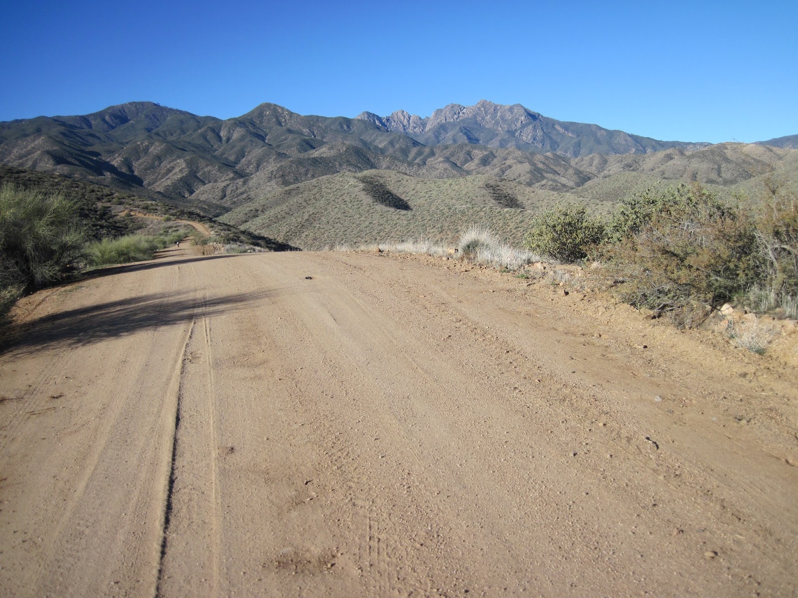
There were only a couple really steep pitches on the road and the road was in really great condition the whole way. All in all, an excellent start to the day.


Four Peaks peaking out there in the distance.

It looks totally rideable - from here

Eh, maybe not so rideable.
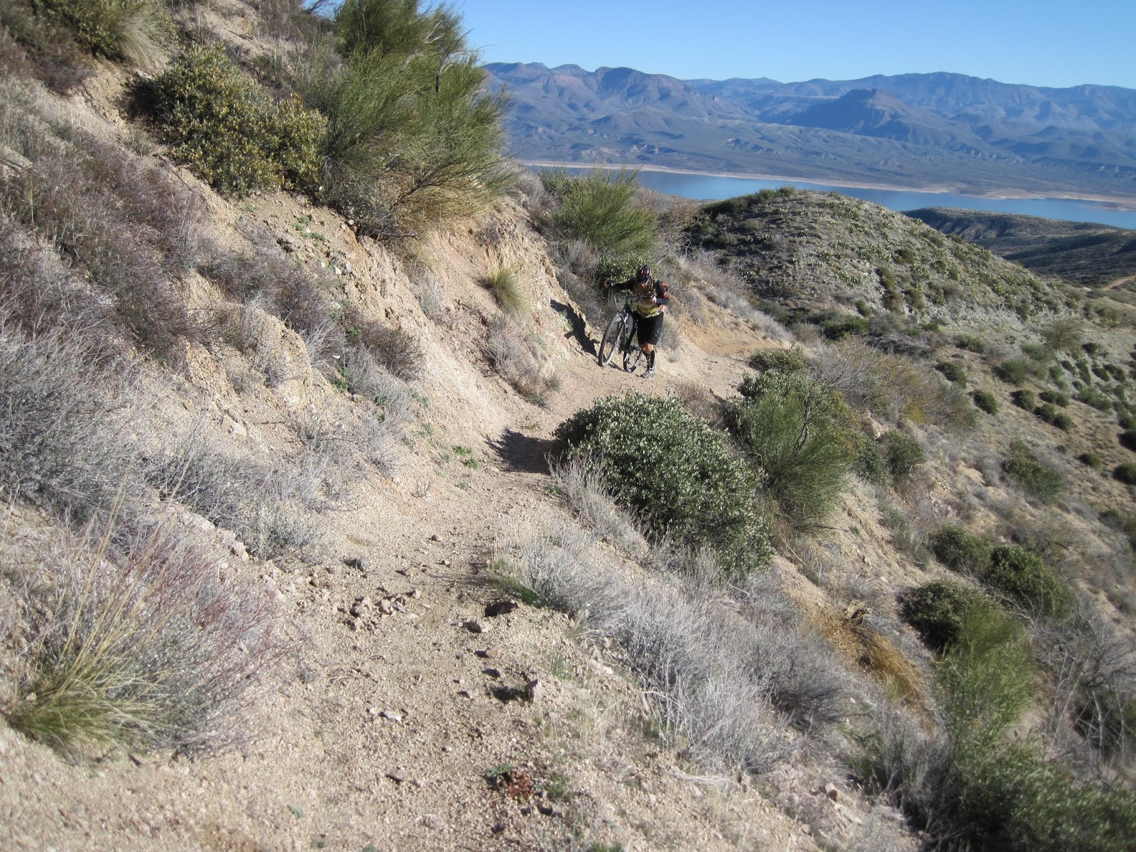
The trail surface got a little less friendly on this stretch.

Another nice section of this trail. Overall it was pretty good.

But there were a few sections that were challenging going up, but fun coming back down. You can see Apache lake peaking out in the right side there.


Ahh, the view.

Time to enjoy the ride back down.

Weeeee

That ridge line is where the AZT goes, after the Mills Ridge trail head.


We saw a few of these out there. Could not figure out what they were.
(Per Kurt, this is probably: a Game and Fish trick tank. The covered area is a rainwater catchment, it fills those two tanks, and there's then probably a tiny (1x1') trough hidden somewhere just downslope)

This ridge line trail had great views and was super fun to ride. I'd put it up against Ripsey. At this point I was thinking this is an A+ loop that everyone needs to do. But it was still early...

Coming down more ridge line. So fun.

All of a sudden we came upon an area where saguaros were growing. They didn't grow above here (about 3200 feet) and weren't on any of the nearby hills. These things have very specific requirements for where they will grow. Apache lake way in the distance.

Roosevelt lake got sooo blue at mid day.

The trail started to get a little bit rocky/techy. No problem. That slows things a bit, but still riding.

Then it went up and got stupid.


Trail??

And just I was getting really irritated with the condition of the trail, we came around a corner to the best view of the day. Looking at the pictures I took makes me sad. They look awful compared to what we saw. The sun sparkling off the water made it appear to shimmer. This was a view that made all the HAB we had done worth while. Just stunning. I'm hoping that John's camera did a better job of capturing this.
So, January 18 - around 70 degrees - sunny - we're out in the middle of nowhere seeing a view that few get to experience. We just stayed there for a bit and soaked it in. It doesn't get much better than this.


Onward. The lake is getting closer - and bluer. You can see by the shoreline how low the lake is.

The interesting thing about the lake being so low is that it exposes lots of little islands.

We came upon this - still pretty high up.

We couldn't come up with any reasonable theories about what it is.
(Turns out it is a microwave reflector. Arturo says: In areas where they don't have communication wiring and inconvenient placement for a powered repeater, they place special metallic billboards that are highly reflective in the microwave frequency range. Microwave is usually line-of-sight so you probably could have figured out where in the canyon below you the signal was coming from and where was it being bounced to. )

More lake

We are parked in the lot between the bridge and the dam. Given how high we are and how close that is, I'm thinking the trail is about to get steep.

Fortunately, there were some good sections mixed in.

And down to the end.


And the obligatory AZT trail sign shot.

Like I said earlier, this is a ride that is well worth doing. The only thing I'd change is to not go all the way to the wilderness boundary. That last half mile or so doesn't add a lot of value. The key to this ride is to realize that you will be doing some HAB, and to bring a camera.