Because Nancy and I both had time off at the end of the year, and we had gifted ourselves an ultralight tent for Christmas, it was decided that we needed to do a couple of trips to try out the new gear. I was in charge of a bikepacking trip and she'd put together a backpack adventure.
I've been wanting to see if there is a way to get to Bartlett Lake from our house and I could see that continuing north from there would get us to Sheep Bridge. So, I had a destination. Just needed to break out Topofusion and sketch out a route. The plan was to get to Sheep Bridge the first night, Seven Springs the second and an easy day home on day three. The thought was to have a relaxed trip with mild days where we could check out whatever interesting things came along and not worry about getting to a destination by dark.
All set, the only variable was weather. The forecast showed 3 days near 70 degrees in a row coming up, so I rearranged some vacation and we were on our way.
Cool, but sunny
Most sections of the GWT are neither Great or a Trail
Cockpit view
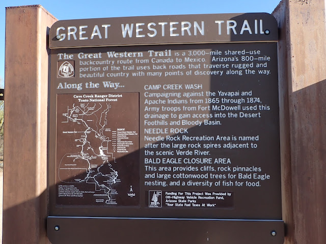
Once we got off the brief bit of pavement from the house we headed up Camp Creek Wash - near Needle Point. Fortunately this bit was short as it is mostly sand. It is a really cool canyon though.
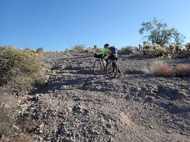
To get out of the wash we headed up this jeep "road". I'm not sure how a vehicle would even get up there.
Never too soon to start HAB
Once we got up out of the wash we hit dirt trails of varying quality.
The dam way off in the distance is our first destination
Cholla heaven
Not sure how that is even a jeep trail
Lots of cool little canyons out here
Bringing power to the people - from the dam
More interesting rock formations
Weather station
We found this bucket thing that traversed a cable across the river. Not sure exactly what happens when it gets to the middle of the river where the cable starts going up. Perhaps when they actually use it there is some sort of motor that attaches to the cable? Does this carry people or stuff? Nancy was unwilling to go for a ride to try it out.
Anyone want to go for a ride?
Living near the Verde River I've seen these signs about staying away at certain times of the year. It was interesting to come upon this (very faded) sign saying exactly why. Apparently this area is the only known area for desert nesting bald eagles in the US. We occasionally see them up in our neighborhood - looking for fish in the big pond at the Tonto Verde club.
Finally to the dam. I really wanted to get up close and check it out. However, in this time of terror and paranoia they don't let anyone near dams anymore. So I just had to look from afar.
In order to get up to the top of the dam, where the lake was we had to do a big climb and subsequent downhill.
cresting the climb
You can see the lake in the distance. Pretty low.
From the lake the easiest thing to do would be to head north along the Verde to Horseshoe lake. However, the only dirt road that I could find on the map that did something like that appeared to have numerous steep climbs. And there was no way to determine the quality of this route. The alternative was to head up the 2000 foot climb away from the lake on Bartlett Lake Road and then drop back down on Horseshoe Dam Road. After some thought and consideration, the partially known option seemed safest.
Beginning of a long climb
Then back down again
We'll be over near those white hills in about an hour
Nice little walkway to cross the dam
We stopped on the top of the dam for a late lunch. Thought it would be scenic, but it was rather industrial. There was lots of work going on at the base of the dam.
The Humbolt Mountain communication ball - from Horseshoe Lake
Lunch time
Lots of activity
Nice view down the Verde
Not too far. And the roads turned out to be mostly good from here
Some really nice stands of saguaro
There were some nice views of the lake on one side and the Mazatzal Mountains on the other. I'm determined to do at least one trip up into the Mazatzals. I'm not much of a hiker, but there is much to explore there and since it is wilderness, bikes aren't allowed.
Lake is looking pretty low
Chalk Mountain road
Chalk Mountain
Snow up in the Mazatzal mountains. Desert and mountain in the same view
Eventually we made it to the bridge.
View from the south
I am unable to resist rope swings
When we got down to the water we saw people camping on the other bank. Nothing unusual there. Nancy said she thought they were bicyclists. I said she was crazy. Who else would be BP-ing out here. Anyway, after a little map consultation we decided to head a little east of the bridge to find a camping spot. Also wanted to check out the intersecting trails - just to see what they were like. Not bike friendly is the answer. This is definitely hiking territory.
We may explore these some other time
After looking around a bit we found a suitable place to camp that was not near the bridge. This turned out to be a good decision as some idiots rolled up to the bridge late at night with music blaring and fired off some shots. Really? This is how you spend Friday night?
The perfect spot for our new tent
Not what you'd call roomy.
Home for the night
I set up a modest campfire and Nancy found a piece of wood that ended up being a perfect bench. All the comforts of home.
So, now, where are we?
Getting cool as the sun goes down
Hot cup of coffee and a warm fire
Filtering water before we head out again
A little history of the bridge
North from the bridge
and south
From the bridge it was all up. It was about 1200 feet of climbing with a nice descent on the other side. This was to be pretty much the pattern of the day - big climb followed by a descent.
Bridge is way down there - Mazatzals in the distance
You can barely see Nancy climbing up
Big climbs = big vistas
Where the road started running along Tangle Creek it was actually in better condition. Down near the water it looked like fall - with the trees and fallen leaves.
At the intersection of Bloody Basin and Cave Creek roads, we headed south on Cave Creek. We've driven Bloody Basin. It is quite scenic.
Heading south
We came upon snow as low as 3800 feet. The storm that brought this was like a week ago. Really surprised to see snow still on the ground.
Nancy's snowball missed me
Lunch break on this cool rock outcropping
climb/descend/repeat
Didn't expect this
After what seemed like an excessive amount of climbing (ended up with about 7000 feet for the day) we reached Seven Springs. This was to be our destination for the day. The plan was to take a spin up Humbolt and generally mess around in the Seven Springs area. However. It was around 1:30 and still overcast and cooler than we expected. The thought of just hanging out in the cold day to wait for another cold night started to seem less than appealing. If it had been like the previous day we likely would have set up camp for the night. However, we decided we keep rolling and see how far we could get.
Filtering water
We continued to roll down Cave Creek road. Past Bronco, on to pavement. That was easier than expected and went pretty quick. We looked at the time left in the day and decided we could probably make it home by night.
Down we rolled, past Sears Kay Ruins and up near the ranger's station on Bartlett road when we saw a couple of folks approaching on bikes - that appeared to be loaded with BP gear. Turns out they were the people camping out across the river at Sheep Bridge. Nancy was right (had to happen eventually) - they were bikepackers. The one guy (Richard?) even recognized Nancy from the Flight of the Pigs XX, ride we did the day after Thanksgiving. Turns out these guys did almost the same loop as us - in reverse. Small world.
We still had some ground to cover so we got rolling. Into Brown's Ranch - where we hit singletrack for the first time. It was really fun to rail the trails with BP gear. The extra weight drives you through corners. We made it over to Gooseneck with about an hour until sundown. My goal was to make the gate to our development before sundown. We went into hyperdrive and had fun ripping through the empty trails. Unfortunately, we missed my goal by a couple of minutes, but we still made it home before it got too dark to ride.
Day 2 turned out to be pretty long (66 miles) and tough, but satisfying. Another great little adventure - done.
We still need to do a backpacking trip...


