John wanted to take another shot at the route of a ride he and Arturo attempted back in December 2014. They ran into snow and mud and had to abandon. He figured that this would be a good time to try again. Nancy and I were somewhat reluctant partners on this quest. We had hiked and ridden parts of Highline that were in this route a couple of years ago. We hadn't been back since, due to the trail being not so good for bikes. However, adventure is adventure, so we were in.
Now, were are we going again?
Highline generally follows the contour of the Mogollon Rim
Looking good!
Pretty soon we heard a racket in the woods and saw this guy and his buddy (Forest Service employees) working on closing a section of trail. They hadn't just remediated some parts, but rerouted them as well - where it made sense. Nice. We thanked them and went on our way.
The easy way to move rocks
Here is a section of old trail. Not the nicest.
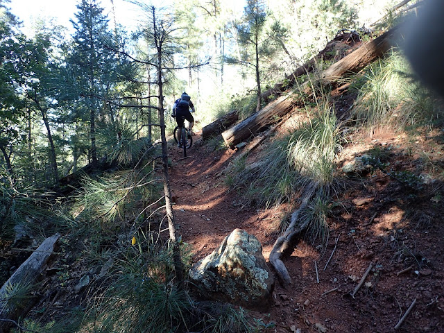
Still, there were challenges. John grunted out a few of these.
Trails still looking good.
Hell yeah. Loving it.
One of many views of the rim.
Some fun stuff.
Still, the trails are looking great.
This is a good example of the old trail (to the right) that was replaced by something much better
Even some ferns up here. Though they were a bit scorched.
Water was not hard to find. An unusual thing in AZ. This is Christopher Creek.
These trees always look so interesting.
Even after Christopher Creek the trails were in great shape.
Get it!
Sedona?
Some big views from up here
Somewhere out there is where we are headed.
When Arturo and John had done this ride before they skipped the section of Highline between the Derrick trail and Horton Springs. Instead they went down Derrick and then up Horton. Taking Highline is much shorter, but it has a reputation of being a pretty lousy section for bikes. However, the trail looked pretty good at the intersection ,and it had been awesome so far. Maybe they cleaned this up too. Let's do it!
Decision time
And the trail did look good - for a while. This was a 2.5 mile section - ending at Horton Springs. At a little less than a mile from the springs the trail revealed it's true character - the kind of stuff I had expected. So we hiked up through rocks for a while.
Assume the position
And it wasn't HORRIBLE, just pretty unrideable. Steep and littered with rocks and stuff. I figured we were still way ahead of the game from what I had expected.
Steady...
Horton Springs is not one of these wimpy trickles of water that you sometimes see. It is a gusher of cold. cold water - coming right out of the rocks. Really awesome.
Who is that guy?
There was also a small spring about 100 feet away. More sedate, but still really cool.
This was a perfect spot to filter some water, get some lunch, and soak our feet. Hard to leave.
I could easily stay here for a few hours
Thankfully, we were not going up there.
We crossed this field.
More really interesting sections to ride. And the trail is still in great shape
Many thanks to the volunteers who worked on the trail!
Soon enough we were at the fish hatchery. Since we were there, may as well go up to the visitors center. See what this is all about.
Preschool?
Now that would be one heavy backpack. But you'd always have lunch with you.
Apparently the hatchery provides fish for waterways all over the state.
I'd never been to one of these, so found it to be a bit of an education. Apparently the fish start at the top of the hill when they are small and move down to each section as they get bigger. At the bottom of the hill was a pond with some that looked like they'd make a meal for two.
Teenagers?
From here we were done with trails. It was control roads all the way to Pine - about 29 miles. How hard could it be? Well, it wasn't that "hard", but it was a slog. Plenty of ups and downs.
We went by lots of "summer home" communities and some permanent communities as well. Wouldn't be a bad thing to spend summer up there.
Nancy wondered if these two communities were in competition
And this was their water supply. We were a little low on water, but balked at trying to open that valve. I expect the water pressure was pretty high.
Not all that interesting from a riding perspective, but at least the views were good.
After many hills and a stop at a community church to get some water, we dumped out onto Highway 87 for a little. Not fun, due to traffic, but it was short. Then onto the AZT for less than a mile - to finish at the Pine trailhead. And there is plenty of daylight left.
The takeaway from this little adventure was that the work we had "heard" was going on up near the rim is real. There has been great progress on the section of highline we rode. I'd ride up here again for sure. Instead of shuttling from Pine to 260, I'd shuttle from the Hatchery to 260. You can get a good 4+ hours of riding on trails that way and have a relatively short shuttle.
There is still a big section of Highline between the fish hatchery and the AZT that none of us has been on. The intel on that is that it is better as a hike - maybe we'll have to do that one at some point.


